Quaker Farms Historic District

Log in to your account

AroundUs is a community-driven map of interesting places, built by curious explorers like you. It grows with every review, story, and photo you share.
Connect to save your favorite spots, contribute locations, and create personalized routes.
Continue with Google
Continue with Apple
Continue with X
Continue with Facebook
Continue with email
By continuing, you accept our Terms and Conditions and our Privacy Policy
Create an account
Add to collection
Map
Suggest a change
Share

Quaker Farms Historic District, Historic district in Oxford, Connecticut, United States

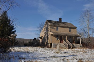
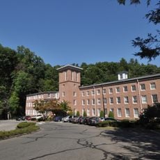
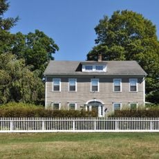
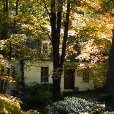
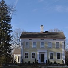
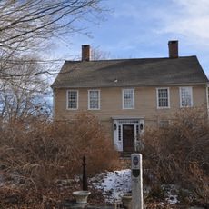
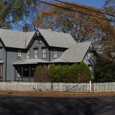
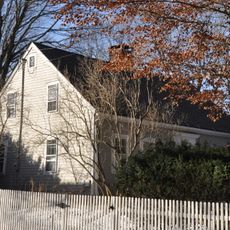
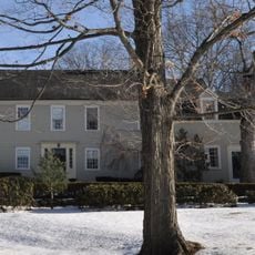
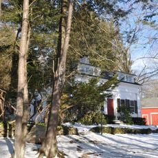
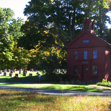
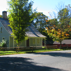
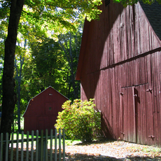
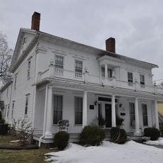
Quaker Farms Historic District contains eleven homes built between 1720 and 1850, arranged along Quaker Farms Road with Christ Church Episcopal as the focal point. The structures form a rural settlement where domestic architecture and religious buildings cluster together around a central gathering place.

English settlers from Derby established this community in the 17th century as a place organized around religious life and rural farming. The area received recognition on the National Register of Historic Places in 1991, acknowledging the long-term significance of this particular settlement.

The mix of Colonial, Federal, and Greek Revival styles across the homes shows how building tastes changed as rural communities developed over more than a century.

The district is best explored on foot by following Quaker Farms Road and using Christ Church Episcopal as a reference point. Walking at your own pace allows you to observe the homes and their details without rush while getting a sense of how the community is laid out.

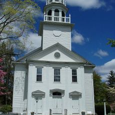
Christ Church Episcopal features curved galleries wrapping around three sides of the interior and Gothic-arched windows positioned above the altar. These design elements make the church distinctly different from many other rural houses of worship in the region.

Location: Connecticut

GPS coordinates: 41.42611,-73.15667

Latest update: December 14, 2025 12:23

Photos
Around this place
Southbury Training School
United States of America

Southbury Training School

10.6 km
Indian Well State Park
United States of America

Indian Well State Park

10.3 km
Southford Falls State Park
United States of America

Southford Falls State Park

3.2 km
Stevenson Dam Bridge
United States of America

Stevenson Dam Bridge

4.9 km
Paugussett Trail
United States of America

Paugussett Trail

5.1 km
Naugatuck State Forest
United States of America

Naugatuck State Forest

8.8 km
Kettletown State Park
United States of America

Kettletown State Park

4.1 km
South Britain Historic District
United States of America

South Britain Historic District

9.2 km
Osbornedale State Park
United States of America

Osbornedale State Park

10.6 km
Paugussett State Forest
United States of America

Paugussett State Forest

4.4 km
Russian Village Historic District
United States of America

Russian Village Historic District

8.4 km
United States of America

Pomperaug Trail

5.1 km
New York Belting and Packing Co.
United States of America

New York Belting and Packing Co.

10.2 km
Sanford-Curtis-Thurber House
United States of America

Sanford-Curtis-Thurber House

8.9 km
Plaster House
United States of America

Plaster House

2.8 km
Reuben Curtiss House
United States of America

Reuben Curtiss House

5.6 km
Daniel Basset House
United States of America

Daniel Basset House

9.2 km
Chatfield Farmstead
United States of America

Chatfield Farmstead

10.1 km
Aaron Bronson House
United States of America

Aaron Bronson House

5.5 km
Depot Street Bridge
United States of America

Depot Street Bridge

8.1 km
William Hurd House
United States of America

William Hurd House

3.7 km
Hurley Road Historic District
United States of America

Hurley Road Historic District

5.5 km
Southbury Historic District No. 1
United States of America

Southbury Historic District No. 1

8.9 km
Adin Wheeler House and Theodore F. Wheeler Wheelwright Shop
United States of America

Adin Wheeler House and Theodore F. Wheeler Wheelwright Shop

3.8 km
Sanford Road Historic District
United States of America

Sanford Road Historic District

4.6 km
Sanford-Humphreys House
United States of America

Sanford-Humphreys House

7.3 km
Larkin State Park Trail
United States of America

Larkin State Park Trail

6.7 km
Strand Theatre
United States of America

Strand Theatre

7.8 km
Show the full map
Reviews

Visited this place? Tap the stars to rate it and share your experience / photos with the community! Try now! You can cancel it anytime.

« Quaker Farms Historic District - Historic district in Oxford, Connecticut, United States » is provided by Around Us (aroundus.com). Images and texts are derived from Wikimedia project under a Creative Commons license. You are allowed to copy, distribute, and modify copies of this page, under the conditions set by the license, as long as this note is clearly visible.

Discover hidden gems everywhere you go!

From secret cafés to breathtaking viewpoints, skip the crowded tourist spots and find places that match your style. Our app makes it easy with voice search, smart filtering, route optimization, and insider tips from travelers worldwide. Download now for the complete mobile experience.

Around Us App Screenshot

A unique approach to discovering new places

Le Figaro

All the places worth exploring

France Info

A tailor-made excursion in just a few clicks

20 Minutes