Enable Location

We need your location to show you interesting places around you

Discover nearby places

Find interesting locations and hidden gems around you

Precise directions

Get accurate directions and distances to places

Your location is never shared with other users. It's only used when you tap the location button.

Southford Falls State Park

Log in to your account

Start exploring — it's free

Trusted by 61,336 travelers worldwide

Continue with Google
Continue with Apple
or

We will send you a code to connect

By continuing, you accept our Terms and Conditions and our Privacy Policy

Check your inbox

We've sent a pincode in your inbox. Please enter the code below.

Southford Falls State Park

Southford Falls State Park, State park in Oxford, United States

Description

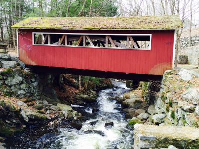
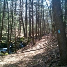
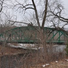
Southford Falls State Park is a nature preserve featuring cascading water, multiple trails for walking and hiking, and a covered bridge spanning Eight Mile Brook between two towns. The grounds include fishing areas and open spaces suitable for various outdoor recreation throughout the year.

History

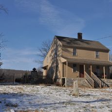
The site became a state park in 1927 after a matchbox factory operated by Diamond Match Company experienced two destructive fires and ceased operations. This transition protected the valley from further industrial development and allowed the landscape to recover.

Culture

The falls supported various trades and craftwork for generations, with water power enabling matchbox production, textile mills, and metalworking operations. Remnants of this working heritage remain visible throughout the park today.

Practical

The park is open year-round with marked trails and designated fishing areas, offering sledding and cross-country skiing during winter. Visitors should watch for varying terrain conditions and plan accordingly for seasonal changes.

Did you know?

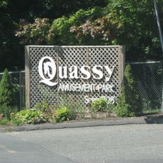
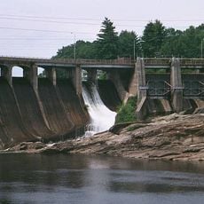
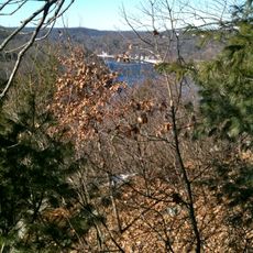
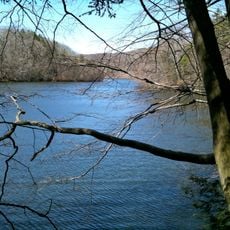
Eight Mile Brook flows through the property as a natural cascade from Lake Quassapaug down to the Housatonic River, with historical modifications to water flow that remain visible. These changes reflect how earlier inhabitants engineered the landscape to harness power for their operations.

Location
Inception
1932
GPS coordinates
41.45430,-73.16180
Latest update
December 12, 2025 12:02

AroundUs brings together thousands of curated places, local tips, and hidden gems, enriched daily by 60,000 contributors worldwide. Discover all places nearby (Connecticut).

Around this place
Quassy Amusement Park
United States of America

Quassy Amusement Park

8.2 km
Southbury Training School
United States of America

Southbury Training School

9.3 km
Stevenson Dam Bridge
United States of America

Stevenson Dam Bridge

8 km
Paugussett Trail
United States of America

Paugussett Trail

8.3 km
Naugatuck State Forest
United States of America

Naugatuck State Forest

8.5 km
Kettletown State Park
United States of America

Kettletown State Park

5.1 km
South Britain Historic District
United States of America

South Britain Historic District

7.6 km
Quaker Farms Historic District
United States of America

Quaker Farms Historic District

3.2 km
Paugussett State Forest
United States of America

Paugussett State Forest

5.9 km
Russian Village Historic District
United States of America

Russian Village Historic District

7.6 km
United States of America

Pomperaug Trail

8.3 km
Tranquility Farm
United States of America

Tranquility Farm

9 km
Sanford-Curtis-Thurber House
United States of America

Sanford-Curtis-Thurber House

9.1 km
Plaster House
United States of America

Plaster House

643 m
Reuben Curtiss House
United States of America

Reuben Curtiss House

2.5 km
Aaron Bronson House
United States of America

Aaron Bronson House

2.6 km
Depot Street Bridge
United States of America

Depot Street Bridge

8.4 km
William Hurd House
United States of America

William Hurd House

1.1 km
Hurley Road Historic District
United States of America

Hurley Road Historic District

2.4 km
Naugatuck Center Historic District
United States of America

Naugatuck Center Historic District

9.6 km
David Sherman House
United States of America

David Sherman House

8.8 km
Middlebury Center Historic District
United States of America

Middlebury Center Historic District

8.7 km
Southbury Historic District No. 1
United States of America

Southbury Historic District No. 1

6.1 km
Adin Wheeler House and Theodore F. Wheeler Wheelwright Shop
United States of America

Adin Wheeler House and Theodore F. Wheeler Wheelwright Shop

682 m
Sanford Road Historic District
United States of America

Sanford Road Historic District

2.1 km
Sanford-Humphreys House
United States of America

Sanford-Humphreys House

9.6 km
Woodbury Historic District No. 2
United States of America

Woodbury Historic District No. 2

7.7 km
Larkin State Park Trail
United States of America

Larkin State Park Trail

4.3 km
Show the full map
« Southford Falls State Park - State park in Oxford, United States » is provided by Around Us (aroundus.com). Images and texts are derived from Wikimedia project under a Creative Commons license. You are allowed to copy, distribute, and modify copies of this page, under the conditions set by the license, as long as this note is clearly visible.

Discover hidden gems everywhere you go!

From secret cafés to breathtaking viewpoints, skip the crowded tourist spots and find places that match your style. Our app makes it easy with voice search, smart filtering, route optimization, and insider tips from travelers worldwide. Download now for the complete mobile experience.

Around Us App Screenshot

A unique approach to discovering new places

Le Figaro

All the places worth exploring

France Info

A tailor-made excursion in just a few clicks

20 Minutes

Around Us
Travel Guide & Maps
Download

Send to your phone

QR Code
1

Open the camera app on your mobile.

2

Point at the QR code with your camera. A notification will appear.

3

Tap the notification to open the link.