Enable Location

We need your location to show you interesting places around you

Discover nearby places

Find interesting locations and hidden gems around you

Precise directions

Get accurate directions and distances to places

Your location is never shared with other users. It's only used when you tap the location button.

Osbornedale State Park

Log in to your account

Start exploring — it's free

Trusted by 61,890 travelers worldwide

Continue with Google
Continue with Apple
or

We will send you a code to connect

By continuing, you accept our Terms and Conditions and our Privacy Policy

Check your inbox

We've sent a pincode in your inbox. Please enter the code below.

Osbornedale State Park

Osbornedale State Park, State park in Derby, United States

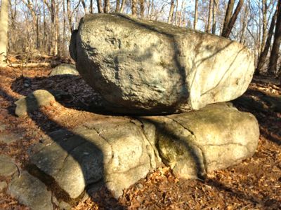
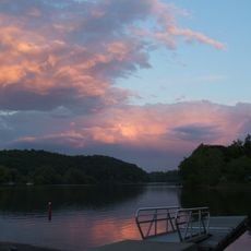
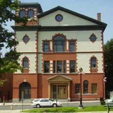
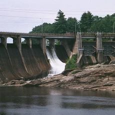
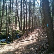
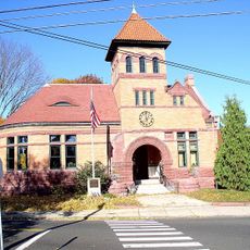
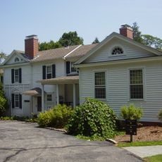
Osbornedale State Park is a 417-acre conservation area on the east bank of the Housatonic River in Derby, featuring hiking trails, a pond, and natural landscapes. The Kellogg Environmental Center serves as a focal point where visitors can learn about the park's ecosystems before heading out to explore on foot.

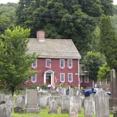
The area served as hunting grounds for the Paugussett Nation before European fur traders made contact in the early 1600s. In the 20th century, Frances Osborne Kellogg acquired multiple farms on the land and eventually transferred them to the state as a public park.

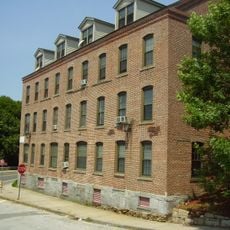
The property belonged to Frances Osborne Kellogg, a businesswoman who ran factories and farmed the land before donating it to the state. Her decision to preserve these grounds shaped how people today can walk through forests and meadows that might otherwise have been developed.

The park is best explored on foot, with marked trails winding through forests and open areas at varying difficulty levels. In winter the pond becomes available for ice skating, and the visitor center offers helpful orientation before you head out to explore the grounds.

The property was once home to specialized cattle breeding operations where Osbornedale Holstein herds and Jersey cattle were raised separately. This agricultural heritage as a breeding ground shapes the park's open meadows and rolling pastures that visitors see today.

The community of curious travelers

AroundUs brings together thousands of curated places, local tips, and hidden gems, enriched daily by 60,000 contributors worldwide.

Start exploring
Location
Inception
1956
Elevation above the sea
135 m
GPS coordinates
41.33972,-73.10278
Latest update
December 14, 2025 09:41
Around this place
Indian Well State Park
United States of America

Indian Well State Park

1.6 km
Sterling Opera House
United States of America

Sterling Opera House

2.3 km
Stevenson Dam Bridge
United States of America

Stevenson Dam Bridge

7.5 km
Paugussett Trail
United States of America

Paugussett Trail

6.6 km
David Humphreys House
United States of America

David Humphreys House

2.5 km
United States of America

Pomperaug Trail

6.6 km
Kraus Corset Factory
United States of America

Kraus Corset Factory

2.4 km
Plumb Memorial Library
United States of America

Plumb Memorial Library

2.3 km
Derby-Shelton Bridge
United States of America

Derby-Shelton Bridge

2.5 km
Osbornedale
United States of America

Osbornedale

932 m
Commodore Isaac Hull Memorial Bridge
United States of America

Commodore Isaac Hull Memorial Bridge

3.1 km
Westville Village Historic District
United States of America

Westville Village Historic District

5.9 km
Woodbridge Green Historic District
United States of America

Woodbridge Green Historic District

7.7 km
Monroe Center Historic District
United States of America

Monroe Center Historic District

8.8 km
Ansonia Library
United States of America

Ansonia Library

2.3 km
Orange Center Historic District
United States of America

Orange Center Historic District

9.4 km
United States Post Office–Ansonia Main
United States of America

United States Post Office–Ansonia Main

2.1 km
United States of America

Upper Main Street Historic District

2 km
Daniel Basset House
United States of America

Daniel Basset House

8 km
Chatfield Farmstead
United States of America

Chatfield Farmstead

7.8 km
John I. Howe House
United States of America

John I. Howe House

2.3 km
Harcourt Wood Memorial Library
United States of America

Harcourt Wood Memorial Library

1.9 km
Richard Mansfield House
United States of America

Richard Mansfield House

2.7 km
Dr. Andrew Castle House
United States of America

Dr. Andrew Castle House

9.5 km
Sanford-Humphreys House
United States of America

Sanford-Humphreys House

6.4 km
Strand Theatre
United States of America

Strand Theatre

6.8 km
Housatonic River Bridge
United States of America

Housatonic River Bridge

2.7 km
Naugatuck River Bridge
United States of America

Naugatuck River Bridge

3.2 km
Show the full map
« Osbornedale State Park - State park in Derby, United States » is provided by Around Us (aroundus.com). Images and texts are derived from Wikimedia project under a Creative Commons license. You are allowed to copy, distribute, and modify copies of this page, under the conditions set by the license, as long as this note is clearly visible.

Discover hidden gems everywhere you go!

From secret cafés to breathtaking viewpoints, skip the crowded tourist spots and find places that match your style. Our app makes it easy with voice search, smart filtering, route optimization, and insider tips from travelers worldwide. Download now for the complete mobile experience.

Around Us App Screenshot

A unique approach to discovering new places

Le Figaro

All the places worth exploring

France Info

A tailor-made excursion in just a few clicks

20 Minutes

Around Us
Travel Guide & Maps
Download

Send to your phone

QR Code
1

Open the camera app on your mobile.

2

Point at the QR code with your camera. A notification will appear.

3

Tap the notification to open the link.