Enable Location

We need your location to show you interesting places around you

Discover nearby places

Find interesting locations and hidden gems around you

Precise directions

Get accurate directions and distances to places

Your location is never shared with other users. It's only used when you tap the location button.

Rachel Carson Trail

Log in to your account

Start exploring — it's free

Trusted by 65,325 travelers worldwide

Continue with Google
Continue with Apple
or

We will send you a code to connect

By continuing, you accept our Terms and Conditions and our Privacy Policy

Check your inbox

We've sent a pincode in your inbox. Please enter the code below.

Rachel Carson Trail
Discussion Reviews 1 Photos
4k Popularity

Rachel Carson Trail, Hiking trail in Allegheny County, Pennsylvania.

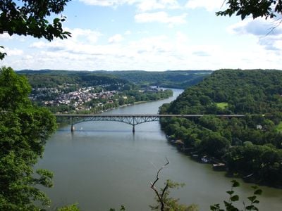
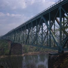
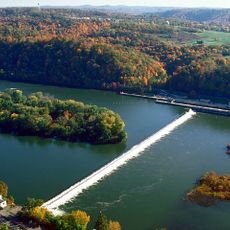
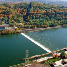
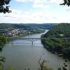
The Rachel Carson Trail is a hiking trail in Allegheny County, Pennsylvania, running from Harrison Hills County Park to North Park. It crosses forests, open farmland, and steep bluffs, linking two county parks across a long stretch of land.

The trail began in the 1950s as part of the Baker Trail system and was later rebuilt by volunteers between 1972 and 1975. That effort turned it into a separate trail network with its own identity in western Pennsylvania.

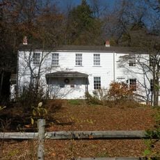
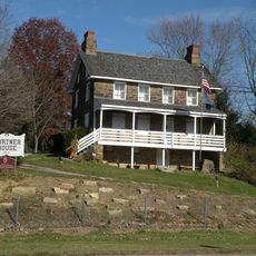
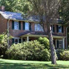
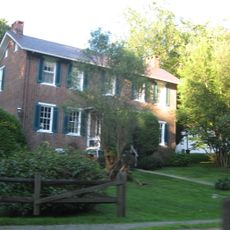
The trail passes close to the childhood home of Rachel Carson in Springdale, where the nature writer grew up observing the land around her. Walking this route gives a sense of the fields and hills that shaped her way of seeing the natural world.

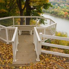
The trail has several access points with parking, making it easy to walk shorter sections rather than the full route. The Rachel Carson Trails Conservancy provides maps and guidance to help plan any outing.

Several sections of the trail cross private land, and hikers are expected to follow rules set by the individual landowners. This arrangement has held for decades and depends on the goodwill built between local property owners and the hiking community.

The community of curious travelers

AroundUs brings together thousands of curated places, local tips, and hidden gems, enriched daily by 60,000 contributors worldwide.

Start exploring
Location
Inception
February 1975
GPS coordinates
40.66213,-79.69920
Latest update
March 3, 2026 10:05
Around this place
Allegheny Islands State Park
United States of America

Allegheny Islands State Park

17.8 km
Rachel Carson Homestead
United States of America

Rachel Carson Homestead

14.7 km
Burtner House
United States of America

Burtner House

4.3 km
Allegheny River Turnpike Bridge
United States of America

Allegheny River Turnpike Bridge

17.4 km
Bessemer & Lake Erie Railroad Bridge
United States of America

Bessemer & Lake Erie Railroad Bridge

17.3 km
Allegheny River Lock and Dam No. 3
United States of America

Allegheny River Lock and Dam No. 3

16.9 km
Allegheny River Lock and Dam No. 4
United States of America

Allegheny River Lock and Dam No. 4

5.5 km
Harrison Hills Park
United States of America

Harrison Hills Park

1.4 km
Drake Log Cabin
United States of America

Drake Log Cabin

14.6 km
St. Gertrude Roman Catholic Church
United States of America

St. Gertrude Roman Catholic Church

12.9 km
Allegheny River Lock and Dam No. 6
United States of America

Allegheny River Lock and Dam No. 6

11.7 km
Allegheny River Lock and Dam No. 5
United States of America

Allegheny River Lock and Dam No. 5

3.8 km
George D. Stuart Bridge
United States of America

George D. Stuart Bridge

8.7 km
New Kensington Downtown Historic District
United States of America

New Kensington Downtown Historic District

12.1 km
Saxonburg Historic District
United States of America

Saxonburg Historic District

14.1 km
Donald R. Lobaugh Bridge
United States of America

Donald R. Lobaugh Bridge

938 m
Pennsalt Historic District
United States of America

Pennsalt Historic District

5.6 km
Valley Sports Complex
United States of America

Valley Sports Complex

10 km
New Kensington Production Works Historic District
United States of America

New Kensington Production Works Historic District

12.3 km
Freeport Rail Bridge
United States of America

Freeport Rail Bridge

2.9 km
Vandergrift Historic District
United States of America

Vandergrift Historic District

13.3 km
John Walter Farmstead
United States of America

John Walter Farmstead

15.8 km
Byerly House
United States of America

Byerly House

12.1 km
Leechburg Bridge
United States of America

Leechburg Bridge

8.6 km
Logans Ferry Powder Works Historic District
United States of America

Logans Ferry Powder Works Historic District

14.9 km
Mill Bridge
United States of America

Mill Bridge

7.7 km
John Roebling House
United States of America

John Roebling House

13.6 km
University of Pittsburgh Applied Research Center
United States of America

University of Pittsburgh Applied Research Center

17.1 km
Show the full map
Reviews
Share your experience

No review yet

Discussions
Start a discussion...

No discussion yet

« Rachel Carson Trail - Hiking trail in Allegheny County, Pennsylvania » is provided by Around Us (aroundus.com). Images and texts are derived from Wikimedia project under a Creative Commons license. You are allowed to copy, distribute, and modify copies of this page, under the conditions set by the license, as long as this note is clearly visible.

Discover hidden gems everywhere you go!

From secret cafés to breathtaking viewpoints, skip the crowded tourist spots and find places that match your style. Our app makes it easy with voice search, smart filtering, route optimization, and insider tips from travelers worldwide. Download now for the complete mobile experience.

Around Us App Screenshot

A unique approach to discovering new places

Le Figaro

All the places worth exploring

France Info

A tailor-made excursion in just a few clicks

20 Minutes

Around Us
Travel Guide & Maps
Download

Send to your phone

QR Code
1

Open the camera app on your mobile.

2

Point at the QR code with your camera. A notification will appear.

3

Tap the notification to open the link.