Enable Location

We need your location to show you interesting places around you

Discover nearby places

Find interesting locations and hidden gems around you

Precise directions

Get accurate directions and distances to places

Your location is never shared with other users. It's only used when you tap the location button.

Salisbury Beach State Reservation

Log in to your account

Start exploring — it's free

Trusted by 62,074 travelers worldwide

Continue with Google
Continue with Apple
or

We will send you a code to connect

By continuing, you accept our Terms and Conditions and our Privacy Policy

Check your inbox

We've sent a pincode in your inbox. Please enter the code below.

Salisbury Beach State Reservation

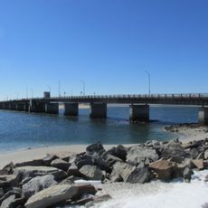
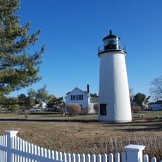
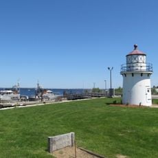
Salisbury Beach State Reservation, Coastal protected area in Essex County, Massachusetts

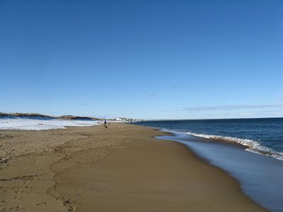
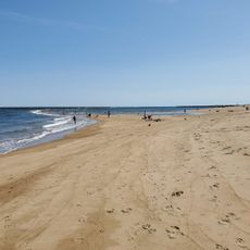
Salisbury Beach State Reservation stretches for several miles along the Atlantic coast and features a wide sandy shore with calm waters suitable for swimming. The grounds also include walking paths, picnic areas, and multiple boat ramps for water activities.

During World War II, the coastline served as a military defensive position with gun emplacements to protect the waters. After the war ended, the land was opened to the public and developed into a protected nature area.

The beach serves as a popular gathering spot where locals and visitors swim, walk, and spend time by the ocean. People come here to watch wildlife, especially the seals and birds that regularly appear in these waters.

The beach is easy to reach with ample parking and restrooms located at various points along the shore. Visitors should note that swimming conditions are best during warmer months, and water conditions vary depending on the season and tides.

The area sits where the Merrimack River meets the Atlantic Ocean, creating a transition zone where river and ocean waters blend and support different plant and animal life. This meeting point draws a mix of species not commonly found in purely ocean or purely freshwater environments.

The community of curious travelers

AroundUs brings together thousands of curated places, local tips, and hidden gems, enriched daily by 60,000 contributors worldwide.

Start exploring
Location
GPS coordinates
42.82650,-70.81740
Latest update
December 8, 2025 20:02
Around this place
Pink House
United States of America

Pink House

3.5 km
Coffin House
United States of America

Coffin House

4.8 km
Chain Bridge
United States of America

Chain Bridge

7.3 km
Hampton Beach State Park
United States of America

Hampton Beach State Park

8.1 km
United States of America

Newburyport Public Library

5.2 km
Dalton House
United States of America

Dalton House

4.9 km
James Noyes House
United States of America

James Noyes House

4.9 km
Hampton Bridge
United States of America

Hampton Bridge

7.7 km
Spencer-Peirce-Little Farm
United States of America

Spencer-Peirce-Little Farm

4.5 km
Cushing House Museum and Garden
United States of America

Cushing House Museum and Garden

4.9 km
Superior Courthouse and Bartlett Mall
United States of America

Superior Courthouse and Bartlett Mall

5.4 km
United States Customhouse
United States of America

United States Customhouse

4.5 km
Dole-Little House
United States of America

Dole-Little House

7.3 km
Newburyport Harbor Light
United States of America

Newburyport Harbor Light

1.3 km
Rocky Hill Meeting House
United States of America

Rocky Hill Meeting House

8.1 km
Newburyport Harbor Rear Range Light
United States of America

Newburyport Harbor Rear Range Light

4.3 km
Market Square Historic District
United States of America

Market Square Historic District

4.6 km
Newburyport Harbor Front Range Light
United States of America

Newburyport Harbor Front Range Light

4.2 km
Newburyport Historic District
United States of America

Newburyport Historic District

5.2 km
Swett-Ilsley House
United States of America

Swett-Ilsley House

4.7 km
Brown Square House
United States of America

Brown Square House

4.9 km
Newbury Historic District
United States of America

Newbury Historic District

4.9 km
Dodge Building
United States of America

Dodge Building

5.5 km
Benjamin Coker House
United States of America

Benjamin Coker House

5.5 km
Plum Island Beach
United States of America

Plum Island Beach

1.2 km
John Greenleaf Whittier Bridge
United States of America

John Greenleaf Whittier Bridge

7.7 km
Custom House Maritime Museum
United States of America

Custom House Maritime Museum

4.5 km
Lowell's Boat Shop
United States of America

Lowell's Boat Shop

8.1 km
Show the full map
« Salisbury Beach State Reservation - Coastal protected area in Essex County, Massachusetts » is provided by Around Us (aroundus.com). Images and texts are derived from Wikimedia project under a Creative Commons license. You are allowed to copy, distribute, and modify copies of this page, under the conditions set by the license, as long as this note is clearly visible.

Discover hidden gems everywhere you go!

From secret cafés to breathtaking viewpoints, skip the crowded tourist spots and find places that match your style. Our app makes it easy with voice search, smart filtering, route optimization, and insider tips from travelers worldwide. Download now for the complete mobile experience.

Around Us App Screenshot

A unique approach to discovering new places

Le Figaro

All the places worth exploring

France Info

A tailor-made excursion in just a few clicks

20 Minutes

Around Us
Travel Guide & Maps
Download

Send to your phone

QR Code
1

Open the camera app on your mobile.

2

Point at the QR code with your camera. A notification will appear.

3

Tap the notification to open the link.