Chest opened
+${chestReward.xp} XP
Explorer
NOUVEAU ×${chestReward.collectible.quantity}
tapez pour fermer
Chest locked

Open chests in the app

Around Us is built for your phone — chests unlock when you walk, explore and capture nearby places.

Enable Location

We need your location to show you interesting places around you

Discover nearby places

Find interesting locations and hidden gems around you

Precise directions

Get accurate directions and distances to places

Your location is never shared with other users. It's only used when you tap the location button.

Log in to your account

Start exploring — it's free

Trusted by 72,879 travelers worldwide

Continue with Google
Continue with Apple
or

We will send you a code to connect

By continuing, you accept our Terms and Conditions and our Privacy Policy

Check your inbox

We've sent a pincode in your inbox. Please enter the code below.

Santee Sioux Indian Reservation
Discussion Reviews Photo
11.9k Popularity

Santee Sioux Indian Reservation, Native American reservation in Knox County, Nebraska

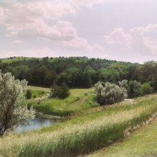
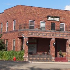
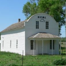
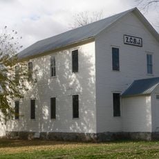
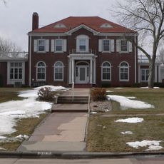
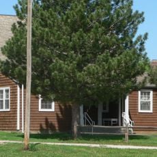
The Santee Sioux Indian Reservation is a tribal territory located along the Missouri River's southern bank in eastern Nebraska. The land encompasses residential areas, schools, and tribal administrative facilities distributed across the reservation's landscape.

The reservation was created in 1863 as a designated homeland for the Santee Sioux after their removal from ancestral territories. This establishment marked a turning point in the tribe's efforts to maintain their community in a new location.

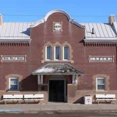
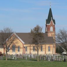
The reservation serves as a living center where Dakota traditions are shared through gatherings and celebrations that bring the community together. Visitors can witness how these occasions remain woven into daily life and tribal identity.

Visiting the reservation offers a chance to see tribal life as it exists today, particularly by exploring local gathering places and community spaces. Taking time to walk around and observe how people use the land helps visitors understand the rhythm and reality of the place.

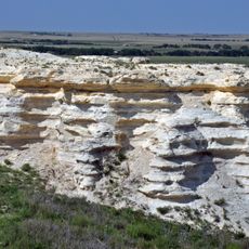
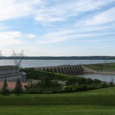
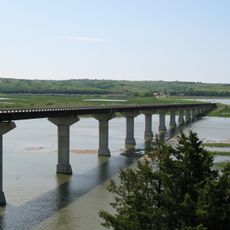
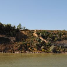
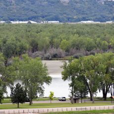
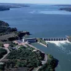
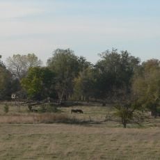
The reservation borders the Missouri River and Lewis and Clark Lake directly, giving it a distinctive geographic location that shaped the tribe's historical settlement patterns. This water access continues to influence daily life on the land today.

The community of curious travelers

AroundUs brings together thousands of curated places, local tips, and hidden gems, enriched daily by 60,000 contributors worldwide.

Start exploring
Location
Inception
March 3, 1863
Capital city
Niobrara
GPS coordinates
42.72640,-97.83030
Latest update
December 7, 2025 20:48
Around this place
Niobrara Formation
United States of America

Niobrara Formation

17.3 km
Lewis and Clark Lake
United States of America

Lewis and Clark Lake

31.5 km
Niobrara State Park
United States of America

Niobrara State Park

18.6 km
Chief Standing Bear Memorial Bridge
United States of America

Chief Standing Bear Memorial Bridge

13.9 km
United States of America

Lewis and Clark State Recreation Area

24 km
Calumet Bluff
United States of America

Calumet Bluff

32 km
Argo Hotel
United States of America

Argo Hotel

27.3 km
Z.C.B.J. Opera House
United States of America

Z.C.B.J. Opera House

22 km
St. Wenceslaus Catholic Church and Parish House
United States of America

St. Wenceslaus Catholic Church and Parish House

28.7 km
Gavins Point National Fish Hatchery
United States of America

Gavins Point National Fish Hatchery

32.8 km
St. Rose of Lima Catholic Church and School Complex
United States of America

St. Rose of Lima Catholic Church and School Complex

26.9 km
Niobrara River Bridge
United States of America

Niobrara River Bridge

18.4 km
Congregational Church and Manse
United States of America

Congregational Church and Manse

12.6 km
Training Dike Recreation Area
United States of America

Training Dike Recreation Area

32.4 km
Church of Our Most Merciful Saviour
United States of America

Church of Our Most Merciful Saviour

12.8 km
Old St. Wenceslaus Catholic Parish House
United States of America

Old St. Wenceslaus Catholic Parish House

28.5 km
Knox County Courthouse
United States of America

Knox County Courthouse

13.6 km
Cottonwood Recreation Area
United States of America

Cottonwood Recreation Area

32.1 km
Rad Sladkovsky
United States of America

Rad Sladkovsky

31.2 km
ZCBJ Hall
United States of America

ZCBJ Hall

30.1 km
St. Boniface Catholic Church Complex
United States of America

St. Boniface Catholic Church Complex

37.9 km
Dr. John Trierweiler House
United States of America

Dr. John Trierweiler House

38.3 km
Bon Homme County Courthouse
United States of America

Bon Homme County Courthouse

29.9 km
Bishop Marty Rectory
United States of America

Bishop Marty Rectory

38.1 km
Ponca Tribal Self-Help Community Building Historic District
United States of America

Ponca Tribal Self-Help Community Building Historic District

21 km
John Frydrych Farmstead
United States of America

John Frydrych Farmstead

28.4 km
Mathias Merkwan Rubblestone Barn
United States of America

Mathias Merkwan Rubblestone Barn

29.7 km
Winnetoon Jail
United States of America

Winnetoon Jail

25.9 km
Show the full map
Reviews
Share your experience

No review yet

Discussions
Start a discussion...

No discussion yet

« Santee Sioux Indian Reservation - Native American reservation in Knox County, Nebraska » is provided by Around Us (aroundus.com). Images and texts are derived from Wikimedia project under a Creative Commons license. You are allowed to copy, distribute, and modify copies of this page, under the conditions set by the license, as long as this note is clearly visible.

Discover hidden gems everywhere you go!

From secret cafés to breathtaking viewpoints, skip the crowded tourist spots and find places that match your style. Our app makes it easy with voice search, smart filtering, route optimization, and insider tips from travelers worldwide. Download now for the complete mobile experience.

Around Us App Screenshot

A unique approach to discovering new places

Le Figaro

All the places worth exploring

France Info

A tailor-made excursion in just a few clicks

20 Minutes

Around Us
Travel Guide & Maps
Download

Send to your phone

QR Code
1

Open the camera app on your mobile.

2

Point at the QR code with your camera. A notification will appear.

3

Tap the notification to open the link.