Enable Location

We need your location to show you interesting places around you

Discover nearby places

Find interesting locations and hidden gems around you

Precise directions

Get accurate directions and distances to places

Your location is never shared with other users. It's only used when you tap the location button.

Savage River State Forest

Log in to your account

Start exploring — it's free

Trusted by 62,189 travelers worldwide

Continue with Google
Continue with Apple
or

We will send you a code to connect

By continuing, you accept our Terms and Conditions and our Privacy Policy

Check your inbox

We've sent a pincode in your inbox. Please enter the code below.

Savage River State Forest

Savage River State Forest, state forest in Garrett County, Western Maryland, United States

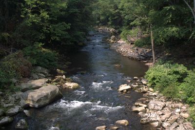
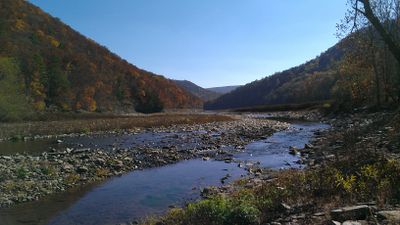
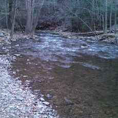
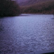
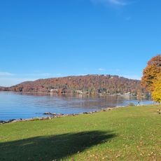
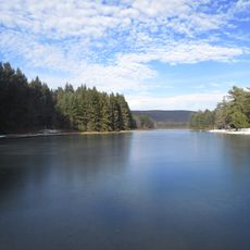
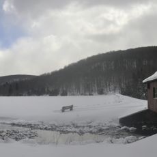
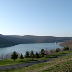
Savage River State Forest is a large woodland covering about 54,000 acres in northeastern Garrett County with multiple waterways and the Savage River Reservoir at its center. The terrain consists mainly of hardwoods like oak and maple, with a mix of mature forest around 100 years old and younger growth areas.

The land was heavily logged starting in the 1800s, leaving large areas stripped bare. The Garrett family donated land in 1906 to begin forest conservation, and Maryland purchased its first state holdings in 1929; the Civilian Conservation Corps expanded trails and facilities during the 1930s.

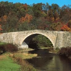
The forest has served Native Americans and early settlers as a passage and resource. Today it functions as a gathering place where people from nearby towns come to walk, fish, and spend quiet time together in nature.

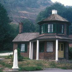
Obtain maps and permits at parking kiosks or online before your visit. Call ahead if planning to visit the office or shooting range, since hours are limited to Tuesday, Thursday, and Friday mornings.

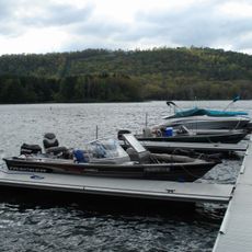
The Savage River Reservoir was built by the U.S. Army in the early 1950s as a backup water supply for Washington, D.C. The forest also has a public shooting range open daily from sunrise to sunset that welcomes visitors for target practice.

The community of curious travelers

AroundUs brings together thousands of curated places, local tips, and hidden gems, enriched daily by 60,000 contributors worldwide.

Start exploring
Location
Inception
1940s
Elevation above the sea
800 m
Accessibility
Wheelchair accessible
Operator
Maryland Department of Natural Resources, Maryland Forest Service
GPS coordinates
39.68278,-79.20694
Latest update
February 7, 2026 11:00
Around this place
Deep Creek Lake
United States of America

Deep Creek Lake

24.9 km
Mount Davis
United States of America

Mount Davis

11.8 km
Deep Creek Lake State Park
United States of America

Deep Creek Lake State Park

19.5 km
Dans Mountain
United States of America

Dans Mountain

28.8 km
Casselman Bridge
United States of America

Casselman Bridge

5.6 km
Stone Cottage
United States of America

Stone Cottage

31.2 km
Inns on the National Road
United States of America

Inns on the National Road

28.9 km
Big Run State Park
United States of America

Big Run State Park

16.5 km
Savage River Reservoir
United States of America

Savage River Reservoir

20.6 km
La Vale Tollgate House
United States of America

La Vale Tollgate House

30.9 km
Deep Creek Lake State Park
United States of America

Deep Creek Lake State Park

19.4 km
Bloomington Viaduct
United States of America

Bloomington Viaduct

25.8 km
Waverly Street Bridge
United States of America

Waverly Street Bridge

25.7 km
Thomas R. Carskadon House
United States of America

Thomas R. Carskadon House

33.7 km
Fuller-Baker Log House
United States of America

Fuller-Baker Log House

3.3 km
Mount Savage Historic District
United States of America

Mount Savage Historic District

28 km
Anderson Chapel
United States of America

Anderson Chapel

25 km
Stanton's Mill
United States of America

Stanton's Mill

5.9 km
Shaw Mansion
United States of America

Shaw Mansion

23.2 km
Henry Glassaway Davis House
United States of America

Henry Glassaway Davis House

26.1 km
Lonaconing Historic District
United States of America

Lonaconing Historic District

23.2 km
Arrowhead Market
United States of America

Arrowhead Market

22.4 km
New Germany State Park
United States of America

New Germany State Park

9.1 km
Mineral County Courthouse
United States of America

Mineral County Courthouse

33.7 km
Frostburg Cinemas 1-2-3
United States of America

Frostburg Cinemas 1-2-3

25.7 km
James Drane House
United States of America

James Drane House

10.9 km
Deer Valley Kissing Bridge
United States of America

Deer Valley Kissing Bridge

12.7 km
Jennings Randolph Lake
United States of America

Jennings Randolph Lake

28.8 km
Show the full map
« Savage River State Forest - state forest in Garrett County, Western Maryland, United States » is provided by Around Us (aroundus.com). Images and texts are derived from Wikimedia project under a Creative Commons license. You are allowed to copy, distribute, and modify copies of this page, under the conditions set by the license, as long as this note is clearly visible.

Discover hidden gems everywhere you go!

From secret cafés to breathtaking viewpoints, skip the crowded tourist spots and find places that match your style. Our app makes it easy with voice search, smart filtering, route optimization, and insider tips from travelers worldwide. Download now for the complete mobile experience.

Around Us App Screenshot

A unique approach to discovering new places

Le Figaro

All the places worth exploring

France Info

A tailor-made excursion in just a few clicks

20 Minutes

Around Us
Travel Guide & Maps
Download

Send to your phone

QR Code
1

Open the camera app on your mobile.

2

Point at the QR code with your camera. A notification will appear.

3

Tap the notification to open the link.