Enable Location

We need your location to show you interesting places around you

Discover nearby places

Find interesting locations and hidden gems around you

Precise directions

Get accurate directions and distances to places

Your location is never shared with other users. It's only used when you tap the location button.

Sherwood Island State Park

Log in to your account

Start exploring — it's free

Trusted by 61,888 travelers worldwide

Continue with Google
Continue with Apple
or

We will send you a code to connect

By continuing, you accept our Terms and Conditions and our Privacy Policy

Check your inbox

We've sent a pincode in your inbox. Please enter the code below.

Sherwood Island State Park

Sherwood Island State Park, State park in Westport, US.

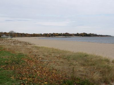
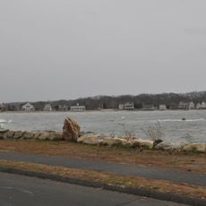
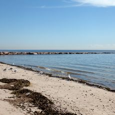
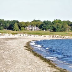
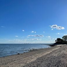
Sherwood Island State Park is a coastal park with a mile-long sandy beach showing three sand colors: reddish garnet, black magnetite, and white quartz. The 238-acre property sits on Long Island Sound and provides various facilities for outdoor activities.

The initial land purchase for Connecticut's first state park took place in 1914, followed by a lengthy acquisition process against local property owners. This marked an important step in securing public coastal access in the region.

The September 11 memorial displays a granite stone with views toward Manhattan's skyline, bearing inscriptions honoring the victims. It serves as Connecticut's official tribute to those affected by the attacks.

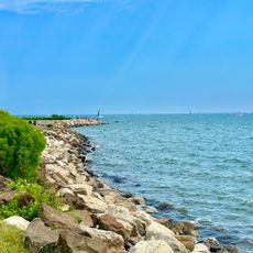
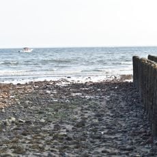
The park allows saltwater swimming, fishing from rocky jetties, disc golf, and model airplane flying, mainly from April through September. An on-site nature center offers educational programs to help visitors learn about the environment.

The park offers direct views of the New York City skyline, providing an unexpected glimpse of the distant city from a quiet shoreline. This geographic proximity to a major metropolitan area creates an interesting contrast between natural landscape and urban surroundings.

The community of curious travelers

AroundUs brings together thousands of curated places, local tips, and hidden gems, enriched daily by 60,000 contributors worldwide.

Start exploring
Location
Inception
1914
GPS coordinates
41.11544,-73.32704
Latest update
December 8, 2025 19:55
Around this place
Westport Country Playhouse
United States of America

Westport Country Playhouse

3.7 km
Pequot Library
United States of America

Pequot Library

3.8 km
Saugatuck River Bridge
United States of America

Saugatuck River Bridge

3.6 km
Louis Micheels House
United States of America

Louis Micheels House

2 km
Saugatuck River Railroad Bridge
United States of America

Saugatuck River Railroad Bridge

3.5 km
Greens Farms School
United States of America

Greens Farms School

2.4 km
Southport Historic District
United States of America

Southport Historic District

4 km
Westport Public Library
United States of America

Westport Public Library

4 km
Compo–Owenoke Historic District
United States of America

Compo–Owenoke Historic District

2.6 km
Our Lady of the Assumption Church
United States of America

Our Lady of the Assumption Church

3.9 km
Pine Creek Park Bridge
United States of America

Pine Creek Park Bridge

5.5 km
Godillot Place
United States of America

Godillot Place

3.9 km
The Allen House
United States of America

The Allen House

4.1 km
Town Hall
United States of America

Town Hall

4 km
Westport Bank and Trust Company
United States of America

Westport Bank and Trust Company

4.1 km
Mill Cove Historic District
United States of America

Mill Cove Historic District

1.3 km
Kings Highway North Historic District
United States of America

Kings Highway North Historic District

4.5 km
Bradley-Wheeler House
United States of America

Bradley-Wheeler House

4.3 km
National Hall Historic District
United States of America

National Hall Historic District

4.2 km
Shambaugh House
United States of America

Shambaugh House

4.8 km
Bridge Street Historic District
United States of America

Bridge Street Historic District

3.2 km
Compo Beach
United States of America

Compo Beach

2.2 km
Southport Beach
United States of America

Southport Beach

3 km
John Osborne House
United States of America

John Osborne House

3 km
Alvord Beach
United States of America

Alvord Beach

266 m
Sasco Hill Beach
United States of America

Sasco Hill Beach

4 km
Burial Hill Beach
United States of America

Burial Hill Beach

1 km
South Pine Creek Beach
United States of America

South Pine Creek Beach

4.9 km
Show the full map
« Sherwood Island State Park - State park in Westport, US » is provided by Around Us (aroundus.com). Images and texts are derived from Wikimedia project under a Creative Commons license. You are allowed to copy, distribute, and modify copies of this page, under the conditions set by the license, as long as this note is clearly visible.

Discover hidden gems everywhere you go!

From secret cafés to breathtaking viewpoints, skip the crowded tourist spots and find places that match your style. Our app makes it easy with voice search, smart filtering, route optimization, and insider tips from travelers worldwide. Download now for the complete mobile experience.

Around Us App Screenshot

A unique approach to discovering new places

Le Figaro

All the places worth exploring

France Info

A tailor-made excursion in just a few clicks

20 Minutes

Around Us
Travel Guide & Maps
Download

Send to your phone

QR Code
1

Open the camera app on your mobile.

2

Point at the QR code with your camera. A notification will appear.

3

Tap the notification to open the link.