Chest opened
+${chestReward.xp} XP
Explorer
NOUVEAU ×${chestReward.collectible.quantity}
tapez pour fermer
Chest locked

Open chests in the app

Around Us is built for your phone — chests unlock when you walk, explore and capture nearby places.

Enable Location

We need your location to show you interesting places around you

Discover nearby places

Find interesting locations and hidden gems around you

Precise directions

Get accurate directions and distances to places

Your location is never shared with other users. It's only used when you tap the location button.

Tahquamenon River

Log in to your account

Start exploring — it's free

Trusted by 72,968 travelers worldwide

Continue with Google
Continue with Apple
or

We will send you a code to connect

By continuing, you accept our Terms and Conditions and our Privacy Policy

Check your inbox

We've sent a pincode in your inbox. Please enter the code below.

Tahquamenon River
Discussion Reviews 1 Photos
9.4k Popularity

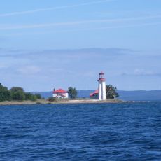
Tahquamenon River, River system in Upper Peninsula, Michigan, United States

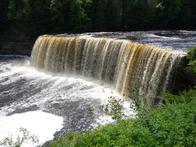
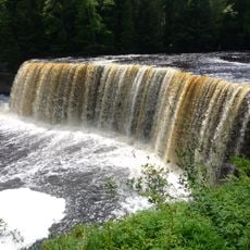
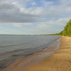
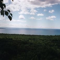
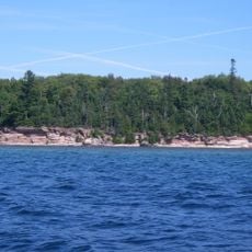
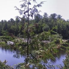
Tahquamenon River is a major waterway in Michigan's Upper Peninsula that extends eastward across forested terrain before reaching Whitefish Bay on Lake Superior. The lower section features wide cascades and an island accessible by boat, while the upper stretch flows through remote wetland areas.

The name first appeared on a Jesuit map in 1672, reflecting early European contact with the waterway used by indigenous peoples. Fur trappers and loggers later shaped the region during the 1800s, and the area eventually became protected as a state park.

The river holds significance in American literature as the setting for adventures in Longfellow's poem about Native American journeys. Generations of canoeists have continued this tradition, treating the waterway as a cultural landmark.

The best way to experience the river is through viewing platforms and walkways at Tahquamenon Falls State Park, which provide access to both upper and lower waterfall areas. Rowboat rentals allow visitors to reach the island between the lower falls, though water conditions and weather should be considered before visiting.

The river water displays a distinctive brown hue caused by tannins leaching from cedar, spruce, and hemlock trees in surrounding wetlands. This coloration persists throughout the waterway and actually helps prevent algae growth while creating the river's signature appearance.

The community of curious travelers

AroundUs brings together thousands of curated places, local tips, and hidden gems, enriched daily by 60,000 contributors worldwide.

Start exploring
Location
GPS coordinates
46.55500,-85.02950
Latest update
December 10, 2025 15:58
Around this place
Tahquamenon Falls
United States of America

Tahquamenon Falls

17.5 km
Tahquamenon Falls State Park
United States of America

Tahquamenon Falls State Park

14.4 km
Great Lakes Shipwreck Museum
United States of America

Great Lakes Shipwreck Museum

24.6 km
Whitefish Point Underwater Preserve
United States of America

Whitefish Point Underwater Preserve

25.5 km
Whitefish Point Light
United States of America

Whitefish Point Light

24.6 km
Bay Mills Community College
United States of America

Bay Mills Community College

34.3 km
Point Iroquois Light
United States of America

Point Iroquois Light

31.4 km
Crisp Point Light
United States of America

Crisp Point Light

28.1 km
SS John Mitchell
United States of America

SS John Mitchell

31.3 km
Brimley State Park
United States of America

Brimley State Park

39.4 km
Whitefish Point Bird Observatory
United States of America

Whitefish Point Bird Observatory

24.6 km
Delirium Wilderness
United States of America

Delirium Wilderness

38 km
Ile Parisienne Light
Canada

Ile Parisienne Light

25.4 km
Gros Cap Reefs Light
Canada

Gros Cap Reefs Light

32.1 km
Birch Lodge
United States of America

Birch Lodge

40.6 km
Sandy Islands Provincial Park
Canada

Sandy Islands Provincial Park

41.1 km
M-28–Tahquamenon River Bridge
United States of America

M-28–Tahquamenon River Bridge

23.9 km
Ile Parisienne Conservation Reserve
Canada

Ile Parisienne Conservation Reserve

27.3 km
Tahqua Land Theater
United States of America

Tahqua Land Theater

43 km
Edmund Fitzgerald Memorial
United States of America

Edmund Fitzgerald Memorial

24.7 km
Whitefish Point Lighthouse Historical Marker
United States of America

Whitefish Point Lighthouse Historical Marker

24.7 km
Luce County Sheriff's House and Jail
United States of America

Luce County Sheriff's House and Jail

43.5 km
Newberry State Bank Historical Marker
United States of America

Newberry State Bank Historical Marker

43.1 km
Jail and Sheriff's Residence Historical Marker
United States of America

Jail and Sheriff's Residence Historical Marker

43.5 km
Post Office Historical Marker
United States of America

Post Office Historical Marker

22.3 km
Whitefish Township Community Library
United States of America

Whitefish Township Community Library

6.4 km
Lower Falls
United States of America

Lower Falls

14.6 km
Tahquamenon Area Public Library
United States of America

Tahquamenon Area Public Library

43.3 km
Show the full map
Reviews
Share your experience

No review yet

Discussions
Start a discussion...

No discussion yet

« Tahquamenon River - River system in Upper Peninsula, Michigan, United States » is provided by Around Us (aroundus.com). Images and texts are derived from Wikimedia project under a Creative Commons license. You are allowed to copy, distribute, and modify copies of this page, under the conditions set by the license, as long as this note is clearly visible.

Discover hidden gems everywhere you go!

From secret cafés to breathtaking viewpoints, skip the crowded tourist spots and find places that match your style. Our app makes it easy with voice search, smart filtering, route optimization, and insider tips from travelers worldwide. Download now for the complete mobile experience.

Around Us App Screenshot

A unique approach to discovering new places

Le Figaro

All the places worth exploring

France Info

A tailor-made excursion in just a few clicks

20 Minutes

Around Us
Travel Guide & Maps
Download

Send to your phone

QR Code
1

Open the camera app on your mobile.

2

Point at the QR code with your camera. A notification will appear.

3

Tap the notification to open the link.