Chest opened
+${chestReward.xp} XP
Explorer
NOUVEAU ×${chestReward.collectible.quantity}
tapez pour fermer
Chest locked

Open chests in the app

Around Us is built for your phone — chests unlock when you walk, explore and capture nearby places.

Enable Location

We need your location to show you interesting places around you

Discover nearby places

Find interesting locations and hidden gems around you

Precise directions

Get accurate directions and distances to places

Your location is never shared with other users. It's only used when you tap the location button.

Tenleytown

Log in to your account

Start exploring — it's free

Trusted by 72,889 travelers worldwide

Continue with Google
Continue with Apple
or

We will send you a code to connect

By continuing, you accept our Terms and Conditions and our Privacy Policy

Check your inbox

We've sent a pincode in your inbox. Please enter the code below.

Discussion Reviews 1 Photos
16k Popularity

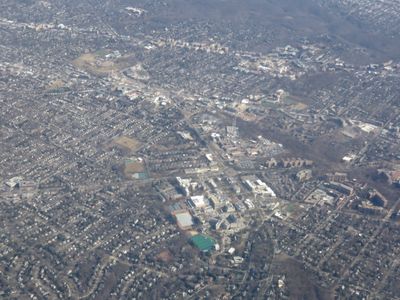
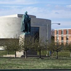
Tenleytown, Historic neighborhood in Northwest Washington, D.C., United States

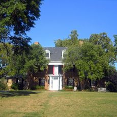
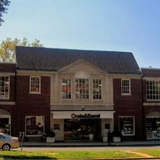
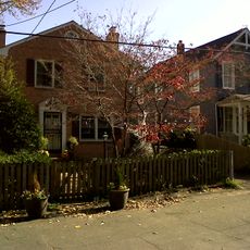
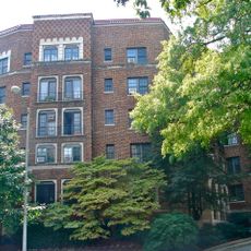
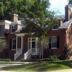
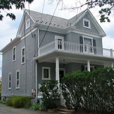
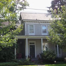
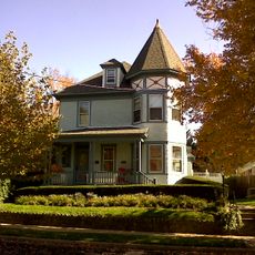
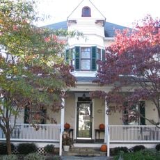
Tenleytown is a neighborhood in Northwest Washington, D.C. featuring a mix of medium-sized single-family homes and apartment buildings. Many structures date to before 1939 and sit along tree-lined streets with green spaces.

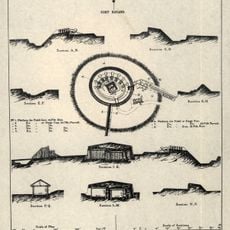
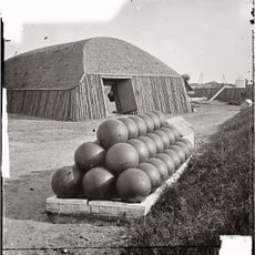
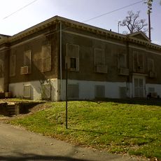
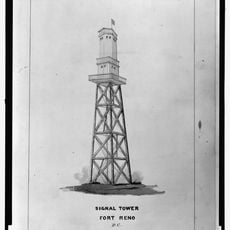
The area became significant during the Civil War when Fort Reno was built here as a strategic defense installation. This military fortification played an important role in protecting the city during that conflict.

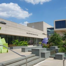
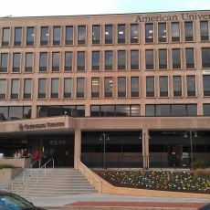
The neighborhood draws residents drawn to academic and professional pursuits, reflected in the schools and institutions that shape daily life here. Streets near the university develop their own character through student activity and scholarly influence.

The Tenleytown-AU Metro station on the Red Line connects directly to the broader transit system. Multiple bus routes also serve the neighborhood, making travel around the city straightforward.

The neighborhood served as a signal center during World War II to support military operations. Traces of this military past remain embedded in the area's geography and street layout.

The community of curious travelers

AroundUs brings together thousands of curated places, local tips, and hidden gems, enriched daily by 60,000 contributors worldwide.

Start exploring
Location
GPS coordinates
38.94600,-77.07900
Latest update
December 7, 2025 19:28
Around this place
Sidwell Friends School
United States of America

Sidwell Friends School

845 m
Fort Reno Park
United States of America

Fort Reno Park

724 m
Peter Muhlenberg Memorial
United States of America

Peter Muhlenberg Memorial

1.2 km
Ward Circle
United States of America

Ward Circle

1.1 km
Katzen Arts Center
United States of America

Katzen Arts Center

1 km
American University Museum
United States of America

American University Museum

1 km
General Artemas Ward
United States of America

General Artemas Ward

1.1 km
Janney Elementary School
United States of America

Janney Elementary School

239 m
Fort Bayard
United States of America

Fort Bayard

1.6 km
Harold and Sylvia Greenberg Theatre
United States of America

Harold and Sylvia Greenberg Theatre

286 m
Sears, Roebuck and Company Department Store
United States of America

Sears, Roebuck and Company Department Store

225 m
Fort Kearny
United States of America

Fort Kearny

1.5 km
Spring Valley Shopping Center
United States of America

Spring Valley Shopping Center

1.4 km
Jesse Reno School
United States of America

Jesse Reno School

740 m
Grant Road Historic District
United States of America

Grant Road Historic District

500 m
Dumblane
United States of America

Dumblane

255 m
Tenley-Friendship Neighborhood Library
United States of America

Tenley-Friendship Neighborhood Library

199 m
Convent de Bon Secours
United States of America

Convent de Bon Secours

293 m
Eldbrooke United Methodist Church
United States of America

Eldbrooke United Methodist Church

380 m
Ponce de Leon Apartment Building
United States of America

Ponce de Leon Apartment Building

1.2 km
Springland
United States of America

Springland

943 m
N. Webster Chappell House
United States of America

N. Webster Chappell House

197 m
Massachusetts Avenue Parking Shops
United States of America

Massachusetts Avenue Parking Shops

1.5 km
Samuel and Harriet Burrows House
United States of America

Samuel and Harriet Burrows House

1.1 km
Robert and Lillie May Stone House
United States of America

Robert and Lillie May Stone House

1.4 km
Walde-Carter House
United States of America

Walde-Carter House

1.5 km
Dopamine Land D.C.: A Multisensory Experience
United States of America

Dopamine Land D.C.: A Multisensory Experience

1.6 km
Fort Reno
United States of America

Fort Reno

525 m
Show the full map
Reviews
Share your experience

No review yet

Discussions
Start a discussion...

No discussion yet

« Tenleytown - Historic neighborhood in Northwest Washington, D.C., United States » is provided by Around Us (aroundus.com). Images and texts are derived from Wikimedia project under a Creative Commons license. You are allowed to copy, distribute, and modify copies of this page, under the conditions set by the license, as long as this note is clearly visible.

Discover hidden gems everywhere you go!

From secret cafés to breathtaking viewpoints, skip the crowded tourist spots and find places that match your style. Our app makes it easy with voice search, smart filtering, route optimization, and insider tips from travelers worldwide. Download now for the complete mobile experience.

Around Us App Screenshot

A unique approach to discovering new places

Le Figaro

All the places worth exploring

France Info

A tailor-made excursion in just a few clicks

20 Minutes

Around Us
Travel Guide & Maps
Download

Send to your phone

QR Code
1

Open the camera app on your mobile.

2

Point at the QR code with your camera. A notification will appear.

3

Tap the notification to open the link.