Chest opened
+${chestReward.xp} XP
Explorer
NOUVEAU ×${chestReward.collectible.quantity}
tapez pour fermer
Chest locked

Open chests in the app

Around Us is built for your phone — chests unlock when you walk, explore and capture nearby places.

Enable Location

We need your location to show you interesting places around you

Discover nearby places

Find interesting locations and hidden gems around you

Precise directions

Get accurate directions and distances to places

Your location is never shared with other users. It's only used when you tap the location button.

Toccoa River

Log in to your account

Start exploring — it's free

Trusted by 72,888 travelers worldwide

Continue with Google
Continue with Apple
or

We will send you a code to connect

By continuing, you accept our Terms and Conditions and our Privacy Policy

Check your inbox

We've sent a pincode in your inbox. Please enter the code below.

Toccoa River
Discussion Reviews 1 Photos
20.6k Popularity

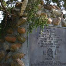
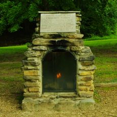
Toccoa River, Mountain river in Fannin County and Union County, United States.

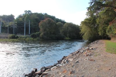
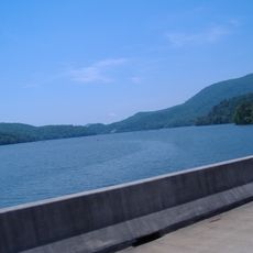
Toccoa River is a mountain waterway in northern Georgia that winds through varying sections from narrow passages to wider openings. The water's character changes depending on the surrounding terrain and landscape conditions.

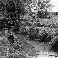
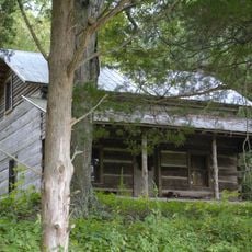
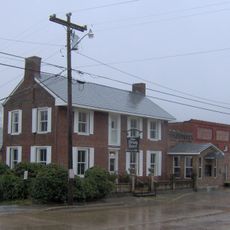
The river once supported logging operations that shaped the region's economy before transforming into a recreation destination. This shift reflects how the northern Georgia landscape adapted from resource extraction to tourism.

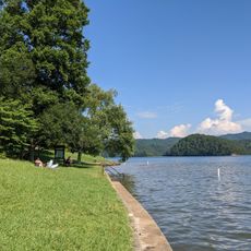
The river holds deep meaning for local anglers who practice fly-fishing traditions passed down through generations in this mountain region. These fishing communities have shaped how people connect with the waterway as a gathering place.

Multiple access points like Tammen Park, Curtis Switch, and Horseshoe Bend Park serve different visitor needs for wading and fishing activities. Planning your visit depends on which section you choose and what type of water activity interests you most.

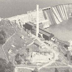
The lower section remains influenced by discharge from Blue Ridge Lake, maintaining steady water temperatures throughout the year. This consistency supports varied insect life that draws fly fishers from surrounding regions.

The community of curious travelers

AroundUs brings together thousands of curated places, local tips, and hidden gems, enriched daily by 60,000 contributors worldwide.

Start exploring
Location
Location
Location
GPS coordinates
35.20618,-84.65771
Latest update
December 7, 2025 10:05
Around this place
United States of America

Copper Basin

34.1 km
Big Frog Mountain
United States of America

Big Frog Mountain

25.7 km
Ocoee Dam No. 2
United States of America

Ocoee Dam No. 2

20.4 km
Big Frog Wilderness
United States of America

Big Frog Wilderness

25.9 km
Rattlesnake Springs
United States of America

Rattlesnake Springs

19.9 km
Nancy Ward Tomb
United States of America

Nancy Ward Tomb

5.1 km
Hair Conrad Cabin
United States of America

Hair Conrad Cabin

23.5 km
St. Luke's Episcopal Church
United States of America

St. Luke's Episcopal Church

20.4 km
Red Clay State Park
United States of America

Red Clay State Park

35.5 km
Henegar House
United States of America

Henegar House

12.6 km
Oswald Dome
United States of America

Oswald Dome

9.2 km
United States of America

Museum Center at Five Points

20.4 km
Broad Street United Methodist Church
United States of America

Broad Street United Methodist Church

20.8 km
Craigmiles Hall
United States of America

Craigmiles Hall

20.4 km
Centenary Avenue Historic District
United States of America

Centenary Avenue Historic District

20.2 km
P.M. Craigmiles House
United States of America

P.M. Craigmiles House

20.9 km
Clear Springs Cumberland Presbyterian Church
United States of America

Clear Springs Cumberland Presbyterian Church

7.7 km
Ocoee Street Historic District
United States of America

Ocoee Street Historic District

19.8 km
First United Presbyterian Church
United States of America

First United Presbyterian Church

27.3 km
W.J. Hughes Business House
United States of America

W.J. Hughes Business House

20.5 km
Polk County Courthouse
United States of America

Polk County Courthouse

3.7 km
Copeland House
United States of America

Copeland House

13.6 km
Cleveland Commercial Historic District
United States of America

Cleveland Commercial Historic District

20.5 km
Fillauer Brothers Building
United States of America

Fillauer Brothers Building

20.5 km
William Wiggins House
United States of America

William Wiggins House

3.6 km
Lake Ocoee
United States of America

Lake Ocoee

12.9 km
Parksville Beach
United States of America

Parksville Beach

11.6 km
Ocoee Dam No. 1
United States of America

Ocoee Dam No. 1

12.4 km
Show the full map
Reviews
Share your experience

No review yet

Discussions
Start a discussion...

No discussion yet

« Toccoa River - Mountain river in Fannin County and Union County, United States » is provided by Around Us (aroundus.com). Images and texts are derived from Wikimedia project under a Creative Commons license. You are allowed to copy, distribute, and modify copies of this page, under the conditions set by the license, as long as this note is clearly visible.

Discover hidden gems everywhere you go!

From secret cafés to breathtaking viewpoints, skip the crowded tourist spots and find places that match your style. Our app makes it easy with voice search, smart filtering, route optimization, and insider tips from travelers worldwide. Download now for the complete mobile experience.

Around Us App Screenshot

A unique approach to discovering new places

Le Figaro

All the places worth exploring

France Info

A tailor-made excursion in just a few clicks

20 Minutes

Around Us
Travel Guide & Maps
Download

Send to your phone

QR Code
1

Open the camera app on your mobile.

2

Point at the QR code with your camera. A notification will appear.

3

Tap the notification to open the link.