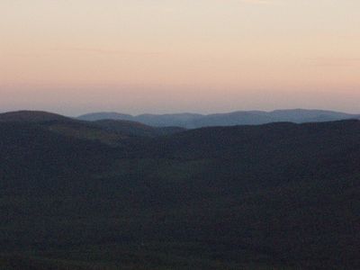
Tumbledown Mountain, Mountain summit in Franklin County, Maine, US
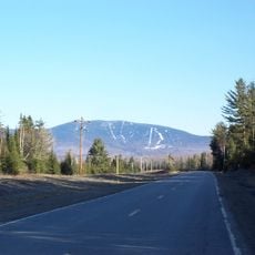
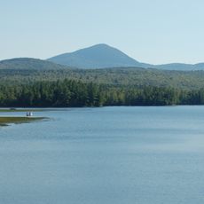
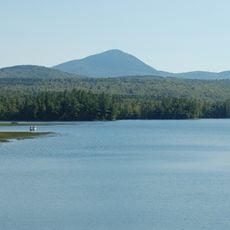
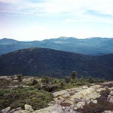
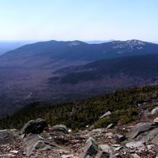
Tumbledown Mountain is a summit in Franklin County with an elevation around 3,054 feet, featuring multiple peaks with steep cliff faces and a natural pond situated near the highest point. The area is accessed through a network of hiking trails that vary in difficulty and route.
The area was originally home to Native American groups before settlers marked trails through the region during the 1800s. Some of the walking routes follow routes of earlier forest paths and logging roads.
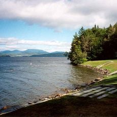
The mountain serves as a destination for outdoor enthusiasts from the region who value its network of walking routes and the chance to reach alpine terrain within their state.
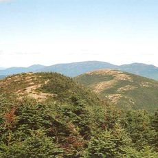
The two main trails offer different levels of difficulty, with one following forest paths to the pond at elevation and another crossing exposed ridge lines. Visitors should be prepared for changing weather and slippery ground after rain.
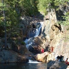
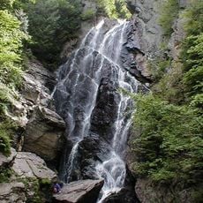
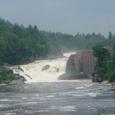
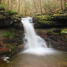
The name comes from the fractured appearance of the summit landscape, which looks tumbled and broken, and many visitors miss the smaller waterfalls hidden in the ravines below the main trails. These hidden falls are especially notable during months with higher water flow.
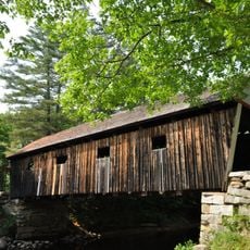
Location: Maine
GPS coordinates: 44.75009,-70.54875
Latest update: December 6, 2025 16:03
Maine offers coastal areas, forest landscapes and many historic sites. The region extends from the Atlantic Ocean to wooded mountains inland. Visitors find state parks like Baxter and Acadia, which provide opportunities for hiking and observing wildlife. The coast is lined with lighthouses, including Pemaquid Point and West Quoddy Head. Islands such as Monhegan and Peaks Island lie offshore. Waterfalls like Screw Auger Falls and Angel Falls draw hikers. Lakes such as Moosehead Lake attract people in warmer months. Old military structures like Fort Gorges remain from earlier centuries. Trails lead through areas like Gulf Hagas and Vaughan Woods. The landscape includes beaches at Roque Bluffs and Reid State Park, where sand meets the ocean. Mountain trails at Tumbledown offer views of surrounding valleys. The Carriage Roads on Mount Desert Island provide paths through forests and along lakeshores. Nature areas like Orono Bog Boardwalk allow close views of wetland plants. These places show the variety of terrain Maine contains, from rocky shores to inland wilderness.
Orgonon
29.3 km
Saddleback Mountain
21 km
Smalls Falls
12.3 km
Mount Blue (Maine)
16.5 km
Angel Falls
13.2 km
Mount Blue State Park
13.5 km
Rangeley Lake State Park
24.6 km
Saddleback Horn
22.9 km
Merrill-Poor House
19.7 km
Andover Public Library
20.8 km
Lovejoy Bridge
22.8 km
Rumford Public Library
22.6 km
Saddleback Junior
24.2 km
Barn on Lot 8, Range G
30.3 km
Rumford Municipal Building
22.6 km
Weld Town Hall
11.7 km
Madrid Village Schoolhouse
14.5 km
Rumford Falls Power Company Building
22.9 km
Capt. Joel Whitney House
18.4 km
Porter-Bell-Brackley Estate
26.6 km
Rangeley Public Library
25 km
Upper Dallas School
24.3 km
Deacon Hutchins House
25.5 km
Rangeley Trust Company Building
24.9 km
Maine Woods Office
17.8 km
Rumford Falls
23.5 km
Mount Abraham
30.4 km
Cascade Stream Gorge Trail
20 kmVisited this place? Tap the stars to rate it and share your experience / photos with the community! Try now! You can cancel it anytime.
Discover hidden gems everywhere you go!
From secret cafés to breathtaking viewpoints, skip the crowded tourist spots and find places that match your style. Our app makes it easy with voice search, smart filtering, route optimization, and insider tips from travelers worldwide. Download now for the complete mobile experience.
A unique approach to discovering new places❞
— Le Figaro
All the places worth exploring❞
— France Info
A tailor-made excursion in just a few clicks❞
— 20 Minutes