Enable Location

We need your location to show you interesting places around you

Discover nearby places

Find interesting locations and hidden gems around you

Precise directions

Get accurate directions and distances to places

Your location is never shared with other users. It's only used when you tap the location button.

Merrill-Poor House

Log in to your account

Start exploring — it's free

Trusted by 61,867 travelers worldwide

Continue with Google
Continue with Apple
or

We will send you a code to connect

By continuing, you accept our Terms and Conditions and our Privacy Policy

Check your inbox

We've sent a pincode in your inbox. Please enter the code below.

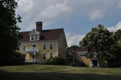
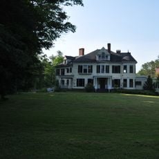
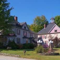
Merrill-Poor House, Colonial estate in Andover, United States.

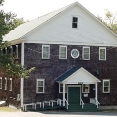
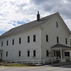
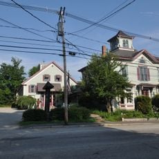
The Merrill-Poor House is a two-and-a-half-story colonial residence built with wood framing and a granite foundation, featuring a centered entrance with five bays. A later addition includes a great hall with Gothic woodwork and an open lodge space.

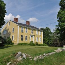
A Revolutionary War veteran built the house between 1788 and 1792 in recognition of his military service. The building was expanded in later years, reflecting the family's growth and changing needs.

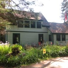
This house was home to individuals whose careers shaped American finance and transportation industries in significant ways. The rooms today reflect how an established family lived and worked during the 19th century.

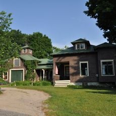
The house sits northeast of downtown Andover along Maine State Route 120 and preserves its original architectural character. Visitors should expect uneven floors and narrow stairs typical of homes from this period.

The 1896 addition created a dramatic great hall with soaring vertical space that transformed how the family used the building. This expansion shows how architectural tastes and living spaces evolved by the late 1800s.

The community of curious travelers

AroundUs brings together thousands of curated places, local tips, and hidden gems, enriched daily by 60,000 contributors worldwide.

Start exploring
Location
Inception
1791
Architectural style
colonial architecture, Colonial Revival architecture
GPS coordinates
44.63583,-70.73861
Latest update
December 14, 2025 16:42
Around this place
Tumbledown Mountain
United States of America

Tumbledown Mountain

19.7 km
Old Speck Mountain
United States of America

Old Speck Mountain

18.6 km
Grafton Notch State Park
United States of America

Grafton Notch State Park

17.2 km
Angel Falls
United States of America

Angel Falls

16.5 km
United States of America

Baldpate Mountain

12.7 km
Goose Eye Mountain
United States of America

Goose Eye Mountain

25.5 km
Forest Lodge
United States of America

Forest Lodge

22.2 km
Umbagog Lake State Park
United States of America

Umbagog Lake State Park

26.2 km
Sunday River Bridge
United States of America

Sunday River Bridge

18 km
Andover Public Library
United States of America

Andover Public Library

1.2 km
Lovejoy Bridge
United States of America

Lovejoy Bridge

4.7 km
Gehring Clinic
United States of America

Gehring Clinic

26.6 km
Rumford Public Library
United States of America

Rumford Public Library

18 km
Hall House
United States of America

Hall House

25.8 km
Dr. Moses Mason House
United States of America

Dr. Moses Mason House

26 km
Rumford Municipal Building
United States of America

Rumford Municipal Building

18.2 km
Weld Town Hall
United States of America

Weld Town Hall

26.1 km
Middle Intervale Meeting House and Common
United States of America

Middle Intervale Meeting House and Common

19.5 km
John M. Philbrook House
United States of America

John M. Philbrook House

26 km
Rumford Falls Power Company Building
United States of America

Rumford Falls Power Company Building

18.3 km
Former Greenwood Town Hall
United States of America

Former Greenwood Town Hall

26.3 km
Whitman Memorial Library
United States of America

Whitman Memorial Library

29.5 km
Lower Meeting House and East Bethel Cemetery
United States of America

Lower Meeting House and East Bethel Cemetery

19.1 km
Deacon Hutchins House
United States of America

Deacon Hutchins House

10.5 km
Lower Sunday River School
United States of America

Lower Sunday River School

19.7 km
Samuel D. Philbrook House
United States of America

Samuel D. Philbrook House

25.5 km
Rumford Falls
United States of America

Rumford Falls

18.8 km
Screw Auger Falls
United States of America

Screw Auger Falls

14.7 km
Show the full map
« Merrill-Poor House - Colonial estate in Andover, United States » is provided by Around Us (aroundus.com). Images and texts are derived from Wikimedia project under a Creative Commons license. You are allowed to copy, distribute, and modify copies of this page, under the conditions set by the license, as long as this note is clearly visible.

Discover hidden gems everywhere you go!

From secret cafés to breathtaking viewpoints, skip the crowded tourist spots and find places that match your style. Our app makes it easy with voice search, smart filtering, route optimization, and insider tips from travelers worldwide. Download now for the complete mobile experience.

Around Us App Screenshot

A unique approach to discovering new places

Le Figaro

All the places worth exploring

France Info

A tailor-made excursion in just a few clicks

20 Minutes

Around Us
Travel Guide & Maps
Download

Send to your phone

QR Code
1

Open the camera app on your mobile.

2

Point at the QR code with your camera. A notification will appear.

3

Tap the notification to open the link.