Enable Location

We need your location to show you interesting places around you

Discover nearby places

Find interesting locations and hidden gems around you

Precise directions

Get accurate directions and distances to places

Your location is never shared with other users. It's only used when you tap the location button.

Log in to your account

Start exploring — it's free

Trusted by 65,578 travelers worldwide

Continue with Google
Continue with Apple
or

We will send you a code to connect

By continuing, you accept our Terms and Conditions and our Privacy Policy

Check your inbox

We've sent a pincode in your inbox. Please enter the code below.

Baldpate Mountain
Discussion Reviews Photo
3.1k Popularity

Baldpate Mountain, Mountain summit in Maine, United States.

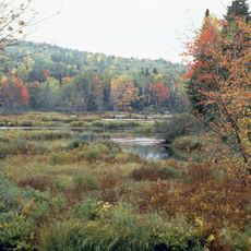
Baldpate Mountain is a double-peaked summit in Oxford County, Maine, made up of two distinct tops connected by a narrow saddle along a shared ridge. The higher of the two peaks sits to the east, and from either top the views reach across forested hills and open bogs in all directions.

The Appalachian Trail was routed through this area in the 1930s, turning the mountain into a regular stop on the long path between Maine and Georgia. Before that, the slopes were used mainly by loggers and local hunters who knew the forests well.

The name Baldpate comes from the open, rocky crown of the summit, which has little or no tree cover at the top. Hikers who reach the ridge notice right away how the forest gives way to bare granite slabs and wide open sky.

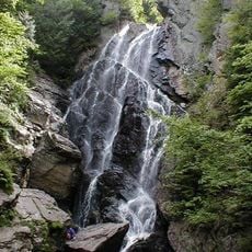
The hike begins at Grafton Notch State Park, where the main trailheads have parking areas. The terrain gets noticeably rockier as you gain elevation, so solid footwear makes a real difference on the upper sections of the trail.

The summit holds a small stand of pitch pines, a tree species more commonly associated with coastal dunes and sandy lowlands than with exposed mountain tops. Their presence at this elevation is considered unusual enough that botanists have studied the site to understand how this population survives so far from its typical habitat.

The community of curious travelers

AroundUs brings together thousands of curated places, local tips, and hidden gems, enriched daily by 60,000 contributors worldwide.

Start exploring
Location
GPS coordinates
44.60843,-70.89445
Latest update
March 3, 2026 13:55
Around this place
Old Speck Mountain
United States of America

Old Speck Mountain

6.3 km
Grafton Notch State Park
United States of America

Grafton Notch State Park

4.6 km
Angel Falls
United States of America

Angel Falls

24.3 km
St. Anne Church
United States of America

St. Anne Church

27.1 km
Goose Eye Mountain
United States of America

Goose Eye Mountain

14.4 km
Forest Lodge
United States of America

Forest Lodge

18.2 km
Umbagog National Wildlife Refuge
United States of America

Umbagog National Wildlife Refuge

25.3 km
Umbagog Lake State Park
United States of America

Umbagog Lake State Park

16.5 km
Sunday River Bridge
United States of America

Sunday River Bridge

13.6 km
Mollidgewock State Park
United States of America

Mollidgewock State Park

24.6 km
Merrill-Poor House
United States of America

Merrill-Poor House

12.7 km
United States of America

Milan Hill State Park

26.4 km
Andover Public Library
United States of America

Andover Public Library

11.6 km
Congregational Church
United States of America

Congregational Church

26.4 km
Lovejoy Bridge
United States of America

Lovejoy Bridge

12.8 km
Gehring Clinic
United States of America

Gehring Clinic

24.8 km
Androscoggin Wayside Park
United States of America

Androscoggin Wayside Park

27 km
Meadow Bridge
United States of America

Meadow Bridge

26.5 km
Hall House
United States of America

Hall House

24 km
Dr. Moses Mason House
United States of America

Dr. Moses Mason House

24.1 km
Middle Intervale Meeting House and Common
United States of America

Middle Intervale Meeting House and Common

18.2 km
John M. Philbrook House
United States of America

John M. Philbrook House

24 km
Lower Meeting House and East Bethel Cemetery
United States of America

Lower Meeting House and East Bethel Cemetery

21.1 km
Saint Anne Historic District
United States of America

Saint Anne Historic District

27 km
Deacon Hutchins House
United States of America

Deacon Hutchins House

17.3 km
Lower Sunday River School
United States of America

Lower Sunday River School

15.9 km
Samuel D. Philbrook House
United States of America

Samuel D. Philbrook House

23.6 km
Screw Auger Falls
United States of America

Screw Auger Falls

4.1 km
Show the full map
Reviews
Share your experience

No review yet

Discussions
Start a discussion...

No discussion yet

« Baldpate Mountain - Mountain summit in Maine, United States » is provided by Around Us (aroundus.com). Images and texts are derived from Wikimedia project under a Creative Commons license. You are allowed to copy, distribute, and modify copies of this page, under the conditions set by the license, as long as this note is clearly visible.

Discover hidden gems everywhere you go!

From secret cafés to breathtaking viewpoints, skip the crowded tourist spots and find places that match your style. Our app makes it easy with voice search, smart filtering, route optimization, and insider tips from travelers worldwide. Download now for the complete mobile experience.

Around Us App Screenshot

A unique approach to discovering new places

Le Figaro

All the places worth exploring

France Info

A tailor-made excursion in just a few clicks

20 Minutes

Around Us
Travel Guide & Maps
Download

Send to your phone

QR Code
1

Open the camera app on your mobile.

2

Point at the QR code with your camera. A notification will appear.

3

Tap the notification to open the link.