Enable Location

We need your location to show you interesting places around you

Discover nearby places

Find interesting locations and hidden gems around you

Precise directions

Get accurate directions and distances to places

Your location is never shared with other users. It's only used when you tap the location button.

Waterloo Historic District

Log in to your account

Start exploring — it's free

Trusted by 61,895 travelers worldwide

Continue with Google
Continue with Apple
or

We will send you a code to connect

By continuing, you accept our Terms and Conditions and our Privacy Policy

Check your inbox

We've sent a pincode in your inbox. Please enter the code below.

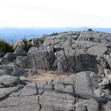
Waterloo Historic District, Historic district in Warner, New Hampshire, United States.

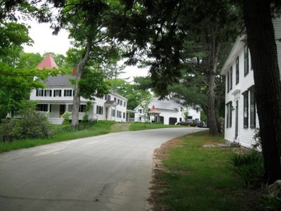
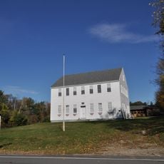
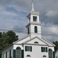
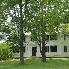
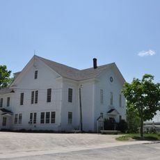
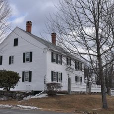
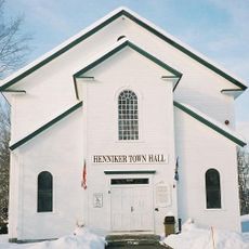
Waterloo Historic District spans about one mile along Waterloo Street and Newmarket Street, featuring buildings from the second half of the 19th century. The structures display various architectural styles and include both residential and commercial buildings from that era.

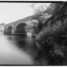
The area started as a mill town in the 1770s, with the first sawmill operating from 1789 and water-powered industries growing along the Warner River. This waterpower-driven development shaped the community for more than a century.

The district was home to William E. Chandler, a U.S. Senator and Secretary of the Navy, and Nehemiah G. Ordway, who served as governor of Dakota Territory. These connections to national figures shaped the place's standing and identity in local memory.

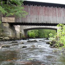
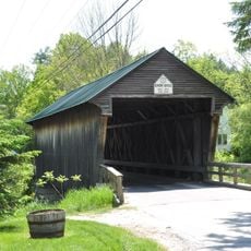
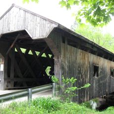
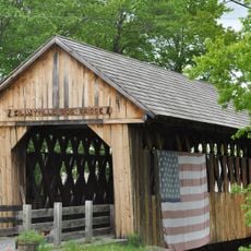
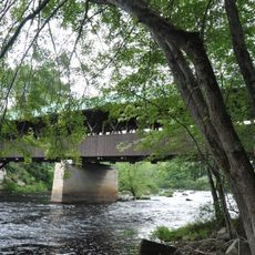
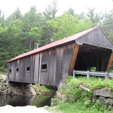
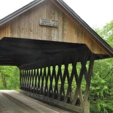
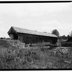
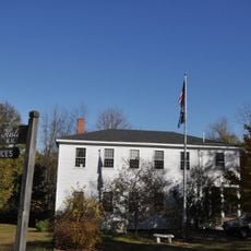
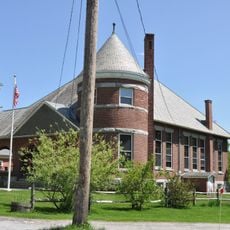
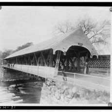
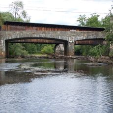
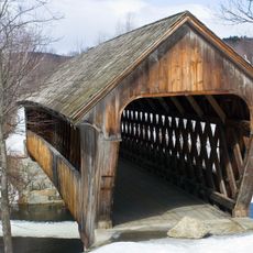
The district is walkable, allowing visitors to explore multiple preserved structures including a covered bridge from 1875, a historic tavern, and two old train stations. The buildings spread across the two main streets, so comfortable shoes are recommended.

A mill building from 1836 stands beside railroad tracks and the river, showing the industrial past of this place. The visible foundations of earlier structures tell the story of the intense economic activity that once defined it.

The community of curious travelers

AroundUs brings together thousands of curated places, local tips, and hidden gems, enriched daily by 60,000 contributors worldwide.

Start exploring
Location
GPS coordinates
43.28861,-71.85417
Latest update
December 14, 2025 18:42
Around this place
Mount Kearsarge
United States of America

Mount Kearsarge

10.6 km
The Fells
United States of America

The Fells

17.1 km
Contoocook Railroad Bridge
United States of America

Contoocook Railroad Bridge

13.5 km
Winslow State Park
United States of America

Winslow State Park

11.4 km
Bement Covered Bridge
United States of America

Bement Covered Bridge

8.5 km
Waterloo Covered Bridge
United States of America

Waterloo Covered Bridge

166 m
Bog Bridge
United States of America

Bog Bridge

15.8 km
Rowell's Covered Bridge
United States of America

Rowell's Covered Bridge

13.7 km
Kearsarge Mountain State Forest
United States of America

Kearsarge Mountain State Forest

10.5 km
Dalton Covered Bridge
United States of America

Dalton Covered Bridge

3.7 km
Old Webster Meeting House
United States of America

Old Webster Meeting House

12 km
New Hampshire Telephone Museum
United States of America

New Hampshire Telephone Museum

3.3 km
Keniston Bridge
United States of America

Keniston Bridge

16.4 km
New Henniker Bridge
United States of America

New Henniker Bridge

14.5 km
South Sutton Meeting House
United States of America

South Sutton Meeting House

7.5 km
Center Meetinghouse
United States of America

Center Meetinghouse

15.1 km
Matthew Harvey House
United States of America

Matthew Harvey House

12.5 km
Salisbury Academy Building
United States of America

Salisbury Academy Building

15.2 km
Bradford Town Hall
United States of America

Bradford Town Hall

9 km
Pillsbury Memorial Hall
United States of America

Pillsbury Memorial Hall

9.5 km
Lower Warner Meetinghouse
United States of America

Lower Warner Meetinghouse

4.7 km
Bradford Center Meetinghouse
United States of America

Bradford Center Meetinghouse

11 km
Jonathan Barnes House
United States of America

Jonathan Barnes House

17 km
Henniker Town Hall
United States of America

Henniker Town Hall

12.8 km
Contoocook Covered Bridge
United States of America

Contoocook Covered Bridge

13.5 km
Contoocook Road Bridge
United States of America

Contoocook Road Bridge

13.5 km
Henniker Covered Bridge
United States of America

Henniker Covered Bridge

12.6 km
Edna Dean Proctor Bridge
United States of America

Edna Dean Proctor Bridge

12.5 km
Show the full map
« Waterloo Historic District - Historic district in Warner, New Hampshire, United States » is provided by Around Us (aroundus.com). Images and texts are derived from Wikimedia project under a Creative Commons license. You are allowed to copy, distribute, and modify copies of this page, under the conditions set by the license, as long as this note is clearly visible.

Discover hidden gems everywhere you go!

From secret cafés to breathtaking viewpoints, skip the crowded tourist spots and find places that match your style. Our app makes it easy with voice search, smart filtering, route optimization, and insider tips from travelers worldwide. Download now for the complete mobile experience.

Around Us App Screenshot

A unique approach to discovering new places

Le Figaro

All the places worth exploring

France Info

A tailor-made excursion in just a few clicks

20 Minutes

Around Us
Travel Guide & Maps
Download

Send to your phone

QR Code
1

Open the camera app on your mobile.

2

Point at the QR code with your camera. A notification will appear.

3

Tap the notification to open the link.