Wolcott Mill Metropark

Log in to your account

AroundUs is a community-driven map of interesting places, built by curious explorers like you. It grows with every review, story, and photo you share.
Connect to save your favorite spots, contribute locations, and create personalized routes.
Continue with Google
Continue with Apple
Continue with X
Continue with Facebook
Continue with email
By continuing, you accept our Terms and Conditions and our Privacy Policy
Create an account
Add to collection
Map
Suggest a change
Share

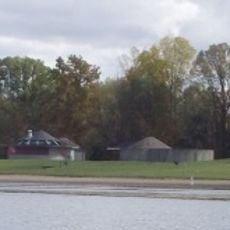
Wolcott Mill Metropark, Regional park in Ray Township, Michigan.

Wolcott Mill Metropark is a large regional park in Michigan featuring an operational farmstead with livestock, numerous trails for walking and riding, and a historic mill complex. The grounds encompass diverse natural habitats along a river corridor and organized camping facilities for youth groups.

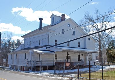
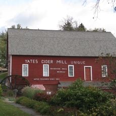
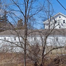
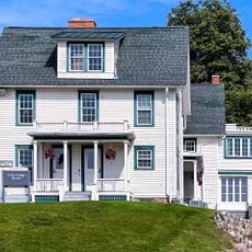
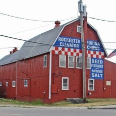
The mill at the park's center was built in 1847 and operated as both a grist and feed mill for more than a century with its original machinery intact. This industrial heritage shaped the development of the surrounding area.

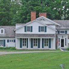
The working farm demonstrates traditional agricultural methods and animal husbandry practices that visitors can observe directly. These living displays show how rural communities sustained themselves through daily farm operations.

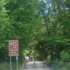
The park provides well-marked trails accessible to walkers, riders, and other visitors with routes of varying difficulty throughout the grounds. Bring water and wear sturdy shoes, as trails can be muddy or uneven depending on recent weather.

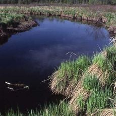
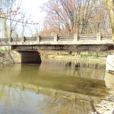
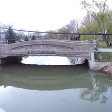
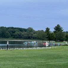
A river corridor runs through the entire property, creating multiple environments where wildlife and plants thrive in distinct ways along the water. This natural feature makes the park an important location for observing how different species adapt to riparian conditions.

Location: Ray Township

Location: Michigan

Location: Macomb County

Operator: Huron-Clinton Metroparks

Website: https://metroparks.com/wolcott-metropark

GPS coordinates: 42.77550,-82.94210

Latest update: December 13, 2025 17:00

Photos
Around this place
Meadow Brook Hall
United States of America

Meadow Brook Hall

24.1 km
Packard Proving Grounds
United States of America

Packard Proving Grounds

14.9 km
Woodside Bible Church
United States of America

Woodside Bible Church

23.2 km
Loren Andrus Octagon House
United States of America

Loren Andrus Octagon House

9.9 km
Bald Mountain Recreation Area
United States of America

Bald Mountain Recreation Area

22 km
C.J. Barrymore's
United States of America

C.J. Barrymore's

17 km
Yates Cider Mill
United States of America

Yates Cider Mill

16.9 km
Paint Creek Trail
United States of America

Paint Creek Trail

18.5 km
Emerald Theatre
United States of America

Emerald Theatre

20.4 km
Wolcott Mill
United States of America

Wolcott Mill

1.6 km
John Dodge House
United States of America

John Dodge House

23.6 km
Holcombe Site
United States of America

Holcombe Site

23.7 km
Currier House
United States of America

Currier House

18.1 km
Rochester Grain Elevator
United States of America

Rochester Grain Elevator

18.7 km
William Upton House
United States of America

William Upton House

21.3 km
Lakeville Swamp
United States of America

Lakeville Swamp

17.6 km
Meadow Brook Hall
United States of America

Meadow Brook Hall

24.1 km
Stony Creek Village Historic District
United States of America

Stony Creek Village Historic District

16.5 km
Romeo Historic District
United States of America

Romeo Historic District

6.6 km
First Congregational Church
United States of America

First Congregational Church

15.4 km
West Saint Clair Street Historic District
United States of America

West Saint Clair Street Historic District

18.3 km
Eli and Sidney Teeter Albertson House
United States of America

Eli and Sidney Teeter Albertson House

15.8 km
Masters Road–Belle River Bridge
United States of America

Masters Road–Belle River Bridge

20.4 km
Vernier Street–Swan Creek Bridge
United States of America

Vernier Street–Swan Creek Bridge

25.5 km
Eastwood Beach
United States of America

Eastwood Beach

12.9 km
Michigan Transit Museum
United States of America

Michigan Transit Museum

20.1 km
Baypoint Beach
United States of America

Baypoint Beach

13.2 km
Lower Trout Lake Bathhouse Complex and Contact Station
United States of America

Lower Trout Lake Bathhouse Complex and Contact Station

23.4 km
Show the full map
Reviews

Visited this place? Tap the stars to rate it and share your experience / photos with the community! Try now! You can cancel it anytime.

« Wolcott Mill Metropark - Regional park in Ray Township, Michigan » is provided by Around Us (aroundus.com). Images and texts are derived from Wikimedia project under a Creative Commons license. You are allowed to copy, distribute, and modify copies of this page, under the conditions set by the license, as long as this note is clearly visible.

Discover hidden gems everywhere you go!

From secret cafés to breathtaking viewpoints, skip the crowded tourist spots and find places that match your style. Our app makes it easy with voice search, smart filtering, route optimization, and insider tips from travelers worldwide. Download now for the complete mobile experience.

Around Us App Screenshot

A unique approach to discovering new places

Le Figaro

All the places worth exploring

France Info

A tailor-made excursion in just a few clicks

20 Minutes