Chest opened
+${chestReward.xp} XP
Explorer
NOUVEAU ×${chestReward.collectible.quantity}
tapez pour fermer
Chest locked

Open chests in the app

Around Us is built for your phone — chests unlock when you walk, explore and capture nearby places.

Enable Location

We need your location to show you interesting places around you

Discover nearby places

Find interesting locations and hidden gems around you

Precise directions

Get accurate directions and distances to places

Your location is never shared with other users. It's only used when you tap the location button.

Log in to your account

Start exploring — it's free

Trusted by 72,976 travelers worldwide

Continue with Google
Continue with Apple
or

We will send you a code to connect

By continuing, you accept our Terms and Conditions and our Privacy Policy

Check your inbox

We've sent a pincode in your inbox. Please enter the code below.

Discussion Reviews Photo
12k Popularity

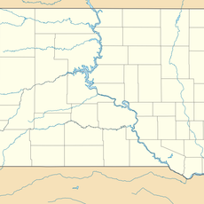
Yankton Indian Reservation, Native American reservation in Charles Mix County, United States.

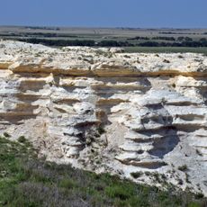
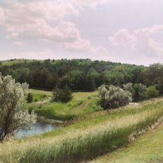
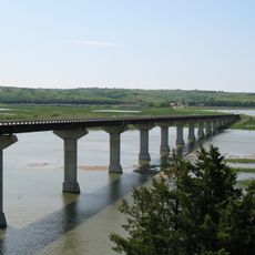
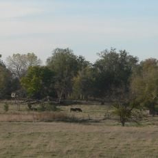
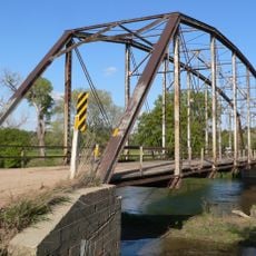
The Yankton Indian Reservation is located in southeastern South Dakota along the Missouri River and contains grasslands, waterways, and wetland areas. The land is home to the Yankton Sioux community and serves as their tribal homeland.

The reservation was established through an 1858 treaty between the Yankton Sioux and the United States government that defined territorial boundaries. This agreement shaped the foundation of the modern Yankton community and their legal standing.

Tribal members maintain Dakota language education programs and hold regular council meetings that shape community decisions and preserve their way of life.

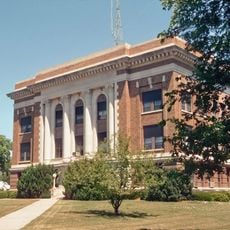
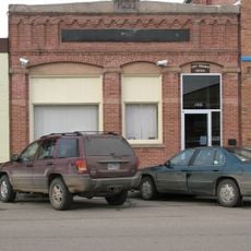
Visitors can drive on paved roads and explore key locations like Fort Randall Casino and tribal government offices throughout the reservation. It is important to respect the community and follow local guidelines, as this is an active reservation with ongoing tribal operations.

The reservation maintains a free-ranging bison herd and protects the sacred Pipestone Quarry, a spiritually important site for the Dakota people. This stone source is valued by many indigenous communities as a place to gather ritual materials.

The community of curious travelers

AroundUs brings together thousands of curated places, local tips, and hidden gems, enriched daily by 60,000 contributors worldwide.

Start exploring
GPS coordinates
43.08330,-98.38330
Latest update
December 7, 2025 20:47
Around this place
Niobrara Formation
United States of America

Niobrara Formation

46.8 km
Niobrara State Park
United States of America

Niobrara State Park

46.6 km
Chief Standing Bear Memorial Bridge
United States of America

Chief Standing Bear Memorial Bridge

47.4 km
United States of America

Lake Andes National Wildlife Refuge

12.2 km
United States of America

White Horse Ranch

59.7 km
St. Wenceslaus Catholic Church and Parish House
United States of America

St. Wenceslaus Catholic Church and Parish House

60.9 km
Niobrara River Bridge
United States of America

Niobrara River Bridge

44.6 km
Congregational Church and Manse
United States of America

Congregational Church and Manse

51.5 km
Church of Our Most Merciful Saviour
United States of America

Church of Our Most Merciful Saviour

52 km
St. Andrew's Episcopal Church
United States of America

St. Andrew's Episcopal Church

54.6 km
Old St. Wenceslaus Catholic Parish House
United States of America

Old St. Wenceslaus Catholic Parish House

61 km
Delmont Public School
United States of America

Delmont Public School

26.9 km
Rad Sladkovsky
United States of America

Rad Sladkovsky

42.1 km
Rouse Ranch
United States of America

Rouse Ranch

46.7 km
ZCBJ Hall
United States of America

ZCBJ Hall

43.2 km
William P. Smith House
United States of America

William P. Smith House

56.9 km
Armour Historic District
United States of America

Armour Historic District

26.5 km
Methodist Episcopal Church
United States of America

Methodist Episcopal Church

56 km
Charles Mix County Courthouse
United States of America

Charles Mix County Courthouse

14.9 km
Bon Homme County Courthouse
United States of America

Bon Homme County Courthouse

43.2 km
Ponca Tribal Self-Help Community Building Historic District
United States of America

Ponca Tribal Self-Help Community Building Historic District

47.7 km
Douglas County Courthouse
United States of America

Douglas County Courthouse

25.8 km
John Frydrych Farmstead
United States of America

John Frydrych Farmstead

50.8 km
Delmont State Bank
United States of America

Delmont State Bank

27.4 km
Wagner House
United States of America

Wagner House

17.6 km
Dimock (Dakota do Sul)
United States of America

Dimock (Dakota do Sul)

60.8 km
Gross State Aid Bridge
United States of America

Gross State Aid Bridge

55.2 km
Lake Francis Case
United States of America

Lake Francis Case

14.8 km
Show the full map
Reviews
Share your experience

No review yet

Discussions
Start a discussion...

No discussion yet

« Yankton Indian Reservation - Native American reservation in Charles Mix County, United States » is provided by Around Us (aroundus.com). Images and texts are derived from Wikimedia project under a Creative Commons license. You are allowed to copy, distribute, and modify copies of this page, under the conditions set by the license, as long as this note is clearly visible.

Discover hidden gems everywhere you go!

From secret cafés to breathtaking viewpoints, skip the crowded tourist spots and find places that match your style. Our app makes it easy with voice search, smart filtering, route optimization, and insider tips from travelers worldwide. Download now for the complete mobile experience.

Around Us App Screenshot

A unique approach to discovering new places

Le Figaro

All the places worth exploring

France Info

A tailor-made excursion in just a few clicks

20 Minutes

Around Us
Travel Guide & Maps
Download

Send to your phone

QR Code
1

Open the camera app on your mobile.

2

Point at the QR code with your camera. A notification will appear.

3

Tap the notification to open the link.