Enable Location

We need your location to show you interesting places around you

Discover nearby places

Find interesting locations and hidden gems around you

Precise directions

Get accurate directions and distances to places

Your location is never shared with other users. It's only used when you tap the location button.

Highline Lake State Park

Log in to your account

Start exploring — it's free

Trusted by 62,187 travelers worldwide

Continue with Google
Continue with Apple
or

We will send you a code to connect

By continuing, you accept our Terms and Conditions and our Privacy Policy

Check your inbox

We've sent a pincode in your inbox. Please enter the code below.

Highline Lake State Park

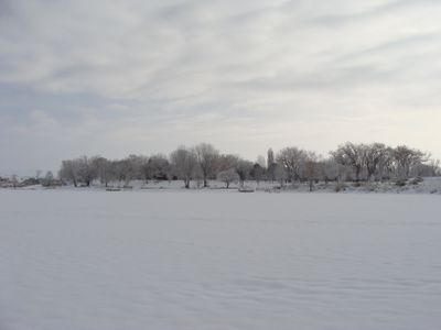
Highline Lake State Park, State park in Loma, Colorado, US.

Highline Lake State Park is a recreation area in Colorado featuring two interconnected lakes surrounded by desert landscape. The park provides access to trails, camping areas, and picnic grounds along the water.

The park was created in the 1960s when the Government Highline Canal was modified to supply water for recreation. This development turned an arid desert region into a public gathering place.

The National Audubon Society recognizes this location as an Important Bird Area, attracting numerous migratory birds throughout winter seasons.

The park is easily accessed from Interstate 70 via the Loma exit and offers facilities like restrooms, water access, and parking throughout. Paved roads lead to the main areas, making navigation straightforward for all visitors.

The park operates a special fishing program where standard size limits are removed for certain species. This allows anglers with a valid license to catch and keep fish that would normally be restricted.

The community of curious travelers

AroundUs brings together thousands of curated places, local tips, and hidden gems, enriched daily by 60,000 contributors worldwide.

Start exploring
Location
Inception
1967
GPS coordinates
39.27030,-108.83700
Latest update
December 9, 2025 18:47
Around this place
Colorado National Monument
United States of America

Colorado National Monument

28.5 km
Rattlesnake Canyon
United States of America

Rattlesnake Canyon

11.9 km
Black Ridge Canyons Wilderness
United States of America

Black Ridge Canyons Wilderness

20.1 km
McInnis Canyons National Conservation Area
United States of America

McInnis Canyons National Conservation Area

16.4 km
Independence Monument
United States of America

Independence Monument

21.8 km
Rim Rock Drive
United States of America

Rim Rock Drive

27.9 km
Kissing Couple
United States of America

Kissing Couple

22.6 km
Value Place
United States of America

Value Place

27.3 km
Kokopelli's Trail
United States of America

Kokopelli's Trail

10.3 km
Mee Canyon
United States of America

Mee Canyon

16 km
Saddlehorn Comfort Station
United States of America

Saddlehorn Comfort Station

20.5 km
Colorado National Monument Visitor Center Complex
United States of America

Colorado National Monument Visitor Center Complex

20.8 km
Saddlehorn Caretaker's House and Garage
United States of America

Saddlehorn Caretaker's House and Garage

20.8 km
Saddlehorn Utility Area Historic District
United States of America

Saddlehorn Utility Area Historic District

20.6 km
Fruita Museum
United States of America

Fruita Museum

16.3 km
Monument Canyon
United States of America

Monument Canyon

22.2 km
Fruita Canyon
United States of America

Fruita Canyon

19.3 km
Saddlehorn Visitor Center
United States of America

Saddlehorn Visitor Center

20.8 km
Bookcliff Shelter
United States of America

Bookcliff Shelter

20.8 km
Mondi Cable Ski
United States of America

Mondi Cable Ski

13.6 km
Horsethief Canyon
United States of America

Horsethief Canyon

15 km
Saddlehorn Caretaker's Garage
United States of America

Saddlehorn Caretaker's Garage

20.8 km
Saddlehorn Caretaker's Residence
United States of America

Saddlehorn Caretaker's Residence

20.8 km
Mather Plaque in Colorado National Monument
United States of America

Mather Plaque in Colorado National Monument

20.8 km
Fruita Bridge
United States of America

Fruita Bridge

17.4 km
West Lower Tunnel
United States of America

West Lower Tunnel

19.5 km
Balanced Rock
United States of America

Balanced Rock

20.2 km
Saddlehorn Oil Storage Building
United States of America

Saddlehorn Oil Storage Building

20.6 km
Show the full map
« Highline Lake State Park - State park in Loma, Colorado, US » is provided by Around Us (aroundus.com). Images and texts are derived from Wikimedia project under a Creative Commons license. You are allowed to copy, distribute, and modify copies of this page, under the conditions set by the license, as long as this note is clearly visible.

Discover hidden gems everywhere you go!

From secret cafés to breathtaking viewpoints, skip the crowded tourist spots and find places that match your style. Our app makes it easy with voice search, smart filtering, route optimization, and insider tips from travelers worldwide. Download now for the complete mobile experience.

Around Us App Screenshot

A unique approach to discovering new places

Le Figaro

All the places worth exploring

France Info

A tailor-made excursion in just a few clicks

20 Minutes

Around Us
Travel Guide & Maps
Download

Send to your phone

QR Code
1

Open the camera app on your mobile.

2

Point at the QR code with your camera. A notification will appear.

3

Tap the notification to open the link.