Enable Location

We need your location to show you interesting places around you

Discover nearby places

Find interesting locations and hidden gems around you

Precise directions

Get accurate directions and distances to places

Your location is never shared with other users. It's only used when you tap the location button.

Rattlesnake Canyon

Log in to your account

Start exploring — it's free

Trusted by 62,193 travelers worldwide

Continue with Google
Continue with Apple
or

We will send you a code to connect

By continuing, you accept our Terms and Conditions and our Privacy Policy

Check your inbox

We've sent a pincode in your inbox. Please enter the code below.

Rattlesnake Canyon

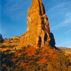
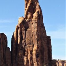
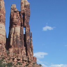
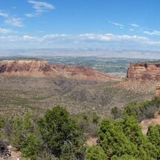
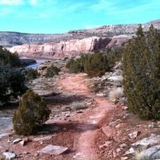
Rattlesnake Canyon, Natural canyon in Mesa County, Colorado, United States.

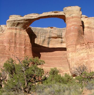
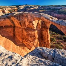
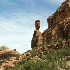
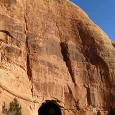
Rattlesnake Canyon is a canyon in Mesa County featuring nine natural stone arches scattered across red sandstone cliffs and desert terrain. The arches rise from a remote landscape shaped by wind and water over millions of years.

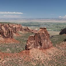
The canyon sits within McInnis Canyons National Conservation Area, which was created to protect Colorado's geological landscape. This protected status ensures the canyon's natural character is maintained over time.

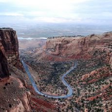
The Bureau of Land Management maintains this area as part of Black Ridge Canyons Wilderness, preserving its natural state for future generations.

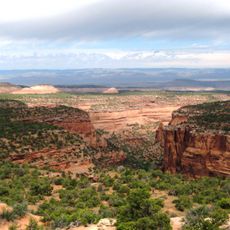
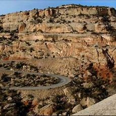
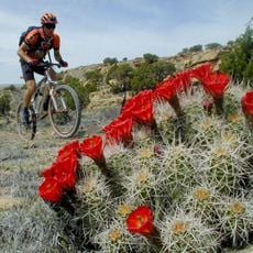
Two main access routes exist: a 15-mile (24 km) round-trip hike from Pollock Bench Trailhead or a high-clearance vehicle via Black Ridge Road to Upper Trailhead. Either way requires preparation for remote desert conditions and long exposure to sun and heat.

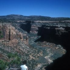
This location holds the second-largest concentration of natural stone arches in the United States, with Cedar Tree Arch standing out for its exceptional size. The arch is one of the most visually striking structures visitors encounter in the canyon.

The community of curious travelers

AroundUs brings together thousands of curated places, local tips, and hidden gems, enriched daily by 60,000 contributors worldwide.

Start exploring
Location
GPS coordinates
39.16500,-108.86200
Latest update
December 6, 2025 17:40
Rock formations and hoodoos for Instagram photos

Rock pillars and spires shaped by erosion stand as natural monuments across various locations worldwide. These geological structures, known as hoodoos, display different colors and shapes based on their mineral composition and environmental conditions. From the red rocks of Utah to the limestone...

Around this place
Colorado National Monument
United States of America

Colorado National Monument

20.4 km
Black Ridge Canyons Wilderness
United States of America

Black Ridge Canyons Wilderness

8.9 km
Highline Lake State Park
United States of America

Highline Lake State Park

11.9 km
McInnis Canyons National Conservation Area
United States of America

McInnis Canyons National Conservation Area

11.4 km
Independence Monument
United States of America

Independence Monument

14.2 km
Rim Rock Drive
United States of America

Rim Rock Drive

19.2 km
Kissing Couple
United States of America

Kissing Couple

15 km
Kokopelli's Trail
United States of America

Kokopelli's Trail

3.3 km
Mee Canyon
United States of America

Mee Canyon

8 km
Saddlehorn Comfort Station
United States of America

Saddlehorn Comfort Station

13 km
Colorado National Monument Visitor Center Complex
United States of America

Colorado National Monument Visitor Center Complex

13.1 km
Saddlehorn Caretaker's House and Garage
United States of America

Saddlehorn Caretaker's House and Garage

13.1 km
Saddlehorn Utility Area Historic District
United States of America

Saddlehorn Utility Area Historic District

12.7 km
Fruita Museum
United States of America

Fruita Museum

11.6 km
Monument Canyon
United States of America

Monument Canyon

15 km
Fruita Canyon
United States of America

Fruita Canyon

12.5 km
Ute Canyon
United States of America

Ute Canyon

21.1 km
Saddlehorn Visitor Center
United States of America

Saddlehorn Visitor Center

13.1 km
Bookcliff Shelter
United States of America

Bookcliff Shelter

13.5 km
Horsethief Canyon
United States of America

Horsethief Canyon

9.1 km
Saddlehorn Caretaker's Garage
United States of America

Saddlehorn Caretaker's Garage

13.1 km
Saddlehorn Caretaker's Residence
United States of America

Saddlehorn Caretaker's Residence

13.1 km
Mather Plaque in Colorado National Monument
United States of America

Mather Plaque in Colorado National Monument

13.1 km
Fruita Bridge
United States of America

Fruita Bridge

11.7 km
Balanced Rock
United States of America

Balanced Rock

12.8 km
Saddlehorn Campground
United States of America

Saddlehorn Campground

13 km
West Lower Tunnel
United States of America

West Lower Tunnel

12.3 km
Saddlehorn Oil Storage Building
United States of America

Saddlehorn Oil Storage Building

12.8 km
Show the full map
« Rattlesnake Canyon - Natural canyon in Mesa County, Colorado, United States » is provided by Around Us (aroundus.com). Images and texts are derived from Wikimedia project under a Creative Commons license. You are allowed to copy, distribute, and modify copies of this page, under the conditions set by the license, as long as this note is clearly visible.

Discover hidden gems everywhere you go!

From secret cafés to breathtaking viewpoints, skip the crowded tourist spots and find places that match your style. Our app makes it easy with voice search, smart filtering, route optimization, and insider tips from travelers worldwide. Download now for the complete mobile experience.

Around Us App Screenshot

A unique approach to discovering new places

Le Figaro

All the places worth exploring

France Info

A tailor-made excursion in just a few clicks

20 Minutes

Around Us
Travel Guide & Maps
Download

Send to your phone

QR Code
1

Open the camera app on your mobile.

2

Point at the QR code with your camera. A notification will appear.

3

Tap the notification to open the link.