Enable Location

We need your location to show you interesting places around you

Discover nearby places

Find interesting locations and hidden gems around you

Precise directions

Get accurate directions and distances to places

Your location is never shared with other users. It's only used when you tap the location button.

Monmouth Battlefield State Park

Log in to your account

Start exploring — it's free

Trusted by 62,491 travelers worldwide

Continue with Google
Continue with Apple
or

We will send you a code to connect

By continuing, you accept our Terms and Conditions and our Privacy Policy

Check your inbox

We've sent a pincode in your inbox. Please enter the code below.

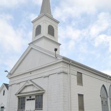
Monmouth Battlefield State Park, Revolutionary War battlefield park in Manalapan Township, United States

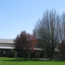
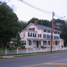
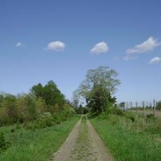
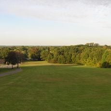
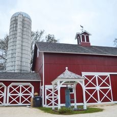
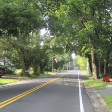
Monmouth Battlefield State Park is an 1,818-acre park with rolling terrain, colonial farm buildings, and extensive hiking trails that follow former military positions. The interpretive center displays exhibits and provides maps along with details about guided tours.

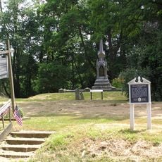
The Battle of Monmouth in 1778 was a turning point when Washington's Continental forces clashed with British troops in one of the Revolutionary War's largest engagements. The outcome boosted American morale and shifted momentum in the conflict.

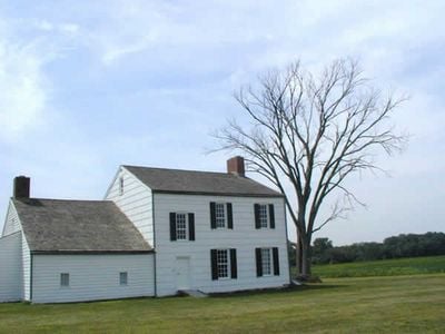
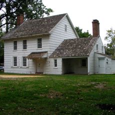
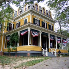
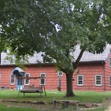
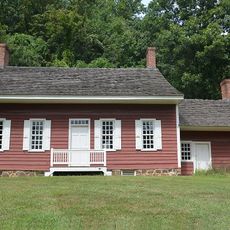
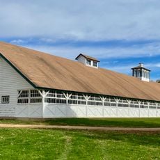
The Craig House displays Dutch and English design elements common to colonial-era farms, with furnishings and tools that show how rural families lived and worked in the 1700s. Walking through rooms reveals the daily routines and priorities of that agricultural community.

The grounds are open daily from sunrise to sunset with accessible paths suitable for walking at a leisurely pace. Bring water and wear comfortable shoes, as trails can be muddy during wet seasons.

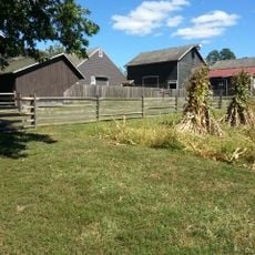
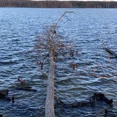
The preserved hedgerows and orchards maintain the exact field patterns that guided troop movements during the battle. This landscape layout lets visitors understand why commanders positioned forces where they did.

The community of curious travelers

AroundUs brings together thousands of curated places, local tips, and hidden gems, enriched daily by 60,000 contributors worldwide.

Start exploring
Inception
1961
GPS coordinates
40.25615,-74.32072
Latest update
December 20, 2025 19:40
Around this place
Holmdel Park
United States of America

Holmdel Park

17.5 km
United States of America

Old Tennent Church

4.8 km
Co-Cathedral of St. Robert Bellarmine
United States of America

Co-Cathedral of St. Robert Bellarmine

5.1 km
Hankinson-Moreau-Covenhoven House
United States of America

Hankinson-Moreau-Covenhoven House

3 km
Temple Shaari Emeth
United States of America

Temple Shaari Emeth

3.6 km
Buckelew Mansion
United States of America

Buckelew Mansion

14 km
George Taylor House
United States of America

George Taylor House

4.7 km
Old Scots Graveyard
United States of America

Old Scots Graveyard

10.6 km
United States of America

Walker-Combs-Hartshorne Farmstead

1.3 km
Longstreet Farm
United States of America

Longstreet Farm

17.1 km
Upper Meeting House of the Baptist Church of Middletown
United States of America

Upper Meeting House of the Baptist Church of Middletown

15.1 km
United States of America

Monmouth County Jewish Heritage Museum

1.9 km
Holmdel Arboretum
United States of America

Holmdel Arboretum

17.4 km
Kovenhoven
United States of America

Kovenhoven

16.2 km
Thompson Park
United States of America

Thompson Park

12.8 km
Old Kentuck
United States of America

Old Kentuck

14.9 km
St. Peters Church and Buildings
United States of America

St. Peters Church and Buildings

16.2 km
St. George's Anglican Church
United States of America

St. George's Anglican Church

16 km
Church Street School
United States of America

Church Street School

3.3 km
Clarksburg Methodist Episcopal Church
United States of America

Clarksburg Methodist Episcopal Church

13.2 km
Probasco-Dittner Farmstead
United States of America

Probasco-Dittner Farmstead

10.5 km
Holmes-Hendrickson House
United States of America

Holmes-Hendrickson House

17.3 km
Monmouth County Horse Show
United States of America

Monmouth County Horse Show

6.2 km
Thompson Park
United States of America

Thompson Park

17.2 km
Cedar Grove School
United States of America

Cedar Grove School

17.4 km
Manasquan Reservoir
United States of America

Manasquan Reservoir

12.9 km
Jersey Homesteads Historic District
United States of America

Jersey Homesteads Historic District

13.6 km
Brookdale Farm Historic District
United States of America

Brookdale Farm Historic District

17.4 km
Show the full map
« Monmouth Battlefield State Park - Revolutionary War battlefield park in Manalapan Township, United States » is provided by Around Us (aroundus.com). Images and texts are derived from Wikimedia project under a Creative Commons license. You are allowed to copy, distribute, and modify copies of this page, under the conditions set by the license, as long as this note is clearly visible.

Discover hidden gems everywhere you go!

From secret cafés to breathtaking viewpoints, skip the crowded tourist spots and find places that match your style. Our app makes it easy with voice search, smart filtering, route optimization, and insider tips from travelers worldwide. Download now for the complete mobile experience.

Around Us App Screenshot

A unique approach to discovering new places

Le Figaro

All the places worth exploring

France Info

A tailor-made excursion in just a few clicks

20 Minutes

Around Us
Travel Guide & Maps
Download

Send to your phone

QR Code
1

Open the camera app on your mobile.

2

Point at the QR code with your camera. A notification will appear.

3

Tap the notification to open the link.