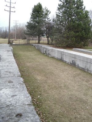
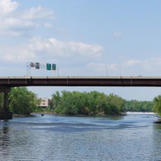
Watervliet Side Cut Locks
Watervliet Side Cut Locks, also known as West Troy Side Cut Locks, are a historic lock system in Watervliet, New York that guided vessels between the Erie Canal and Hudson River. The structures were built from cut limestone blocks and include a sea wall, showing careful construction techniques from the early 1800s.
Built in the early 1800s, the locks were designed to guide vessels between the Erie Canal and Hudson River while improving trade routes. As the canal expanded, larger locks were constructed to handle increased shipping demands and heavier cargo.
The locks were central to how the region's economy developed and shaped community life around water routes. Local memory preserves stories of workers and ships that once moved through these structures, connecting people across the area through trade.
The site is located near 23rd Street and is partially hidden beneath Interstate 787, making it difficult to access directly. Visitors can approach the area and view the old stone structures and water channels to understand how boats once navigated through here.
The original site included a weigh lock to measure boat and cargo weight, which was later replaced by a newer facility down the way. This early weight control system shows how carefully trade was managed through these waterways.
The community of curious travelers
AroundUs brings together thousands of curated places, local tips, and hidden gems, enriched daily by 60,000 contributors worldwide.