Chest opened
+${chestReward.xp} XP
Explorer
NOUVEAU ×${chestReward.collectible.quantity}
tapez pour fermer
Chest locked

Open chests in the app

Around Us is built for your phone — chests unlock when you walk, explore and capture nearby places.

Enable Location

We need your location to show you interesting places around you

Discover nearby places

Find interesting locations and hidden gems around you

Precise directions

Get accurate directions and distances to places

Your location is never shared with other users. It's only used when you tap the location button.

Krejci Dump

Log in to your account

Start exploring — it's free

Trusted by 72,880 travelers worldwide

Continue with Google
Continue with Apple
or

We will send you a code to connect

By continuing, you accept our Terms and Conditions and our Privacy Policy

Check your inbox

We've sent a pincode in your inbox. Please enter the code below.

Krejci Dump
Discussion Reviews 1 Photos
9.8k Popularity

Krejci Dump, Industrial landfill in Summit County, US.

Krejci Dump is a former landfill in Summit County, Ohio, now designated as a federal Superfund site under environmental oversight. The property is divided into separate management zones where soil contamination and potential pollutant spread are continuously tracked.

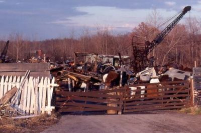
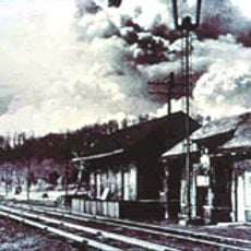
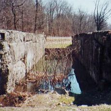
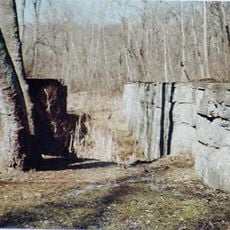
The site operated as a dumping ground for municipal and industrial waste from the 1950s through the early 1980s. After closure, documented soil and water contamination led to its placement on the national Superfund list, triggering a federally managed cleanup process.

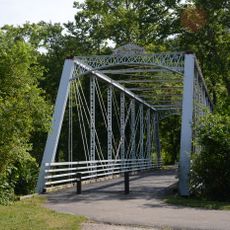
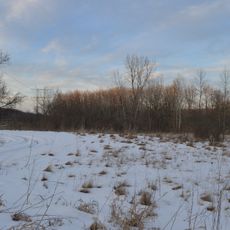
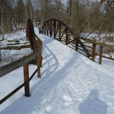
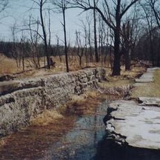
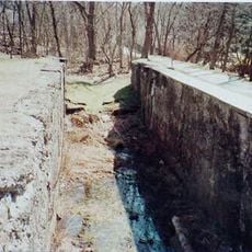
Krejci Dump sits within Cuyahoga Valley National Park, making it one of the few Superfund sites located inside a national park in the United States. Hikers on nearby trails may notice fenced-off areas and monitoring equipment as visible signs of the ongoing cleanup work.

The site is closed to the public because active remediation work is still underway. Anyone interested in the current cleanup status can find updated reports through federal environmental agencies.

Several major automobile manufacturers were identified as responsible parties and contributed substantial funds toward the cleanup. This case became an early example of industrial companies being held directly liable for the costs of remediating a contaminated site.

The community of curious travelers

AroundUs brings together thousands of curated places, local tips, and hidden gems, enriched daily by 60,000 contributors worldwide.

Start exploring
Location
GPS coordinates
41.27000,-81.54000
Latest update
March 3, 2026 10:12
Around this place
Blossom Music Center
United States of America

Blossom Music Center

8.9 km
United States of America

Twins Days

8.7 km
Western Reserve Academy
United States of America

Western Reserve Academy

9.1 km
Boston Mills Historic District
United States of America

Boston Mills Historic District

1.7 km
Loomis Observatory
United States of America

Loomis Observatory

8.3 km
Brecksville-Northfield High Level Bridge
United States of America

Brecksville-Northfield High Level Bridge

7 km
Brecksville Reservation
United States of America

Brecksville Reservation

7.4 km
Jaite Mill Historic District
United States of America

Jaite Mill Historic District

2.5 km
Virginia Kendall State Park Historic District
United States of America

Virginia Kendall State Park Historic District

6 km
Station Road Bridge
United States of America

Station Road Bridge

6.8 km
Everett Historic District
United States of America

Everett Historic District

7.8 km
Valley Railway Historic District
United States of America

Valley Railway Historic District

5.4 km
Hudson Historic District
United States of America

Hudson Historic District

8.7 km
Daniel Tilden House
United States of America

Daniel Tilden House

4.8 km
Peninsula Village Historic District
United States of America

Peninsula Village Historic District

3.2 km
Jim Brown Tavern
United States of America

Jim Brown Tavern

1.7 km
Coonrad Ranger Station
United States of America

Coonrad Ranger Station

3 km
Allen Welton House
United States of America

Allen Welton House

5.5 km
Charles B. Rich House
United States of America

Charles B. Rich House

8.3 km
Camp Manatoc Dining Hall
United States of America

Camp Manatoc Dining Hall

5.5 km
Vaughn Site
United States of America

Vaughn Site

3.4 km
Lock No. 34
United States of America

Lock No. 34

3 km
Lock No. 31
United States of America

Lock No. 31

2.1 km
Furnace Run Aqueduct
United States of America

Furnace Run Aqueduct

8 km
Lock No. 33
United States of America

Lock No. 33

1.9 km
Lock No. 32
United States of America

Lock No. 32

1.6 km
Blue Hen Falls
United States of America

Blue Hen Falls

3 km
Everett Covered Bridge
United States of America

Everett Covered Bridge

8.2 km
Show the full map
Reviews
Share your experience

No review yet

Discussions
Start a discussion...

No discussion yet

« Krejci Dump - Industrial landfill in Summit County, US » is provided by Around Us (aroundus.com). Images and texts are derived from Wikimedia project under a Creative Commons license. You are allowed to copy, distribute, and modify copies of this page, under the conditions set by the license, as long as this note is clearly visible.

Discover hidden gems everywhere you go!

From secret cafés to breathtaking viewpoints, skip the crowded tourist spots and find places that match your style. Our app makes it easy with voice search, smart filtering, route optimization, and insider tips from travelers worldwide. Download now for the complete mobile experience.

Around Us App Screenshot

A unique approach to discovering new places

Le Figaro

All the places worth exploring

France Info

A tailor-made excursion in just a few clicks

20 Minutes

Around Us
Travel Guide & Maps
Download

Send to your phone

QR Code
1

Open the camera app on your mobile.

2

Point at the QR code with your camera. A notification will appear.

3

Tap the notification to open the link.