Chest opened
+${chestReward.xp} XP
Explorer
NOUVEAU ×${chestReward.collectible.quantity}
tapez pour fermer
Chest locked

Open chests in the app

Around Us is built for your phone — chests unlock when you walk, explore and capture nearby places.

Enable Location

We need your location to show you interesting places around you

Discover nearby places

Find interesting locations and hidden gems around you

Precise directions

Get accurate directions and distances to places

Your location is never shared with other users. It's only used when you tap the location button.

Log in to your account

Start exploring — it's free

Trusted by 73,003 travelers worldwide

Continue with Google
Continue with Apple
or

We will send you a code to connect

By continuing, you accept our Terms and Conditions and our Privacy Policy

Check your inbox

We've sent a pincode in your inbox. Please enter the code below.

Muskallonge Lake State Park
Discussion Reviews Photo
3.8k Popularity

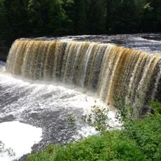
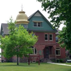
Muskallonge Lake State Park, State park between Lake Superior and Muskallonge Lake in Michigan, US.

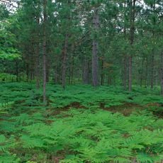
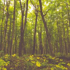
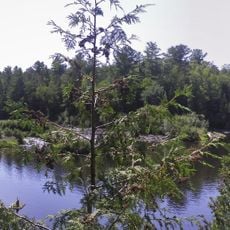
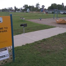
Muskallonge Lake State Park sits between Lake Superior and Muskallonge Lake in Luce County, spanning about 217 acres of dense forest. The park includes sandy shorelines, walking paths through the woods, and two campgrounds with a combined 159 campsites.

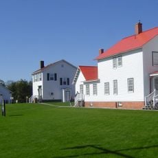
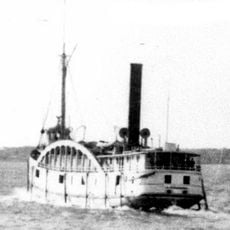
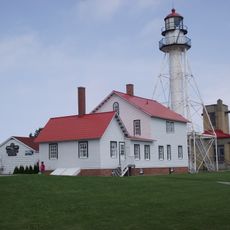
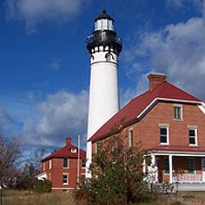
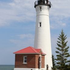
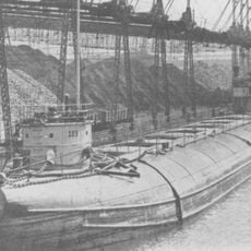
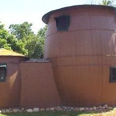
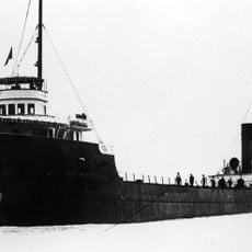
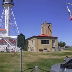
The site began as a Native American settlement and later became Deer Park, a logging town with a sawmill processing white pine during the 1880s. A Coast Guard Life Saving Station then operated there from 1876 to 1909, protecting ships and swimmers along the Lake Superior coast.

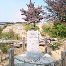
The area held great importance for the Anishinaabe people, who fished and hunted along these shores. Their presence is still visible through artifacts and stories shared in local museums and interpretive displays.

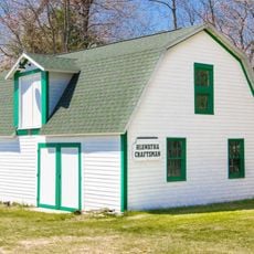
The park is open year-round with facilities including restrooms, picnic tables, and boat ramps at both lakes. Winter visitors can enjoy snowshoeing and cross-country skiing on the trails, while summer is ideal for fishing and swimming.

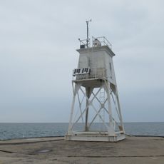
The abandoned Coast Guard Life Saving Station tower still stands on the Lake Superior shore today, one of the few remaining structures of its kind from the 1800s. Visitors can see the building and imagine the lookouts scanning the waters for ships in distress.

The community of curious travelers

AroundUs brings together thousands of curated places, local tips, and hidden gems, enriched daily by 60,000 contributors worldwide.

Start exploring
Location
Inception
1957
GPS coordinates
46.67640,-85.63580
Latest update
December 11, 2025 18:06
Around this place
Tahquamenon Falls
United States of America

Tahquamenon Falls

31.2 km
Tahquamenon Falls State Park
United States of America

Tahquamenon Falls State Park

33.9 km
Great Lakes Shipwreck Museum
United States of America

Great Lakes Shipwreck Museum

52.9 km
Whitefish Point Underwater Preserve
United States of America

Whitefish Point Underwater Preserve

53.4 km
Whitefish Point Light
United States of America

Whitefish Point Light

52.9 km
Seney National Wildlife Refuge
United States of America

Seney National Wildlife Refuge

59.3 km
Au Sable Light
United States of America

Au Sable Light

38.4 km
Crisp Point Light
United States of America

Crisp Point Light

30.1 km
129
United States of America

129

46.1 km
Pickle Barrel House
United States of America

Pickle Barrel House

26.7 km
SS John Mitchell
United States of America

SS John Mitchell

45.9 km
Sable Falls
United States of America

Sable Falls

28.8 km
Whitefish Point Bird Observatory
United States of America

Whitefish Point Bird Observatory

52.9 km
Beaver Basin Wilderness
United States of America

Beaver Basin Wilderness

54 km
Hiawatha Sportsman's Club 1931 Maintenance Building and Commissary
United States of America

Hiawatha Sportsman's Club 1931 Maintenance Building and Commissary

59.8 km
Tahqua Land Theater
United States of America

Tahqua Land Theater

37 km
Edmund Fitzgerald Memorial
United States of America

Edmund Fitzgerald Memorial

52.8 km
Luce County Sheriff's House and Jail
United States of America

Luce County Sheriff's House and Jail

37.2 km
Whitefish Point Lighthouse Historical Marker
United States of America

Whitefish Point Lighthouse Historical Marker

52.9 km
Grand Marais Harbor of Refuge Outer Light
United States of America

Grand Marais Harbor of Refuge Outer Light

25.7 km
Newberry State Bank Historical Marker
United States of America

Newberry State Bank Historical Marker

37.1 km
Whitefish Township Community Library
United States of America

Whitefish Township Community Library

46.2 km
Lower Falls
United States of America

Lower Falls

33.7 km
Jail and Sheriff's Residence Historical Marker
United States of America

Jail and Sheriff's Residence Historical Marker

37.3 km
Post Office Historical Marker
United States of America

Post Office Historical Marker

50.7 km
Tahquamenon Area Public Library
United States of America

Tahquamenon Area Public Library

37.5 km
Luce County Government Building
United States of America

Luce County Government Building

37.2 km
Atlas Park
United States of America

Atlas Park

37.6 km
Show the full map
Reviews
Share your experience

No review yet

Discussions
Start a discussion...

No discussion yet

« Muskallonge Lake State Park - State park between Lake Superior and Muskallonge Lake in Michigan, US » is provided by Around Us (aroundus.com). Images and texts are derived from Wikimedia project under a Creative Commons license. You are allowed to copy, distribute, and modify copies of this page, under the conditions set by the license, as long as this note is clearly visible.

Discover hidden gems everywhere you go!

From secret cafés to breathtaking viewpoints, skip the crowded tourist spots and find places that match your style. Our app makes it easy with voice search, smart filtering, route optimization, and insider tips from travelers worldwide. Download now for the complete mobile experience.

Around Us App Screenshot

A unique approach to discovering new places

Le Figaro

All the places worth exploring

France Info

A tailor-made excursion in just a few clicks

20 Minutes

Around Us
Travel Guide & Maps
Download

Send to your phone

QR Code
1

Open the camera app on your mobile.

2

Point at the QR code with your camera. A notification will appear.

3

Tap the notification to open the link.