Enable Location

We need your location to show you interesting places around you

Discover nearby places

Find interesting locations and hidden gems around you

Precise directions

Get accurate directions and distances to places

Your location is never shared with other users. It's only used when you tap the location button.

Sable Falls

Log in to your account

Start exploring — it's free

Trusted by 61,913 travelers worldwide

Continue with Google
Continue with Apple
or

We will send you a code to connect

By continuing, you accept our Terms and Conditions and our Privacy Policy

Check your inbox

We've sent a pincode in your inbox. Please enter the code below.

Sable Falls

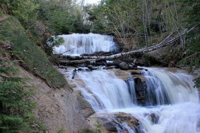
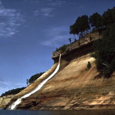
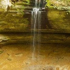
Sable Falls, Waterfall in Pictured Rocks National Lakeshore, Michigan, US.

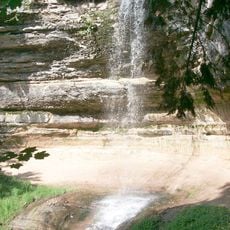
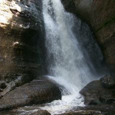
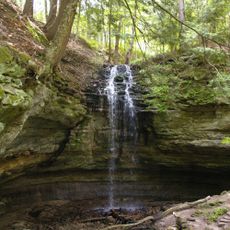
Sable Falls is a waterfall in Pictured Rocks National Lakeshore that drops about 23 meters through multiple tiers of sandstone rock. The water cascades down in several distinct stages, creating pools and currents as it flows through the Sable Creek.

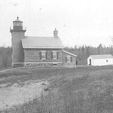
The area served as a passage and water source for indigenous peoples and early settlers before becoming part of the national park system. In the 2000s, wooden structures and stairs were installed to make the site safer and more accessible for visitors.

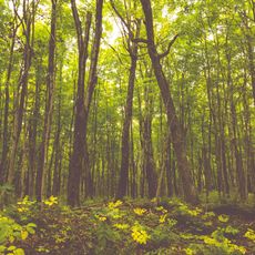
The falls serve as a natural connection point between the dense forest trails and the nearby Grand Sable Dunes ecosystem.

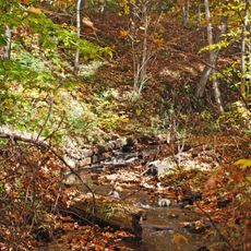
You can reach the falls by following a marked hiking trail from the parking area, which is about a kilometer long. The path includes several observation platforms with stairs where you can safely view the different waterfall tiers.

The water originates from underground springs and flows through hidden rock cavities before becoming visible at the falls. This subterranean journey gives the water its distinctive clarity and cool temperature.

The community of curious travelers

AroundUs brings together thousands of curated places, local tips, and hidden gems, enriched daily by 60,000 contributors worldwide.

Start exploring
Location
Height
23 m
GPS coordinates
46.66889,-86.01333
Latest update
December 12, 2025 09:04
Around this place
Grand Island National Recreation Area
United States of America

Grand Island National Recreation Area

52.9 km
Seney National Wildlife Refuge
United States of America

Seney National Wildlife Refuge

47.1 km
Grand Island East Channel Light
United States of America

Grand Island East Channel Light

52.3 km
Au Sable Light
United States of America

Au Sable Light

9.6 km
Munising Falls
United States of America

Munising Falls

54 km
129
United States of America

129

51.5 km
Pickle Barrel House
United States of America

Pickle Barrel House

2.2 km
Miners Falls
United States of America

Miners Falls

45.2 km
Bridalveil Falls
United States of America

Bridalveil Falls

42.9 km
Tannery Falls
United States of America

Tannery Falls

54.8 km
Munising Front Range Light
United States of America

Munising Front Range Light

57.1 km
Grand Island North Light
United States of America

Grand Island North Light

52.4 km
Memorial Falls
United States of America

Memorial Falls

54.7 km
Beaver Basin Wilderness
United States of America

Beaver Basin Wilderness

26.4 km
Schoolcraft Furnace Site
United States of America

Schoolcraft Furnace Site

54 km
Lobb House
United States of America

Lobb House

57.1 km
Tahqua Land Theater
United States of America

Tahqua Land Theater

52 km
Chapel Rock
United States of America

Chapel Rock

35.2 km
Luce County Sheriff's House and Jail
United States of America

Luce County Sheriff's House and Jail

51.9 km
Grand Marais Harbor of Refuge Outer Light
United States of America

Grand Marais Harbor of Refuge Outer Light

3.6 km
Newberry State Bank Historical Marker
United States of America

Newberry State Bank Historical Marker

52.1 km
Munising School Public Library
United States of America

Munising School Public Library

57.1 km
Jail and Sheriff's Residence Historical Marker
United States of America

Jail and Sheriff's Residence Historical Marker

52 km
Pictured Rocks
United States of America

Pictured Rocks

39.3 km
Tahquamenon Area Public Library
United States of America

Tahquamenon Area Public Library

52.4 km
Sherman Park
United States of America

Sherman Park

51.7 km
Luce County Government Building
United States of America

Luce County Government Building

52 km
Atlas Park
United States of America

Atlas Park

52.6 km
Show the full map
« Sable Falls - Waterfall in Pictured Rocks National Lakeshore, Michigan, US » is provided by Around Us (aroundus.com). Images and texts are derived from Wikimedia project under a Creative Commons license. You are allowed to copy, distribute, and modify copies of this page, under the conditions set by the license, as long as this note is clearly visible.

Discover hidden gems everywhere you go!

From secret cafés to breathtaking viewpoints, skip the crowded tourist spots and find places that match your style. Our app makes it easy with voice search, smart filtering, route optimization, and insider tips from travelers worldwide. Download now for the complete mobile experience.

Around Us App Screenshot

A unique approach to discovering new places

Le Figaro

All the places worth exploring

France Info

A tailor-made excursion in just a few clicks

20 Minutes

Around Us
Travel Guide & Maps
Download

Send to your phone

QR Code
1

Open the camera app on your mobile.

2

Point at the QR code with your camera. A notification will appear.

3

Tap the notification to open the link.