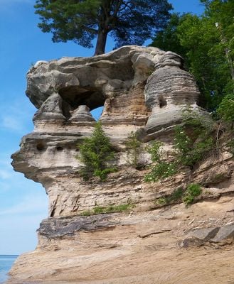
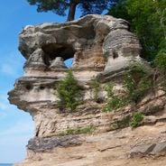
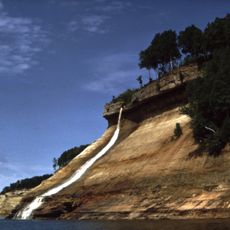
Chapel Rock, Natural sandstone arch in Alger County, Michigan, US.
Chapel Rock is a sandstone formation near Lake Superior with a white pine tree growing from its top, reaching approximately 35 feet (11 meters) in height. The shape resembles a natural arch that rises distinctly against the shoreline.
European explorers named the formation La Chappelle during the 1820 Cass expedition, comparing it to Doric architectural columns. The distinctive arch developed through natural erosion over many centuries.
The formation is a landmark in the traditional landscape of Anishnaabeg peoples, who recognized this section of the Pictured Rocks as part of their homeland. Today, it stands in visitor perception as a natural symbol connecting human presence to the surrounding environment.
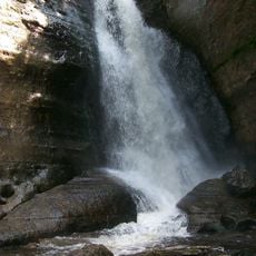
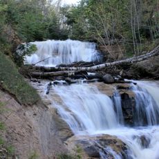
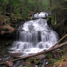
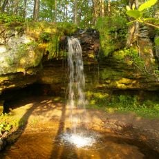
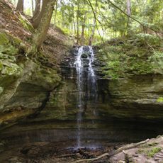
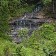
The formation is reached via a hiking trail from the trailhead and requires sturdy footwear over rocky terrain. The route passes Chapel Lake and Chapel Falls, so plan enough time to explore and appreciate the natural landscape along the way.
The white pine tree atop the formation survived the collapse of the connecting arch in 1906 and is now sustained by root extensions reaching the mainland. This underground lifeline is an uncommon example of how nature adapts when connections are severed.
Location: Alger County
Made from material: sandstone
GPS coordinates: 46.54861,-86.43833
Latest update: December 6, 2025 19:07
Michigan holds a wide array of natural and historical sites across its two peninsulas. The shoreline runs for hundreds of miles along the Great Lakes, showing sand beaches, rocky cliffs, and dune formations. In the north, dense forests, waterfalls, and rock formations shaped by erosion dominate the...
Grand Island National Recreation Area
17.8 km
Seney National Wildlife Refuge
42.2 km
Grand Island East Channel Light
17.5 km
Au Sable Light
26.7 km
Munising Falls
19.8 km
Pickle Barrel House
37.3 km
Miners Falls
10.9 km
Sable Falls
35.2 km
Wagner Falls Scenic Site
24 km
Wagner Falls
24.7 km
Scott Falls
30.7 km
Bridalveil Falls
7.9 km
Tannery Falls
20.7 km
Onota, Au Train Township, Michigan
23.8 km
Munising Front Range Light
22.7 km
Grand Island North Light
18.5 km
Grand Island Harbor Rear Range Light
23 km
Munising Rear Range Light
23 km
Alger Falls
23.6 km
Memorial Falls
20.5 km
Beaver Basin Wilderness
9.1 km
Old M-94–Au Train River Bridge
32.2 km
Schoolcraft Furnace Site
19.8 km
Paulson House
35.3 km
Lobb House
22.7 km
Grand Island Harbor Front Range Light
23 km
Grand Marais Harbor of Refuge Outer Light
38.7 km
Munising School Public Library
22.6 kmVisited this place? Tap the stars to rate it and share your experience / photos with the community! Try now! You can cancel it anytime.
Discover hidden gems everywhere you go!
From secret cafés to breathtaking viewpoints, skip the crowded tourist spots and find places that match your style. Our app makes it easy with voice search, smart filtering, route optimization, and insider tips from travelers worldwide. Download now for the complete mobile experience.
A unique approach to discovering new places❞
— Le Figaro
All the places worth exploring❞
— France Info
A tailor-made excursion in just a few clicks❞
— 20 Minutes