Chest opened
+${chestReward.xp} XP
Explorer
NOUVEAU ×${chestReward.collectible.quantity}
tapez pour fermer
Chest locked

Open chests in the app

Around Us is built for your phone — chests unlock when you walk, explore and capture nearby places.

Enable Location

We need your location to show you interesting places around you

Discover nearby places

Find interesting locations and hidden gems around you

Precise directions

Get accurate directions and distances to places

Your location is never shared with other users. It's only used when you tap the location button.

Log in to your account

Start exploring — it's free

Trusted by 72,884 travelers worldwide

Continue with Google
Continue with Apple
or

We will send you a code to connect

By continuing, you accept our Terms and Conditions and our Privacy Policy

Check your inbox

We've sent a pincode in your inbox. Please enter the code below.

Ayers Island
Discussion Reviews Photo
2.1k Popularity

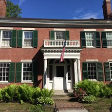
Ayers Island, River island in Penobscot County, Maine, US.

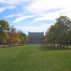
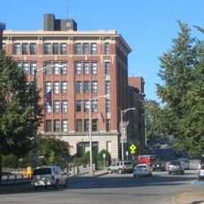
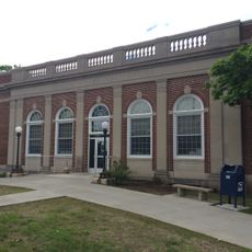
Ayers Island is a 62-acre area in the Penobscot River near Orono with an old mill complex, multiple industrial buildings, and two coal-burning smokestacks that still rise above the landscape. The structures line the riverbank and clearly show how the place was once organized for production.

Joshua Ayers started a sawmill here in 1774, which later became the Striar Textile Mill that kept running until 1996. The operation went through different phases as local needs for work and goods changed over time.

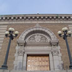
The mill complex shows Maine's industrial past, reflecting how local work shifted from cutting timber to making textiles over two centuries. You can sense how important this place was to people who lived and worked here.

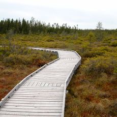
The island is open on weekdays, though you cannot go inside the buildings due to safety concerns. Wear sturdy shoes and be prepared for overgrown plants and uneven terrain around the structures.

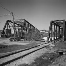
Hidden beneath overgrown plants are stone arches from old railroad tracks and pump valves from the 1920s that remain largely forgotten. These remnants reveal how carefully the industrial setup was once engineered.

The community of curious travelers

AroundUs brings together thousands of curated places, local tips, and hidden gems, enriched daily by 60,000 contributors worldwide.

Start exploring
Location
GPS coordinates
44.87530,-68.66980
Latest update
December 21, 2025 16:05
Around this place
Mount Hope Cemetery
United States of America

Mount Hope Cemetery

7.1 km
Bangor Public Library
United States of America

Bangor Public Library

11.3 km
Maine Discovery Museum
United States of America

Maine Discovery Museum

11.6 km
United States of America

Congregation Beth Israel

11 km
Penobscot River Bridge
United States of America

Penobscot River Bridge

11.2 km
St. Anne's Church and Mission Site
United States of America

St. Anne's Church and Mission Site

7.6 km
Fay Hyland Botanical Plantation
United States of America

Fay Hyland Botanical Plantation

2.3 km
Great Fire of 1911 Historic District
United States of America

Great Fire of 1911 Historic District

11.3 km
Bangor Children's Home
United States of America

Bangor Children's Home

11.6 km
Orono Bog
United States of America

Orono Bog

4.5 km
Page Farm & Home Museum
United States of America

Page Farm & Home Museum

2.5 km
Godfrey-Kellogg House
United States of America

Godfrey-Kellogg House

11.2 km
Graham Building
United States of America

Graham Building

11.3 km
William Colburn House
United States of America

William Colburn House

1.6 km
Gov. Israel Washburn House
United States of America

Gov. Israel Washburn House

655 m
Connors House
United States of America

Connors House

10.5 km
Phi Gamma Delta House
United States of America

Phi Gamma Delta House

1.9 km
Jones P. Veazie House
United States of America

Jones P. Veazie House

11 km
Nathaniel Treat House
United States of America

Nathaniel Treat House

731 m
Edith Marion Patch House
United States of America

Edith Marion Patch House

3.9 km
Orono Post Office
United States of America

Orono Post Office

990 m
Morse & Co. Office Building
United States of America

Morse & Co. Office Building

11.4 km
West Market Square Historic District
United States of America

West Market Square Historic District

11.5 km
Charles W. Jenkins House
United States of America

Charles W. Jenkins House

11.1 km
Charles G. Bryant Double House
United States of America

Charles G. Bryant Double House

11.2 km
Jonas Cutting–Edward Kent House
United States of America

Jonas Cutting–Edward Kent House

11 km
East Eddington Public Hall
United States of America

East Eddington Public Hall

11.4 km
Sargent-Roberts House
United States of America

Sargent-Roberts House

10.8 km
Show the full map
Reviews
Share your experience

No review yet

Discussions
Start a discussion...

No discussion yet

« Ayers Island - River island in Penobscot County, Maine, US » is provided by Around Us (aroundus.com). Images and texts are derived from Wikimedia project under a Creative Commons license. You are allowed to copy, distribute, and modify copies of this page, under the conditions set by the license, as long as this note is clearly visible.

Discover hidden gems everywhere you go!

From secret cafés to breathtaking viewpoints, skip the crowded tourist spots and find places that match your style. Our app makes it easy with voice search, smart filtering, route optimization, and insider tips from travelers worldwide. Download now for the complete mobile experience.

Around Us App Screenshot

A unique approach to discovering new places

Le Figaro

All the places worth exploring

France Info

A tailor-made excursion in just a few clicks

20 Minutes

Around Us
Travel Guide & Maps
Download

Send to your phone

QR Code
1

Open the camera app on your mobile.

2

Point at the QR code with your camera. A notification will appear.

3

Tap the notification to open the link.