Enable Location

We need your location to show you interesting places around you

Discover nearby places

Find interesting locations and hidden gems around you

Precise directions

Get accurate directions and distances to places

Your location is never shared with other users. It's only used when you tap the location button.

Log in to your account

Start exploring — it's free

Trusted by 61,953 travelers worldwide

Continue with Google
Continue with Apple
or

We will send you a code to connect

By continuing, you accept our Terms and Conditions and our Privacy Policy

Check your inbox

We've sent a pincode in your inbox. Please enter the code below.

Rocky Knob Recreation Area

Rocky Knob Recreation Area, Mountain recreational park in Patrick County, United States.

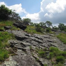
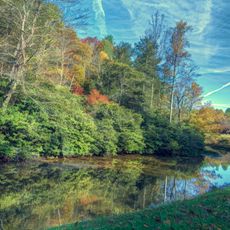
Rocky Knob Recreation Area is a mountain park that spans roughly 4,800 acres through the Blue Ridge region's hilly landscape. A network of approximately 15 miles (24 km) of trails winds through the terrain, offering different routes for various ability levels.

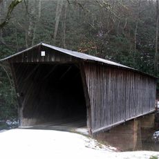
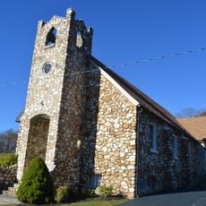
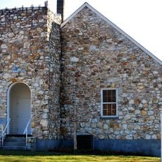
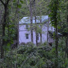
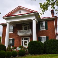
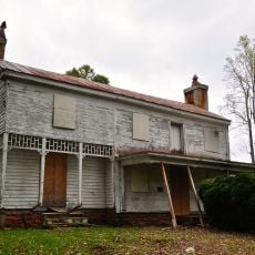
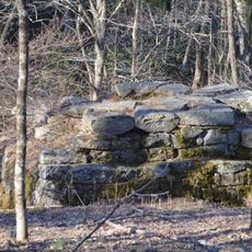
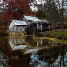
The area was settled starting in the 19th century, when farmers and communities established themselves in Rock Castle Gorge and the surrounding land. This early human presence shaped the landscape and left traces still visible today.

The area connects visitors with the rural heritage of the Blue Ridge region, where local craftsmanship traditions remain alive through demonstrations by National Park Service volunteers. This link to the past shows itself in the everyday skills and practices shared here.

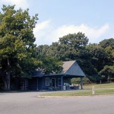
The park provides more than 100 campsites for tents and recreational vehicles, plus numerous picnic areas spread throughout the grounds. Visitors should know that restroom facilities are available and the best time for hiking is during the warmer months.

Rock Castle Gorge holds several environmental zones within a short distance, with elevation changes allowing different plant communities to exist side by side. This variety becomes noticeable during even a brief walk through the area.

The community of curious travelers

AroundUs brings together thousands of curated places, local tips, and hidden gems, enriched daily by 60,000 contributors worldwide.

Start exploring
Location
GPS coordinates
36.80500,-80.33889
Latest update
December 14, 2025 11:04
Around this place
Buffalo Mountain Natural Area Preserve
United States of America

Buffalo Mountain Natural Area Preserve

12.3 km
Bob White Covered Bridge
United States of America

Bob White Covered Bridge

8.6 km
United States of America

Chestnut Creek Wetlands Natural Area Preserve

10.6 km
Jack's Creek Covered Bridge
United States of America

Jack's Creek Covered Bridge

7.4 km
Bugbook Historical Computer Museum
United States of America

Bugbook Historical Computer Museum

11.9 km
Cockram Mill
United States of America

Cockram Mill

8.4 km
Slate Mountain Presbyterian Church and Cemetery
United States of America

Slate Mountain Presbyterian Church and Cemetery

5.6 km
Willis Presbyterian Church and Cemetery
United States of America

Willis Presbyterian Church and Cemetery

14.1 km
Floyd Presbyterian Church
United States of America

Floyd Presbyterian Church

12 km
Goblintown Mill
United States of America

Goblintown Mill

16 km
Glenanna
United States of America

Glenanna

12 km
Phlegar Farm
United States of America

Phlegar Farm

13.7 km
Floyd Historic District
United States of America

Floyd Historic District

12 km
West Fork Furnace
United States of America

West Fork Furnace

4.6 km
Mabry Mill
United States of America

Mabry Mill

8.5 km
United States of America

Mabry Mill Cultural Site

8.5 km
United States of America

Mabry Mill Bridge

8.5 km
Rocky Knob Visitor Center
United States of America

Rocky Knob Visitor Center

3.1 km
United States of America

One Clear View

12.7 km
Rakes Mill Pond
United States of America

Rakes Mill Pond

8.3 km
United States of America

Great Oaks Country Club

15.1 km
Mayberry Presbyterian Church
United States of America

Mayberry Presbyterian Church

13.6 km
United States of America

Sun Music Hall

11.8 km
United States of America

Rocky Knob Information Center

1.2 km
United States of America

Jack's Creek Covered Bridge

7.4 km
United States of America

The Saddle Overlook

2 km
United States of America

Lover's Leap Wayside

9.8 km
United States of America

Fred Clifton Park Overlook - Lover's Leap

9.5 km
Show the full map
« Rocky Knob Recreation Area - Mountain recreational park in Patrick County, United States » is provided by Around Us (aroundus.com). Images and texts are derived from Wikimedia project under a Creative Commons license. You are allowed to copy, distribute, and modify copies of this page, under the conditions set by the license, as long as this note is clearly visible.

Discover hidden gems everywhere you go!

From secret cafés to breathtaking viewpoints, skip the crowded tourist spots and find places that match your style. Our app makes it easy with voice search, smart filtering, route optimization, and insider tips from travelers worldwide. Download now for the complete mobile experience.

Around Us App Screenshot

A unique approach to discovering new places

Le Figaro

All the places worth exploring

France Info

A tailor-made excursion in just a few clicks

20 Minutes

Around Us
Travel Guide & Maps
Download

Send to your phone

QR Code
1

Open the camera app on your mobile.

2

Point at the QR code with your camera. A notification will appear.

3

Tap the notification to open the link.