Enable Location

We need your location to show you interesting places around you

Discover nearby places

Find interesting locations and hidden gems around you

Precise directions

Get accurate directions and distances to places

Your location is never shared with other users. It's only used when you tap the location button.

Log in to your account

Start exploring — it's free

Trusted by 62,589 travelers worldwide

Continue with Google
Continue with Apple
or

We will send you a code to connect

By continuing, you accept our Terms and Conditions and our Privacy Policy

Check your inbox

We've sent a pincode in your inbox. Please enter the code below.

Comet Lake

Comet Lake, body of water

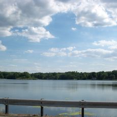
Comet Lake is a man-made reservoir in Summit County, Ohio, formed by damming a stream to create a controlled water storage area. The lake contains one small island and serves mainly for fishing and private recreational use.

The lake was created by constructing a dam across a stream to store water and help control local flooding. Since its creation, it has become an established feature of the local landscape serving community water management needs.

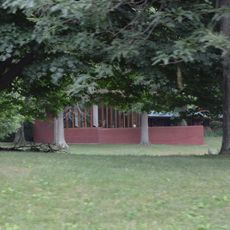
The name Comet comes from the small community on the northwestern shore of the lake. For local residents, it serves as a quiet gathering place for fishing and personal reflection by the water.

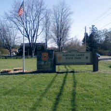
The lake is easily reached by car from the nearby city of Green and offers a quiet experience without major facilities or crowds. Since it is privately owned, visitors should check access permissions before planning a visit.

Water from the lake flows over the dam into Nimisila Creek and eventually connects to the Tuscarawas River, linking to a broader river system that reaches Lake Erie. This hidden hydrological connection shows how a small local reservoir is part of a much larger water network.

The community of curious travelers

AroundUs brings together thousands of curated places, local tips, and hidden gems, enriched daily by 60,000 contributors worldwide.

Start exploring
Location
GPS coordinates
40.92056,-81.52222
Latest update
February 9, 2026 08:20
Around this place
Pro Football Hall of Fame
United States of America

Pro Football Hall of Fame

15.2 km
Tom Benson Hall of Fame Stadium
United States of America

Tom Benson Hall of Fame Stadium

15.3 km
Rubber Bowl
United States of America

Rubber Bowl

14.3 km
Goodyear Airdock
United States of America

Goodyear Airdock

13.1 km
President William McKinley National Memorial
United States of America

President William McKinley National Memorial

16.6 km
Paul Brown Tiger Stadium
United States of America

Paul Brown Tiger Stadium

14.1 km
MAPS Air Museum
United States of America

MAPS Air Museum

5.7 km
Portage Lakes
United States of America

Portage Lakes

9.6 km
Central Catholic High School
United States of America

Central Catholic High School

15.9 km
John and Syd Dobkins House
United States of America

John and Syd Dobkins House

15.9 km
Portage Lakes State Park
United States of America

Portage Lakes State Park

6.1 km
Goodyear Hall-Ohio Savings and Trust Company
United States of America

Goodyear Hall-Ohio Savings and Trust Company

16.6 km
Spring Hill Historic Home
United States of America

Spring Hill Historic Home

12.1 km
Anna-Dean Farm
United States of America

Anna-Dean Farm

13 km
Harvey S. Firestone Memorial
United States of America

Harvey S. Firestone Memorial

13.5 km
Saint Joseph's Roman Catholic Church
United States of America

Saint Joseph's Roman Catholic Church

14.1 km
Frank Mason Raymond House
United States of America

Frank Mason Raymond House

5.2 km
Akron Fulton International Airport Administration Building
United States of America

Akron Fulton International Airport Administration Building

14.5 km
Hall of Fame Bridge
United States of America

Hall of Fame Bridge

9.6 km
O. C. Barber Colt Barn
United States of America

O. C. Barber Colt Barn

10.5 km
St. Timothy's Protestant Episcopal Church
United States of America

St. Timothy's Protestant Episcopal Church

13.9 km
First Methodist Episcopal Church
United States of America

First Methodist Episcopal Church

13.7 km
William McKinley Presidential Library and Museum
United States of America

William McKinley Presidential Library and Museum

16.8 km
Limbach Block Historic District
United States of America

Limbach Block Historic District

9.1 km
Lions Lincoln Theatre
United States of America

Lions Lincoln Theatre

13.7 km
Spring Hill Historic Home & Underground Railroad Site
United States of America

Spring Hill Historic Home & Underground Railroad Site

12.1 km
Park Theatre
United States of America

Park Theatre

12.7 km
Tuscarawas Avenue – Alexander Square Commercial Historic District
United States of America

Tuscarawas Avenue – Alexander Square Commercial Historic District

12.7 km
Show the full map
« Comet Lake - body of water » is provided by Around Us (aroundus.com). Images and texts are derived from Wikimedia project under a Creative Commons license. You are allowed to copy, distribute, and modify copies of this page, under the conditions set by the license, as long as this note is clearly visible.

Discover hidden gems everywhere you go!

From secret cafés to breathtaking viewpoints, skip the crowded tourist spots and find places that match your style. Our app makes it easy with voice search, smart filtering, route optimization, and insider tips from travelers worldwide. Download now for the complete mobile experience.

Around Us App Screenshot

A unique approach to discovering new places

Le Figaro

All the places worth exploring

France Info

A tailor-made excursion in just a few clicks

20 Minutes

Around Us
Travel Guide & Maps
Download

Send to your phone

QR Code
1

Open the camera app on your mobile.

2

Point at the QR code with your camera. A notification will appear.

3

Tap the notification to open the link.