Chest opened
+${chestReward.xp} XP
Explorer
NOUVEAU ×${chestReward.collectible.quantity}
tapez pour fermer
Chest locked

Open chests in the app

Around Us is built for your phone — chests unlock when you walk, explore and capture nearby places.

Enable Location

We need your location to show you interesting places around you

Discover nearby places

Find interesting locations and hidden gems around you

Precise directions

Get accurate directions and distances to places

Your location is never shared with other users. It's only used when you tap the location button.

Log in to your account

Start exploring — it's free

Trusted by 72,993 travelers worldwide

Continue with Google
Continue with Apple
or

We will send you a code to connect

By continuing, you accept our Terms and Conditions and our Privacy Policy

Check your inbox

We've sent a pincode in your inbox. Please enter the code below.

State Game Lands Number 52
Discussion Reviews Photo
1.6k Popularity

State Game Lands Number 52, Wildlife conservation area in Lancaster County, United States

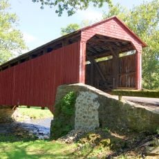
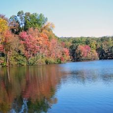
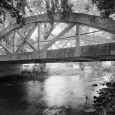
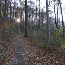
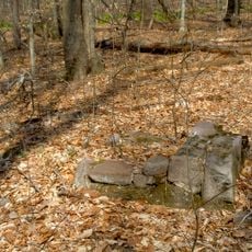
State Game Lands Number 52 is a wildlife conservation area in Lancaster County with mixed landscapes of forests and open fields. The terrain provides diverse habitats for deer, birds, and other animals that live naturally in this region.

This land was established by the Pennsylvania Game Commission as part of a statewide effort to protect natural habitats. Since its creation, it has helped maintain sustainable populations of wildlife across the region.

The game lands facilitate community engagement through educational programs focused on wildlife conservation, ecosystem management, and responsible outdoor practices.

Visitors should plan which entrance to use since the site has multiple access points with different parking areas. Getting a map beforehand or downloading one helps with navigation through the different sections.

The Pennsylvania Turnpike runs through the southern portion and divides the land into distinct zones with different habitats. This split created by the highway creates boundaries between hunting areas and wildlife zones.

The community of curious travelers

AroundUs brings together thousands of curated places, local tips, and hidden gems, enriched daily by 60,000 contributors worldwide.

Start exploring
Location
Location
GPS coordinates
40.17944,-75.95833
Latest update
December 14, 2025 14:27
Around this place
French Creek State Park
United States of America

French Creek State Park

14.6 km
Pool Forge Covered Bridge
United States of America

Pool Forge Covered Bridge

5.8 km
Isabella Furnace
United States of America

Isabella Furnace

13.7 km
Hopewell Big Woods
United States of America

Hopewell Big Woods

14.6 km
Joanna Furnace Complex
United States of America

Joanna Furnace Complex

6 km
Allegheny Aqueduct
United States of America

Allegheny Aqueduct

13.8 km
Red Run Covered Bridge
United States of America

Red Run Covered Bridge

10.6 km
Weaver's Mill Covered Bridge
United States of America

Weaver's Mill Covered Bridge

5.4 km
St. Mary's Episcopal Church
United States of America

St. Mary's Episcopal Church

15.2 km
John Updike Childhood Home
United States of America

John Updike Childhood Home

13.7 km
John Casper Stoever Log House
United States of America

John Casper Stoever Log House

14.4 km
Bangor Episcopal Church
United States of America

Bangor Episcopal Church

5.1 km
Thomas Bull House
United States of America

Thomas Bull House

14.4 km
Poole Forge
United States of America

Poole Forge

5.7 km
Ridgewood Farm
United States of America

Ridgewood Farm

13.9 km
Windsor Forge Mansion
United States of America

Windsor Forge Mansion

5.8 km
Geiger Mill
United States of America

Geiger Mill

10.5 km
Alleghany Mennonite Meetinghouse
United States of America

Alleghany Mennonite Meetinghouse

6.3 km
David Davis Farm
United States of America

David Davis Farm

12.1 km
Thompson Mill
United States of America

Thompson Mill

13.6 km
Ann Cunningham Evans House
United States of America

Ann Cunningham Evans House

7.8 km
Elverson Historic District
United States of America

Elverson Historic District

11 km
Weaverland Bridge
United States of America

Weaverland Bridge

9.8 km
Morgantown Historic District (Morgantown, Pennsylvania)
United States of America

Morgantown Historic District (Morgantown, Pennsylvania)

6.4 km
Edward Davies House
United States of America

Edward Davies House

5.1 km
Kagerise Store and House
United States of America

Kagerise Store and House

11 km
Nolde Forest Environmental Education Center
United States of America

Nolde Forest Environmental Education Center

10.6 km
French Creek State Park Six Penny Day Use District
United States of America

French Creek State Park Six Penny Day Use District

15.1 km
Show the full map
Reviews
Share your experience

No review yet

Discussions
Start a discussion...

No discussion yet

« State Game Lands Number 52 - Wildlife conservation area in Lancaster County, United States » is provided by Around Us (aroundus.com). Images and texts are derived from Wikimedia project under a Creative Commons license. You are allowed to copy, distribute, and modify copies of this page, under the conditions set by the license, as long as this note is clearly visible.

Discover hidden gems everywhere you go!

From secret cafés to breathtaking viewpoints, skip the crowded tourist spots and find places that match your style. Our app makes it easy with voice search, smart filtering, route optimization, and insider tips from travelers worldwide. Download now for the complete mobile experience.

Around Us App Screenshot

A unique approach to discovering new places

Le Figaro

All the places worth exploring

France Info

A tailor-made excursion in just a few clicks

20 Minutes

Around Us
Travel Guide & Maps
Download

Send to your phone

QR Code
1

Open the camera app on your mobile.

2

Point at the QR code with your camera. A notification will appear.

3

Tap the notification to open the link.