Enable Location

We need your location to show you interesting places around you

Discover nearby places

Find interesting locations and hidden gems around you

Precise directions

Get accurate directions and distances to places

Your location is never shared with other users. It's only used when you tap the location button.

Log in to your account

Start exploring — it's free

Trusted by 68,749 travelers worldwide

Continue with Google
Continue with Apple
or

We will send you a code to connect

By continuing, you accept our Terms and Conditions and our Privacy Policy

Check your inbox

We've sent a pincode in your inbox. Please enter the code below.

State Game Lands Number 80
Discussion Reviews Photo
1.5k Popularity

State Game Lands Number 80, park in the United States of America

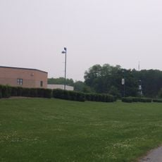
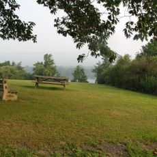
State Game Lands Number 80 spreads across forested areas and open fields in two counties, creating habitat for deer, wild boars, and birds. The land includes multiple entry points that allow visitors to reach different sections of the property.

The Pennsylvania Game Commission established these hunting grounds in the early 1900s during a period of wildlife conservation efforts across the state. This designation represented a shift toward managing natural resources for long-term sustainability.

Local hunters view this land as a place to practice their traditions while respecting wildlife populations. The seasonal rhythm of hunting shapes how people use and value these forests and fields.

Visitors must obtain valid hunting permits and check current hunting seasons before accessing the land. Different entry points require some planning depending on which area you want to explore.

The property connects sections across both counties, with some areas particularly noted for healthy deer populations among hunters. Many visitors focus on forested sections without realizing the open fields support equally important wildlife habitats.

The community of curious travelers

AroundUs brings together thousands of curated places, local tips, and hidden gems, enriched daily by 60,000 contributors worldwide.

Start exploring
Location
Location
GPS coordinates
40.48389,-76.50389
Latest update
December 14, 2025 15:02
Around this place
Union Canal
United States of America

Union Canal

15.1 km
Cedar Crest High School
United States of America

Cedar Crest High School

21.2 km
Swatara State Park
United States of America

Swatara State Park

7.1 km
Indiantown Gap National Cemetery
United States of America

Indiantown Gap National Cemetery

8.9 km
Memorial Lake State Park
United States of America

Memorial Lake State Park

10.6 km
Light's Fort
United States of America

Light's Fort

16.2 km
United States of America

Annville Mill

17.6 km
Waterville Bridge
United States of America

Waterville Bridge

2.4 km
United States of America

Swatara Gap

2.2 km
Salem Evangelical Lutheran Church
United States of America

Salem Evangelical Lutheran Church

17.2 km
Tulpehocken Manor Plantation
United States of America

Tulpehocken Manor Plantation

19.3 km
Swatara Furnace
United States of America

Swatara Furnace

6.7 km
St. Lukes Episcopal Church
United States of America

St. Lukes Episcopal Church

17.7 km
Nutting Hall
United States of America

Nutting Hall

12.3 km
Tabor Reformed Church
United States of America

Tabor Reformed Church

17.6 km
Isaac Meier Homestead
United States of America

Isaac Meier Homestead

21.1 km
Fort Swatara
United States of America

Fort Swatara

17.8 km
Chestnut Street Log House
United States of America

Chestnut Street Log House

17.5 km
Pine Grove Historic District
United States of America

Pine Grove Historic District

12.3 km
Bindnagles Evangelical Lutheran Church
United States of America

Bindnagles Evangelical Lutheran Church

18.3 km
Annville Historic District
United States of America

Annville Historic District

17.4 km
Josiah Funck Mansion
United States of America

Josiah Funck Mansion

17.6 km
John Todd House
United States of America

John Todd House

20.4 km
GAR Building
United States of America

GAR Building

19.1 km
Biever House
United States of America

Biever House

17.4 km
Gloninger Estate
United States of America

Gloninger Estate

18.4 km
Schuylkill County Bridge No. 113
United States of America

Schuylkill County Bridge No. 113

18.9 km
Bridge in Lykens Township No. 2
United States of America

Bridge in Lykens Township No. 2

21.4 km
Show the full map
Reviews
Share your experience

No review yet

Discussions
Start a discussion...

No discussion yet

« State Game Lands Number 80 - park in the United States of America » is provided by Around Us (aroundus.com). Images and texts are derived from Wikimedia project under a Creative Commons license. You are allowed to copy, distribute, and modify copies of this page, under the conditions set by the license, as long as this note is clearly visible.

Discover hidden gems everywhere you go!

From secret cafés to breathtaking viewpoints, skip the crowded tourist spots and find places that match your style. Our app makes it easy with voice search, smart filtering, route optimization, and insider tips from travelers worldwide. Download now for the complete mobile experience.

Around Us App Screenshot

A unique approach to discovering new places

Le Figaro

All the places worth exploring

France Info

A tailor-made excursion in just a few clicks

20 Minutes

Around Us
Travel Guide & Maps
Download

Send to your phone

QR Code
1

Open the camera app on your mobile.

2

Point at the QR code with your camera. A notification will appear.

3

Tap the notification to open the link.