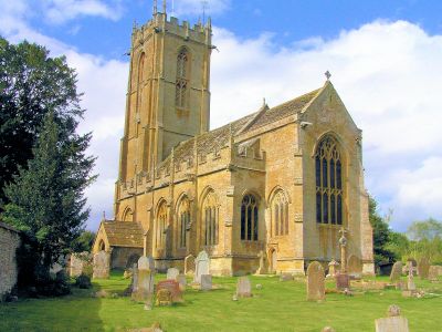
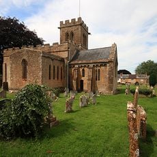
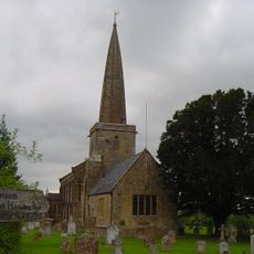
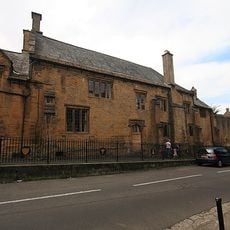
Church of St Mary the Virgin, Norton Sub Hamdon, Medieval parish church in Norton Sub Hamdon, England.
Church of St Mary the Virgin is a medieval parish church featuring a prominent five-stage tower with buttresses and decorative stonework typical of gothic design. The structure displays traditional elements including pointed arch windows and a buttressed parapet that rises significantly above the surrounding roofline.
The church originated in the mid-1200s and has endured centuries of use and modification as community needs changed. Major rebuilding work in the early 1500s and repairs following storm damage represent key periods when locals invested in maintaining their gathering place.
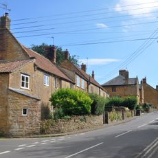
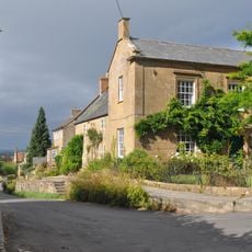
The building serves as a community hub where locals gather for worship and social events throughout the year. You can sense how the space remains central to village life in ways that extend beyond religious practice.
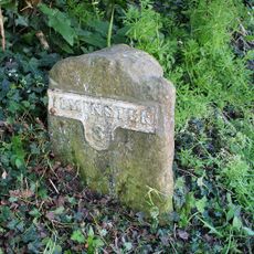
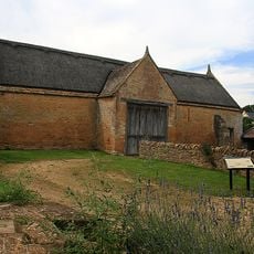
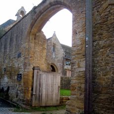
The building sits along Church Lane where it is easily found from central locations in the village. The surrounding churchyard is open for exploration and contains historical features worth noting during your visit.
The churchyard serves as the burial ground for Paddy Ashdown, a former leader of the Liberal Democrats party and influential political figure in recent British history. His presence here links the quiet village location to broader national events.
Location: Norton-sub-Hamdon
Inception: 13 century
GPS coordinates: 50.94000,-2.75361
Latest update: December 12, 2025 14:27
Montacute Castle
2.5 km
Ham Hill
1.4 km
Stoke sub Hamdon Priory
1.5 km
Abbey Farmhouse, Montacute
2.6 km
Church of St Mary the Virgin, East Stoke
1.8 km
Wigborough Manor House
2.3 km
Stoke Sub Hamdon United Reformed Church
1.7 km
Church of St Peter and St Paul
1.1 km
Church of Saint Mary
2.5 km
Fleur De Lis Hotel
1.5 km
Hamdon Hill War Memorial
1.5 km
Milestone About 10 Metres East Of Gateway To Greenways (Not Included On List)
1.8 km
18, 22 And 24, North Street
1.6 km
Direction stone at the junction of Smith's Hill and Smoky Hole Lane
1.9 km
Remains Of Barn About 15 Metres West Of The Priory
1.6 km
68, North Street
1.9 km
Hillside Farmhouse And Front Boundary Railings
2.6 km
Barn About 25 Metres North West Of The Priory
1.6 km
Gateway And Wall Linking The Priory And The Barn, About 14 Metres North
1.6 km
Dovecote About 50 Metres West Of The Priory
1.5 km
Castle Farmhouse And Attached Outbuildings To North
1.9 km
Medieval secular college at Parsonage Farm
1.6 km
Hoods
1.6 km
Barn About 14 Metres North Of The Priory
1.6 km
Tower On St Michaels Hill
2.5 km
Milestone At Ngr St4637 1687
1.3 km
Cross In Churchyard About 11 Metres North Of Tower, Church Of St Mary The Virgin
1.9 km
Guidestone, Smoky Hole Lane
1.9 kmVisited this place? Tap the stars to rate it and share your experience / photos with the community! Try now! You can cancel it anytime.
Discover hidden gems everywhere you go!
From secret cafés to breathtaking viewpoints, skip the crowded tourist spots and find places that match your style. Our app makes it easy with voice search, smart filtering, route optimization, and insider tips from travelers worldwide. Download now for the complete mobile experience.
A unique approach to discovering new places❞
— Le Figaro
All the places worth exploring❞
— France Info
A tailor-made excursion in just a few clicks❞
— 20 Minutes