Enable Location

We need your location to show you interesting places around you

Discover nearby places

Find interesting locations and hidden gems around you

Precise directions

Get accurate directions and distances to places

Your location is never shared with other users. It's only used when you tap the location button.

Weston Big Wood

Log in to your account

Start exploring — it's free

Trusted by 64,047 travelers worldwide

Continue with Google
Continue with Apple
or

We will send you a code to connect

By continuing, you accept our Terms and Conditions and our Privacy Policy

Check your inbox

We've sent a pincode in your inbox. Please enter the code below.

Discussion Reviews 1 Photos
2k Popularity

Weston Big Wood, Protected woodland in North Somerset, England.

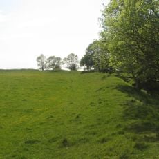
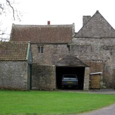
Weston Big Wood is a protected woodland covering about 37 hectares with a mix of tree species including small-leaved lime, oak, and hazel scattered throughout the site. Four entry points provide access to well-marked paths that form a circular route for exploration.

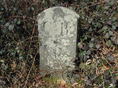
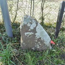
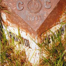
The woodland contains medieval boundary markers and old stones dating to 1637 when the local manor changed ownership. These remnants indicate the forest has persisted through centuries of landscape changes.

The woodland serves as a gathering place where local volunteers engage in hands-on conservation work, making the area feel actively cared for. This collaborative stewardship reflects how residents value their natural surroundings.

The four entry points are accessible from different sides of the woodland, and paths remain open throughout the year for visitors to explore. The circular route can be completed at a comfortable pace in a few hours.

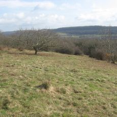
Plant species such as herb paris and yellow archangel growing here indicate the woodland has existed continuously since the last ice age. Their presence reveals the forest as an unusually long-lived ecosystem.

The community of curious travelers

AroundUs brings together thousands of curated places, local tips, and hidden gems, enriched daily by 60,000 contributors worldwide.

Start exploring
GPS coordinates
51.47130,-2.78604
Latest update
December 14, 2025 09:40
Around this place
Noah's Ark Zoo Farm
United Kingdom

Noah's Ark Zoo Farm

3.9 km
Church of SS Peter & Paul, Weston in Gordano
United Kingdom

Church of SS Peter & Paul, Weston in Gordano

1.4 km
Cadbury Camp
United Kingdom

Cadbury Camp

2.5 km
Charlton House, Wraxall
United Kingdom

Charlton House, Wraxall

4.1 km
Black Nore Lighthouse
United Kingdom

Black Nore Lighthouse

1.8 km
Clapton Court
United Kingdom

Clapton Court

1.9 km
Portishead Point lighthouse
United Kingdom

Portishead Point lighthouse

2.7 km
Walton Common
United Kingdom

Walton Common

2.9 km
Church of SS Quiricus & Julietta, Tickenham
United Kingdom

Church of SS Quiricus & Julietta, Tickenham

3.6 km
Portbury Ashlands
United Kingdom

Portbury Ashlands

3.5 km
Church of St Peter, Portishead
United Kingdom

Church of St Peter, Portishead

1.5 km
Portishead Pier to Black Nore SSSI
United Kingdom

Portishead Pier to Black Nore SSSI

3.4 km
Church of St Michael, Clapton in Gordano
United Kingdom

Church of St Michael, Clapton in Gordano

1.9 km
Nightingale Valley
United Kingdom

Nightingale Valley

608 m
Weston-in-Gordano SSSI
United Kingdom

Weston-in-Gordano SSSI

669 m
Chapel At Portishead National Nautical School
United Kingdom

Chapel At Portishead National Nautical School

1.5 km
Church of St Paul
United Kingdom

Church of St Paul

3.5 km
Royal Hotel
United Kingdom

Royal Hotel

3.2 km
The White Lion Public House And Section Of Former Sea Wall To North End Of West Front
United Kingdom

The White Lion Public House And Section Of Former Sea Wall To North End Of West Front

2 km
Birdcombe Court And Birdcombe Court Farmhouse
United Kingdom

Birdcombe Court And Birdcombe Court Farmhouse

3.9 km
The Black Horse
United Kingdom

The Black Horse

2.1 km
Clevedon Pumping Station
United Kingdom

Clevedon Pumping Station

4.2 km
Guidestone At Junction Of Clapton Lane And Clevedon Road
United Kingdom

Guidestone At Junction Of Clapton Lane And Clevedon Road

1.2 km
Engine House, Boiler House And Chimney At Clevedon Pumping Station
United Kingdom

Engine House, Boiler House And Chimney At Clevedon Pumping Station

4.2 km
Milepost
United Kingdom

Milepost

3.2 km
Former Foreman's Lodge And Workshop At Clevedon Pumping Station
United Kingdom

Former Foreman's Lodge And Workshop At Clevedon Pumping Station

4.2 km
The Court
United Kingdom

The Court

3.5 km
Milepost, Clevedon Road, by No. 97, Tickenham Village
United Kingdom

Milepost, Clevedon Road, by No. 97, Tickenham Village

3.4 km
Show the full map
Reviews
Share your experience

No review yet

Discussions
Start a discussion...

No discussion yet

« Weston Big Wood - Protected woodland in North Somerset, England » is provided by Around Us (aroundus.com). Images and texts are derived from Wikimedia project under a Creative Commons license. You are allowed to copy, distribute, and modify copies of this page, under the conditions set by the license, as long as this note is clearly visible.

Discover hidden gems everywhere you go!

From secret cafés to breathtaking viewpoints, skip the crowded tourist spots and find places that match your style. Our app makes it easy with voice search, smart filtering, route optimization, and insider tips from travelers worldwide. Download now for the complete mobile experience.

Around Us App Screenshot

A unique approach to discovering new places

Le Figaro

All the places worth exploring

France Info

A tailor-made excursion in just a few clicks

20 Minutes

Around Us
Travel Guide & Maps
Download

Send to your phone

QR Code
1

Open the camera app on your mobile.

2

Point at the QR code with your camera. A notification will appear.

3

Tap the notification to open the link.