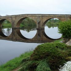
Planetrees, Roman archaeological site in Northumberland, England.
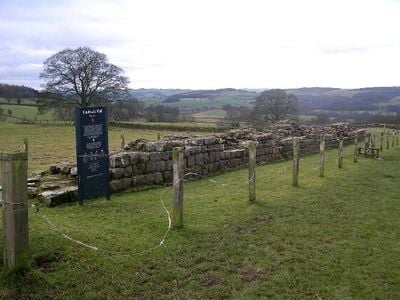
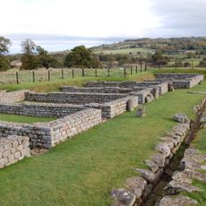
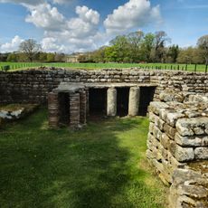
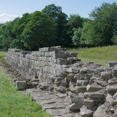
Planetrees is an archaeological site in Northumberland where a 35-meter section of Hadrian's Wall survives with clear evidence of Roman construction methods. The site displays both a broader wall and a narrower wall built side by side, showing how engineers adjusted their building plans over time.
This section was built during the Roman occupation when soldiers constructed this fortification as part of the empire's northern boundary. In 1801, William Hutton stopped workers from stealing stones, protecting this portion from further damage.
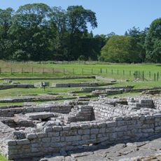
The wall shows Roman building methods through its layered construction and drainage system that served the needs of soldiers stationed here. Visitors can observe how workers adapted their techniques as the project evolved.
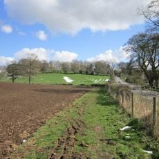
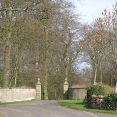
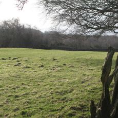
A 30-minute walk from Chesters Roman Fort car park along marked paths is needed to reach this section. The ground can become muddy or slippery depending on recent weather, so appropriate footwear is helpful.
At this location two different wall widths meet, revealing a junction between broader and narrower construction that suggests a change in building plans. This transition zone shows how Roman engineers adapted their approach as the project developed.
Location: Northumberland
Location: Wall
Part of: Hadrian's Wall, Hadrian's Wall and vallum between St Oswald's Cottages, east of Brunton Gate and the North Tyne in wall miles 25, 26 and 27
Website: https://english-heritage.org.uk/visit/places/planetrees-roman-wall-hadrians-wall
GPS coordinates: 55.02104,-2.11246
Latest update: December 14, 2025 13:03
Chesters Roman Fort
1.8 km
Chesters Bridge
1.6 km
Chesters
2.1 km
Chollerford Bridge
1.3 km
Milecastle 26
189 m
Walwick Grange
2.2 km
Chesters Roman Fort
1.8 km
Milecastle 25
1.7 km
Milecastle 27
1.3 km
Church of St George
1.3 km
Church of St Oswald
789 m
Church of St Peter
2 km
Church of St Giles
2.3 km
The George Inn
1.4 km
Clayton Museum
1.9 km
Churchyard Wall To Church Of St Oswald
831 m
Milestone 420 Metres East Of St Oswalds Hill Head Farm
1.5 km
Wall War Memorial
1.3 km
Humshaugh War Memorial
2.3 km
Cocklaw Tower
1.8 km
Milestone 230 Metres East Of High Brunton
84 m
Stable Block 200 Metres North Of Chesters
2.2 km
Railway Bridge 300 Yards South Of Chollerton
2 km
Milestone 360 Metres North Of B6318 Junction
940 m
Hadrian's Wall and vallum between St Oswald's Cottages, east of Brunton Gate and the North Tyne in wall miles 25, 26 and 27
537 m
The Roman fort, vicus, bridge abutments and associated remains of Hadrian's Wall at Chesters in wall mile 27
2 km
Medieval wayside cross, 780m SSE of Walwick Grange
2.2 km
Garden Wall To West End Terrace And Evans Almshouse, With Attached Pant
2.1 kmVisited this place? Tap the stars to rate it and share your experience / photos with the community! Try now! You can cancel it anytime.
Discover hidden gems everywhere you go!
From secret cafés to breathtaking viewpoints, skip the crowded tourist spots and find places that match your style. Our app makes it easy with voice search, smart filtering, route optimization, and insider tips from travelers worldwide. Download now for the complete mobile experience.
A unique approach to discovering new places❞
— Le Figaro
All the places worth exploring❞
— France Info
A tailor-made excursion in just a few clicks❞
— 20 Minutes