Chesters Roman Fort

Log in to your account

AroundUs is a community-driven map of interesting places, built by curious explorers like you. It grows with every review, story, and photo you share.
Connect to save your favorite spots, contribute locations, and create personalized routes.
Continue with Google
Continue with Apple
Continue with X
Continue with Facebook
Continue with email
By continuing, you accept our Terms and Conditions and our Privacy Policy
Create an account
Add to collection
Map
Suggest a change
Share

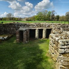
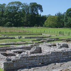
Chesters Roman Fort, Roman cavalry fort at Chollerford, Great Britain.

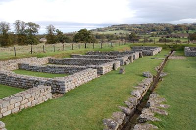
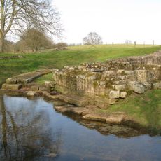
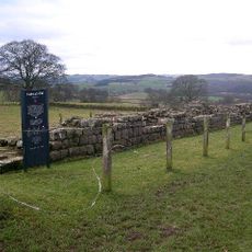
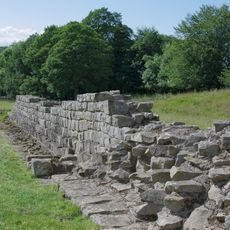
Chesters is a Roman cavalry fort made of stone, built at a river crossing to control movement along a major frontier route. The site displays remains of bathhouses, officer quarters, and barracks that served the soldiers stationed here.

The fort was established in the 120s following the removal of an earlier structure at the location. Multiple cavalry units from across the Roman Empire were stationed here over subsequent decades.

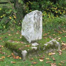
The museum displays objects recovered from the site including jewelry, inscribed pottery, and military items that reveal how soldiers lived at this remote posting. These everyday objects show what mattered to people stationed at this northern frontier fort.

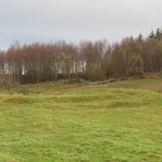
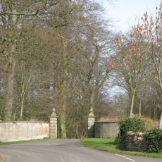
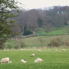
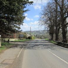
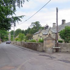
The site sits beside a secondary road in a rural area and is straightforward to find. Interpretive signs throughout the grounds explain the purpose of different buildings and sections, helping visitors understand how the fort functioned.

The fort's headquarters building contained a heavily secured vault for storing military records and official documents of the garrison. This space was protected not just by armed guards but also through religious ceremonies soldiers performed to invoke divine safeguarding.

Location: Humshaugh

Made from material: stone

Part of: Hadrian's Wall, Chesters Roman Fort and Clayton Museum, The Roman fort, vicus, bridge abutments and associated remains of Hadrian's Wall at Chesters in wall mile 27

Website: https://english-heritage.org.uk/visit/places/chesters-roman-fort-and-museum-hadrians-wall

GPS coordinates: 55.02600,-2.13900

Latest update: December 9, 2025 18:41

Photos
Around this place
Chesters Bridge
United Kingdom

Chesters Bridge

181 m
Chesters
United Kingdom

Chesters

300 m
Milecastle 29
United Kingdom

Milecastle 29

2.5 km
Planetrees
United Kingdom

Planetrees

1.8 km
Chollerford Bridge
United Kingdom

Chollerford Bridge

829 m
Milecastle 26
United Kingdom

Milecastle 26

2 km
Walwick Grange
United Kingdom

Walwick Grange

992 m
Chesters Roman Fort
United Kingdom

Chesters Roman Fort

35 m
Milecastle 27
United Kingdom

Milecastle 27

493 m
Milecastle 28
United Kingdom

Milecastle 28

947 m
Church of St Oswald
United Kingdom

Church of St Oswald

2.6 km
Church of St Peter
United Kingdom

Church of St Peter

1.4 km
Church of St George
United Kingdom

Church of St George

1.3 km
The George Inn
United Kingdom

The George Inn

845 m
Clayton Museum
United Kingdom

Clayton Museum

261 m
Little Walwick
United Kingdom

Little Walwick

970 m
Milestone 230 Metres East Of High Brunton
United Kingdom

Milestone 230 Metres East Of High Brunton

1.7 km
Wall War Memorial
United Kingdom

Wall War Memorial

1.2 km
Humshaugh War Memorial
United Kingdom

Humshaugh War Memorial

1.3 km
The Roman fort, vicus, bridge abutments and associated remains of Hadrian's Wall at Chesters in wall mile 27
United Kingdom

The Roman fort, vicus, bridge abutments and associated remains of Hadrian's Wall at Chesters in wall mile 27

300 m
Pant Beside Road 200 Metres North Of Junction By Heatheridge
United Kingdom

Pant Beside Road 200 Metres North Of Junction By Heatheridge

2.4 km
Railway Bridge 300 Yards South Of Chollerton
United Kingdom

Railway Bridge 300 Yards South Of Chollerton

2.4 km
Milestone 360 Metres North Of B6318 Junction
United Kingdom

Milestone 360 Metres North Of B6318 Junction

1.2 km
Hadrian's Wall and vallum between St Oswald's Cottages, east of Brunton Gate and the North Tyne in wall miles 25, 26 and 27
United Kingdom

Hadrian's Wall and vallum between St Oswald's Cottages, east of Brunton Gate and the North Tyne in wall miles 25, 26 and 27

1.2 km
Medieval wayside cross, 780m SSE of Walwick Grange
United Kingdom

Medieval wayside cross, 780m SSE of Walwick Grange

1.6 km
Stable Block 200 Metres North Of Chesters
United Kingdom

Stable Block 200 Metres North Of Chesters

467 m
Garden Wall To West End Terrace And Evans Almshouse, With Attached Pant
United Kingdom

Garden Wall To West End Terrace And Evans Almshouse, With Attached Pant

1.4 km
Milestone, Rye Hill, Walwick
United Kingdom

Milestone, Rye Hill, Walwick

2.4 km
Show the full map
Reviews

Visited this place? Tap the stars to rate it and share your experience / photos with the community! Try now! You can cancel it anytime.

« Chesters Roman Fort - Roman cavalry fort at Chollerford, Great Britain » is provided by Around Us (aroundus.com). Images and texts are derived from Wikimedia project under a Creative Commons license. You are allowed to copy, distribute, and modify copies of this page, under the conditions set by the license, as long as this note is clearly visible.

Discover hidden gems everywhere you go!

From secret cafés to breathtaking viewpoints, skip the crowded tourist spots and find places that match your style. Our app makes it easy with voice search, smart filtering, route optimization, and insider tips from travelers worldwide. Download now for the complete mobile experience.

Around Us App Screenshot

A unique approach to discovering new places

Le Figaro

All the places worth exploring

France Info

A tailor-made excursion in just a few clicks

20 Minutes