Enable Location

We need your location to show you interesting places around you

Discover nearby places

Find interesting locations and hidden gems around you

Precise directions

Get accurate directions and distances to places

Your location is never shared with other users. It's only used when you tap the location button.

Milecastle 28

Log in to your account

Start exploring — it's free

Trusted by 62,914 travelers worldwide

Continue with Google
Continue with Apple
or

We will send you a code to connect

By continuing, you accept our Terms and Conditions and our Privacy Policy

Check your inbox

We've sent a pincode in your inbox. Please enter the code below.

Milecastle 28
Discussion Reviews 1 Photos
1.1k Popularity

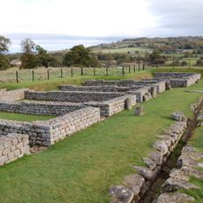
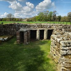
Milecastle 28, milecastle on Hadrian's Wall in Northumberland, England, UK

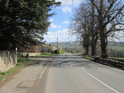
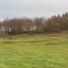
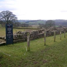
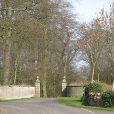
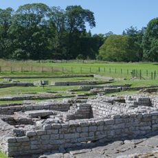
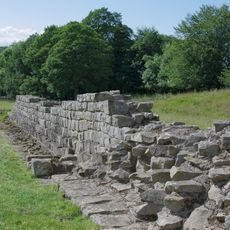
Milecastle 28 is a Roman military outpost once located south of the B6318 Military Road near Walwick in Northumberland. The site was a rectangular structure of the long-axis type, positioned as a control point along the frontier defense line, though no visible remains exist today.

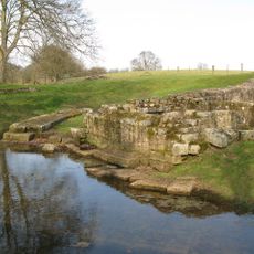
The outpost was built many centuries ago by the Roman army as part of Hadrian's Wall to defend Britain's northern frontier. During the 20th century, archaeologists and scholars found evidence of its earlier positions, but the exact location remains unclear and visible traces have disappeared.

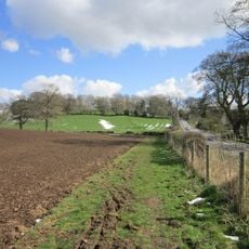
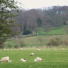
The location sits in open countryside south of the B6318 Military Road and is best explored on foot by following the Hadrian's Wall Path. The area offers walking trails through fields and hills, and bringing maps or historical records helps you understand the site's former position.

In the 1950s a platform was recorded nearby that may have been part of the outpost, yet investigations in the 1960s and 1980s could not pinpoint the exact location. Two associated watchtowers, Turret 28A and Turret 28B, were once positioned roughly a third of a mile apart to provide signals and surveillance.

The community of curious travelers

AroundUs brings together thousands of curated places, local tips, and hidden gems, enriched daily by 60,000 contributors worldwide.

Start exploring
Location
Part of
Hadrian's Wall
GPS coordinates
55.02909,-2.15284
Latest update
February 9, 2026 07:41
Around this place
Chesters Roman Fort
United Kingdom

Chesters Roman Fort

947 m
Chesters Bridge
United Kingdom

Chesters Bridge

1.1 km
Chesters
United Kingdom

Chesters

650 m
Milecastle 29
United Kingdom

Milecastle 29

1.6 km
Planetrees
United Kingdom

Planetrees

2.7 km
Chollerford Bridge
United Kingdom

Chollerford Bridge

1.6 km
Milecastle 26
United Kingdom

Milecastle 26

2.9 km
Walwick Grange
United Kingdom

Walwick Grange

1.3 km
Chesters Roman Fort
United Kingdom

Chesters Roman Fort

935 m
Milecastle 27
United Kingdom

Milecastle 27

1.4 km
Haughton Castle
United Kingdom

Haughton Castle

2.8 km
Church of St George
United Kingdom

Church of St George

2.1 km
Church of St Peter
United Kingdom

Church of St Peter

1.9 km
The George Inn
United Kingdom

The George Inn

1.6 km
Clayton Museum
United Kingdom

Clayton Museum

837 m
Milestone 230 Metres East Of High Brunton
United Kingdom

Milestone 230 Metres East Of High Brunton

2.6 km
Humshaugh War Memorial
United Kingdom

Humshaugh War Memorial

1.5 km
Wall War Memorial
United Kingdom

Wall War Memorial

2 km
Little Walwick
United Kingdom

Little Walwick

38 m
Wester Hall
United Kingdom

Wester Hall

2.8 km
Medieval wayside cross, 780m SSE of Walwick Grange
United Kingdom

Medieval wayside cross, 780m SSE of Walwick Grange

2.1 km
Pant Beside Road 200 Metres North Of Junction By Heatheridge
United Kingdom

Pant Beside Road 200 Metres North Of Junction By Heatheridge

1.9 km
The Roman fort, vicus, bridge abutments and associated remains of Hadrian's Wall at Chesters in wall mile 27
United Kingdom

The Roman fort, vicus, bridge abutments and associated remains of Hadrian's Wall at Chesters in wall mile 27

801 m
Hadrian's Wall and vallum between St Oswald's Cottages, east of Brunton Gate and the North Tyne in wall miles 25, 26 and 27
United Kingdom

Hadrian's Wall and vallum between St Oswald's Cottages, east of Brunton Gate and the North Tyne in wall miles 25, 26 and 27

2.2 km
Milestone 360 Metres North Of B6318 Junction
United Kingdom

Milestone 360 Metres North Of B6318 Junction

2.1 km
Milepost On North Side Of Road Junction At Keepershield
United Kingdom

Milepost On North Side Of Road Junction At Keepershield

2.2 km
Stable Block 200 Metres North Of Chesters
United Kingdom

Stable Block 200 Metres North Of Chesters

537 m
Garden Wall To West End Terrace And Evans Almshouse, With Attached Pant
United Kingdom

Garden Wall To West End Terrace And Evans Almshouse, With Attached Pant

1.8 km
Show the full map
Reviews
Share your experience

No review yet

Discussions
Start a discussion...

No discussion yet

« Milecastle 28 - milecastle on Hadrian's Wall in Northumberland, England, UK » is provided by Around Us (aroundus.com). Images and texts are derived from Wikimedia project under a Creative Commons license. You are allowed to copy, distribute, and modify copies of this page, under the conditions set by the license, as long as this note is clearly visible.

Discover hidden gems everywhere you go!

From secret cafés to breathtaking viewpoints, skip the crowded tourist spots and find places that match your style. Our app makes it easy with voice search, smart filtering, route optimization, and insider tips from travelers worldwide. Download now for the complete mobile experience.

Around Us App Screenshot

A unique approach to discovering new places

Le Figaro

All the places worth exploring

France Info

A tailor-made excursion in just a few clicks

20 Minutes

Around Us
Travel Guide & Maps
Download

Send to your phone

QR Code
1

Open the camera app on your mobile.

2

Point at the QR code with your camera. A notification will appear.

3

Tap the notification to open the link.