Walwick Grange

Log in to your account

AroundUs is a community-driven map of interesting places, built by curious explorers like you. It grows with every review, story, and photo you share.
Connect to save your favorite spots, contribute locations, and create personalized routes.
Continue with Google
Continue with Apple
Continue with X
Continue with Facebook
Continue with email
By continuing, you accept our Terms and Conditions and our Privacy Policy
Create an account
Add to collection
Map
Suggest a change
Share

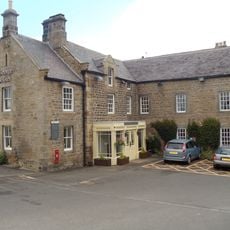
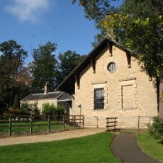
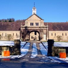
Walwick Grange, Grade II* listed country house in Warden, England

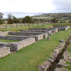
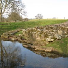
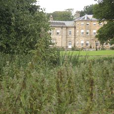
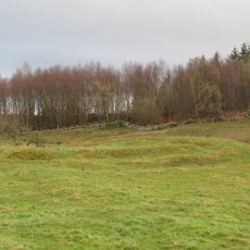
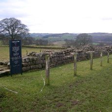
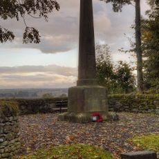
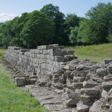
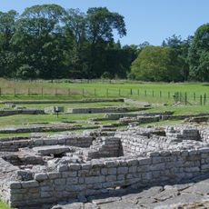
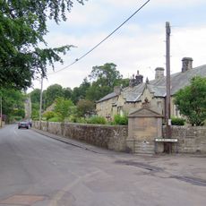
Walwick Grange is a three-storey country house with five bays that sits on the bank of the River North Tyne in Northumberland. The building stands near the remains of Hadrian's Wall and forms part of a wider landscape of Roman and medieval remains in the area.

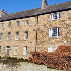
The Errington family settled at Walwick in the mid-16th century and later rebuilt the house in the early 18th century with its current form. The proximity to Hadrian's Wall placed the estate in a region that had been important for nearly two thousand years before the family arrived.

The name Walwick comes from Old English meaning 'settlement by a bay', reflecting the river location that shaped life here for centuries. The house served as a residence for a wealthy family whose standing in the region was visible in every architectural detail.

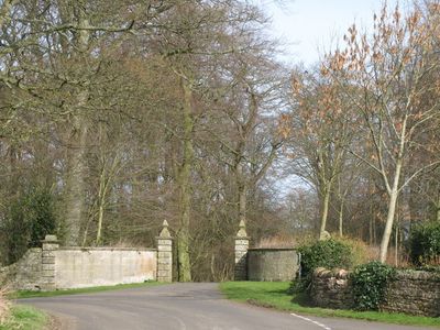
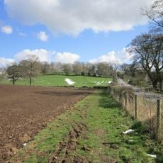
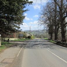
The house is reached via local paths and stands along a scenic stretch of the river that is accessible on foot throughout the year. The terrain is gently rolling and visitors should wear appropriate footwear as conditions can be muddy after rain.

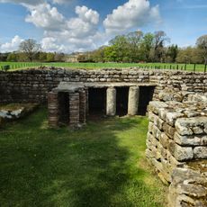
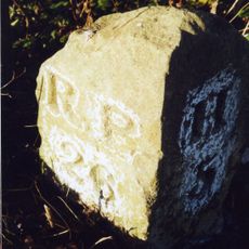
The house stands on the foundations of a medieval tower house, revealing how different periods of construction are layered into one structure. This overlap of several building campaigns across different centuries shows how the location remained continuously occupied and adapted over time.

Location: Warden

GPS coordinates: 55.01820,-2.14653

Latest update: December 14, 2025 16:40

Photos
Around this place
Chesters Roman Fort
United Kingdom

Chesters Roman Fort

992 m
Chesters Bridge
United Kingdom

Chesters Bridge

1 km
Chesters
United Kingdom

Chesters

965 m
Milecastle 29
United Kingdom

Milecastle 29

2.6 km
Planetrees
United Kingdom

Planetrees

2.2 km
Chollerford Bridge
United Kingdom

Chollerford Bridge

1.7 km
Milecastle 26
United Kingdom

Milecastle 26

2.4 km
Chesters Roman Fort
United Kingdom

Chesters Roman Fort

959 m
Milecastle 27
United Kingdom

Milecastle 27

1.2 km
Milecastle 28
United Kingdom

Milecastle 28

1.3 km
Church of St Oswald
United Kingdom

Church of St Oswald

3 km
Church of St George
United Kingdom

Church of St George

1.1 km
Church of St Peter
United Kingdom

Church of St Peter

2.4 km
Church of St Michael
United Kingdom

Church of St Michael

2.9 km
The George Inn
United Kingdom

The George Inn

1.8 km
Clayton Museum
United Kingdom

Clayton Museum

1.2 km
Little Walwick
United Kingdom

Little Walwick

1.3 km
Milestone 230 Metres East Of High Brunton
United Kingdom

Milestone 230 Metres East Of High Brunton

2.1 km
Wall War Memorial
United Kingdom

Wall War Memorial

999 m
Humshaugh War Memorial
United Kingdom

Humshaugh War Memorial

2.3 km
Stable Block 200 Metres North Of Chesters
United Kingdom

Stable Block 200 Metres North Of Chesters

1.2 km
Hadrian's Wall and vallum between St Oswald's Cottages, east of Brunton Gate and the North Tyne in wall miles 25, 26 and 27
United Kingdom

Hadrian's Wall and vallum between St Oswald's Cottages, east of Brunton Gate and the North Tyne in wall miles 25, 26 and 27

1.7 km
Milestone 360 Metres North Of B6318 Junction
United Kingdom

Milestone 360 Metres North Of B6318 Junction

2 km
The Roman fort, vicus, bridge abutments and associated remains of Hadrian's Wall at Chesters in wall mile 27
United Kingdom

The Roman fort, vicus, bridge abutments and associated remains of Hadrian's Wall at Chesters in wall mile 27

747 m
Medieval wayside cross, 780m SSE of Walwick Grange
United Kingdom

Medieval wayside cross, 780m SSE of Walwick Grange

787 m
Cross In Churchyard About 3 Metres South Of Tower Of Church Of St Michael
United Kingdom

Cross In Churchyard About 3 Metres South Of Tower Of Church Of St Michael

2.9 km
Garden Wall To West End Terrace And Evans Almshouse, With Attached Pant
United Kingdom

Garden Wall To West End Terrace And Evans Almshouse, With Attached Pant

2.4 km
Milestone, Rye Hill, Walwick
United Kingdom

Milestone, Rye Hill, Walwick

2.6 km
Show the full map
Reviews

Visited this place? Tap the stars to rate it and share your experience / photos with the community! Try now! You can cancel it anytime.

« Walwick Grange - Grade II* listed country house in Warden, England » is provided by Around Us (aroundus.com). Images and texts are derived from Wikimedia project under a Creative Commons license. You are allowed to copy, distribute, and modify copies of this page, under the conditions set by the license, as long as this note is clearly visible.

Discover hidden gems everywhere you go!

From secret cafés to breathtaking viewpoints, skip the crowded tourist spots and find places that match your style. Our app makes it easy with voice search, smart filtering, route optimization, and insider tips from travelers worldwide. Download now for the complete mobile experience.

Around Us App Screenshot

A unique approach to discovering new places

Le Figaro

All the places worth exploring

France Info

A tailor-made excursion in just a few clicks

20 Minutes