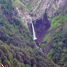
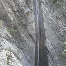
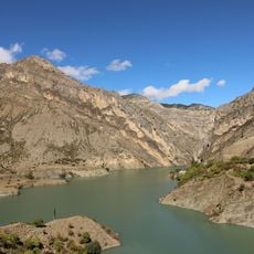
Vodopad Chyrkhalyu, Mountain waterfall in Khunzakh District, Dagestan, Russia
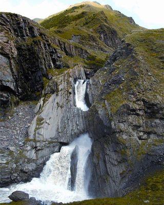
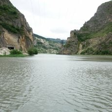
Vodopad Chyrkhalyu is a mountain waterfall in Dagestan that plunges from the Tobot River into a deep canyon below. The water cascades over rocky terrain and creates mist that can be seen from several vantage points around the area.
The waterfall was first documented in the 19th century by Russian explorers studying the North Caucasus region. Since its early recording, it has remained a recognized natural landmark in Dagestan's geography.
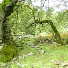
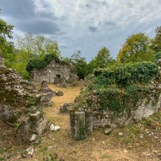
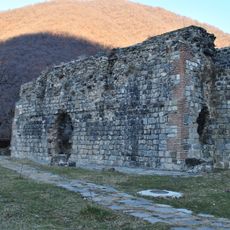
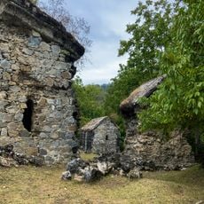
The waterfall forms part of the Khunzakh Nature Park, where local guides share stories about the geological formations and natural heritage of Dagestan.
Access to the waterfall involves driving through the mountains, with several trails leading to viewing areas and the base. Wear sturdy shoes and take care on wet rocks, as spray from the water makes surfaces slippery throughout the year.
During winter months, the waterfall becomes a frozen formation while water continues flowing through its interior, creating a hollow ice shell. This unusual winter phenomenon is uncommon in mountain waterfalls and makes the site remarkable even in cold months.
Location: Dagestan
GPS coordinates: 42.03694,46.72861
Latest update: December 14, 2025 16:41
Lagodekhi Protected Areas
44.3 km
Gunib Fortress
43.6 km
Datuna Church
49 km
Parigala
49.7 km
Zagatala State Reserve
27.5 km
Khunzakh Fortress
57.8 km
Ilisu State Reserve
65.2 km
Кумухская джума-мечеть
35.4 km
Zaqatala City Stadium
44.7 km
Lekit church
63 km
Basilica in Qum village
66.3 km
Seven Church monastery complex
59.4 km
Gergebil Reservoir
51.6 km
Mamrukh Church
54.9 km
Dzveli Gavazi church
63.5 km
Shahali Waterfall
67.3 km
Katekhi Church
46.3 km
Джума-мечеть (Кумух)
35.4 km
Крепостная стена (Гуниб)
43.6 km
Мечеть (Салта)
48.9 km
Селение Нижний Батлух (Нижний Батлух)
52.9 km
Водохранилище (Гуниб)
47.5 km
Селение Корода (архитектурный комплекс) (Корода)
47.1 km
Оборонительная сторожевая башня (Гуниб)
43.8 km
Верхняя боевая башня (Кахиб)
45.2 km
Три Гоорские башни (Гоор)
45.7 km
Селение «Гоор» (Гоор)
45.7 km
Селение Кахиб (старое) (Кахиб)
45 kmVisited this place? Tap the stars to rate it and share your experience / photos with the community! Try now! You can cancel it anytime.
Discover hidden gems everywhere you go!
From secret cafés to breathtaking viewpoints, skip the crowded tourist spots and find places that match your style. Our app makes it easy with voice search, smart filtering, route optimization, and insider tips from travelers worldwide. Download now for the complete mobile experience.
A unique approach to discovering new places❞
— Le Figaro
All the places worth exploring❞
— France Info
A tailor-made excursion in just a few clicks❞
— 20 Minutes