Flanders Historic District

Log in to your account

AroundUs is a community-driven map of interesting places, built by curious explorers like you. It grows with every review, story, and photo you share.
Connect to save your favorite spots, contribute locations, and create personalized routes.
Continue with Google
Continue with Apple
Continue with X
Continue with Facebook
Continue with email
By continuing, you accept our Terms and Conditions and our Privacy Policy
Create an account
Add to collection
Map
Suggest a change
Share

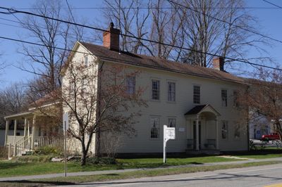
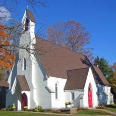
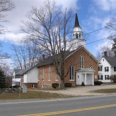
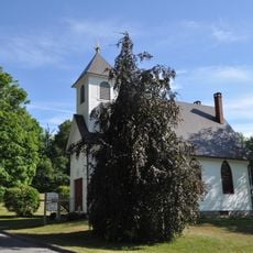
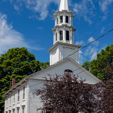
Flanders Historic District, Historic residential district in Kent, Connecticut.

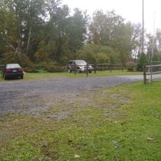
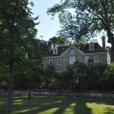
Flanders Historic District is a residential area with twelve major buildings spread across 65 acres at the intersection of U.S. Route 7 with Cobble and Studio Hill Roads. The structures display Greek Revival features and are typical of early Connecticut settlements from the 18th century.

The area was the original center of Kent settlement from the late 18th century until the 1840s when railroad development shifted activities to a new location. This shift marked the end of Kent's first chapter as a commercial hub and signaled a transition to a new phase of community growth.

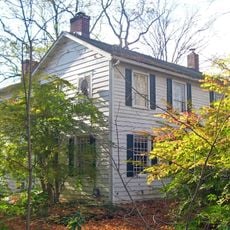
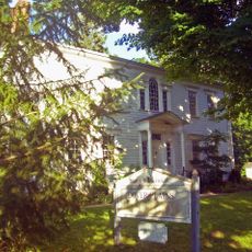
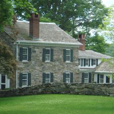
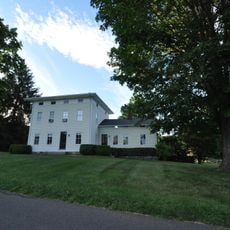
The houses display typical Federal period features with local building elements that reflect the craftsmanship of village artisans. These architectural details tell the story of how early settlers lived and worked with their own hands.

The district is easily accessible for visitors and allows walking tours through the residential area. Its location on U.S. Route 7 makes reaching it straightforward, and the relatively flat to gently rolling terrain supports comfortable sightseeing.

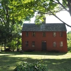
The Nathaniel Slosson Homestead from around 1739 is the oldest documented house in the area and marks the start of Kent's settlement period. This house stands as a quiet witness to the pioneering work of the early colonists who opened up the region.

Location: Connecticut

Architectural style: Greek Revival architecture

Elevation above the sea: 136 m

GPS coordinates: 41.73944,-73.45694

Latest update: December 14, 2025 17:42

Photos
Around this place
Rye House
United States of America

Rye House

14.9 km
House VI
United States of America

House VI

15.3 km
Kent Falls State Park
United States of America

Kent Falls State Park

5.6 km
Bull's Bridge
United States of America

Bull's Bridge

8.3 km
Cathedral Pines
United States of America

Cathedral Pines

15.3 km
Macedonia Brook State Park
United States of America

Macedonia Brook State Park

4.3 km
Cornwall Bridge
United States of America

Cornwall Bridge

11.3 km
Above All State Park
United States of America

Above All State Park

8.8 km
Beth David Synagogue
United States of America

Beth David Synagogue

14.5 km
Housatonic Meadows State Park
United States of America

Housatonic Meadows State Park

13.4 km
Beekman Park
United States of America

Beekman Park

14.6 km
Lewis Mumford House
United States of America

Lewis Mumford House

13.1 km
Audubon Sharon
United States of America

Audubon Sharon

13.1 km
Hunt Hill Farm
United States of America

Hunt Hill Farm

12.8 km
St. Thomas Episcopal Church
United States of America

St. Thomas Episcopal Church

10.4 km
Mount Bushnell State Park
United States of America

Mount Bushnell State Park

9.6 km
Tabor-Wing House
United States of America

Tabor-Wing House

10.2 km
New Preston Hill Historic District
United States of America

New Preston Hill Historic District

10.1 km
Sharon Historic District
United States of America

Sharon Historic District

14.7 km
Gov. Smith Homestead
United States of America

Gov. Smith Homestead

14.5 km
Merryall Union Evangelical Society Chapel
United States of America

Merryall Union Evangelical Society Chapel

10.7 km
Connecticut Antique Machinery Association
United States of America

Connecticut Antique Machinery Association

1 km
Capt. Philo Beardsley House
United States of America

Capt. Philo Beardsley House

6.9 km
Second Baptist Church of Dover
United States of America

Second Baptist Church of Dover

10.1 km
St. Andrew's Episcopal Church
United States of America

St. Andrew's Episcopal Church

11.2 km
Calhoun-Ives Historic District
United States of America

Calhoun-Ives Historic District

13.6 km
Lake Waramaug State Park
United States of America

Lake Waramaug State Park

7.2 km
Kent Falls
United States of America

Kent Falls

5.6 km
Show the full map
Reviews

Visited this place? Tap the stars to rate it and share your experience / photos with the community! Try now! You can cancel it anytime.

« Flanders Historic District - Historic residential district in Kent, Connecticut » is provided by Around Us (aroundus.com). Images and texts are derived from Wikimedia project under a Creative Commons license. You are allowed to copy, distribute, and modify copies of this page, under the conditions set by the license, as long as this note is clearly visible.

Discover hidden gems everywhere you go!

From secret cafés to breathtaking viewpoints, skip the crowded tourist spots and find places that match your style. Our app makes it easy with voice search, smart filtering, route optimization, and insider tips from travelers worldwide. Download now for the complete mobile experience.

Around Us App Screenshot

A unique approach to discovering new places

Le Figaro

All the places worth exploring

France Info

A tailor-made excursion in just a few clicks

20 Minutes