Enable Location

We need your location to show you interesting places around you

Discover nearby places

Find interesting locations and hidden gems around you

Precise directions

Get accurate directions and distances to places

Your location is never shared with other users. It's only used when you tap the location button.

Hunt Hill Farm

Log in to your account

Start exploring — it's free

Trusted by 62,949 travelers worldwide

Continue with Google
Continue with Apple
or

We will send you a code to connect

By continuing, you accept our Terms and Conditions and our Privacy Policy

Check your inbox

We've sent a pincode in your inbox. Please enter the code below.

Discussion Reviews 1 Photos
1.4k Popularity

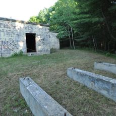
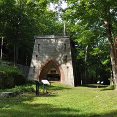
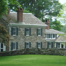
Hunt Hill Farm, Protected farming estate in New Milford, United States

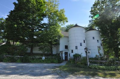
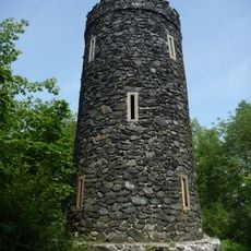
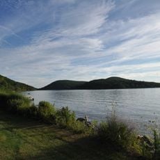
Hunt Hill Farm is a rural farming estate spanning about 137 acres with open fields, wooded sections, and buildings distributed along local roads. Two circular silos serve as landmarks marking the farm's presence at the road intersection.

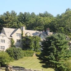
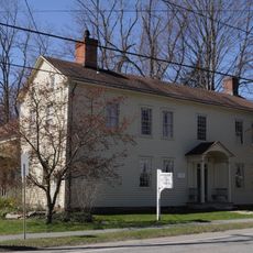
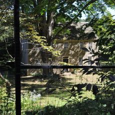
Farming operations started here in 1737 when Daniel Hine established the property, with the oldest surviving house built around 1760. This early settlement made it significant in the area's development and land use patterns.

The Silo Gallery hosts artwork from hundreds of artists and has shaped the region's creative community since the mid-1970s. Visitors experience contemporary and traditional art within this unusual rural setting.

The property operates under conservation rules designed to protect the land while welcoming visitors for educational and recreational activities. It helps to check ahead about current programs and what areas may be accessed during your visit.

The two circular silos at the road junction have served as a local landmark for decades and make the entrance easily recognizable. They function both as working farm structures and as distinctive visual markers for the property.

The community of curious travelers

AroundUs brings together thousands of curated places, local tips, and hidden gems, enriched daily by 60,000 contributors worldwide.

Start exploring
Location
GPS coordinates
41.63833,-73.38250
Latest update
December 14, 2025 17:02
Around this place
Rye House
United States of America

Rye House

12.6 km
Lovers Leap State Park
United States of America

Lovers Leap State Park

10.5 km
Bull's Bridge
United States of America

Bull's Bridge

11.3 km
Mount Tom State Park
United States of America

Mount Tom State Park

10.5 km
Above All State Park
United States of America

Above All State Park

10.1 km
Flanders Historic District
United States of America

Flanders Historic District

12.8 km
Mount Bushnell State Park
United States of America

Mount Bushnell State Park

5.9 km
Mine Hills Preserve
United States of America

Mine Hills Preserve

9.5 km
The Hollister Homestead
United States of America

The Hollister Homestead

9.6 km
Boardman's Bridge
United States of America

Boardman's Bridge

7.6 km
Sherman Historic District
United States of America

Sherman Historic District

11.6 km
New Preston Hill Historic District
United States of America

New Preston Hill Historic District

4.1 km
United Bank Building
United States of America

United Bank Building

7.2 km
New Milford Center Historic District
United States of America

New Milford Center Historic District

6.8 km
Merryall Union Evangelical Society Chapel
United States of America

Merryall Union Evangelical Society Chapel

3.3 km
J. S. Halpine Tobacco Warehouse
United States of America

J. S. Halpine Tobacco Warehouse

7.7 km
Capt. Philo Beardsley House
United States of America

Capt. Philo Beardsley House

7 km
St. Andrew's Episcopal Church
United States of America

St. Andrew's Episcopal Church

2.9 km
Washington Green Historic District
United States of America

Washington Green Historic District

6.3 km
E. A. Wildman & Co. Tobacco Warehouse
United States of America

E. A. Wildman & Co. Tobacco Warehouse

7.3 km
Bridgewater Center Historic District
United States of America

Bridgewater Center Historic District

11.6 km
Calhoun-Ives Historic District
United States of America

Calhoun-Ives Historic District

4.8 km
Frederick S. Sanford House
United States of America

Frederick S. Sanford House

11.5 km
Roxbury Center
United States of America

Roxbury Center

11.1 km
Lake Waramaug State Park
United States of America

Lake Waramaug State Park

7.6 km
Lover's Leap Bridge
United States of America

Lover's Leap Bridge

10.7 km
Bank Street Theater
United States of America

Bank Street Theater

7.2 km
Mount Tom Tower
United States of America

Mount Tom Tower

10.9 km
Show the full map
Reviews
Share your experience

No review yet

Discussions
Start a discussion...

No discussion yet

« Hunt Hill Farm - Protected farming estate in New Milford, United States » is provided by Around Us (aroundus.com). Images and texts are derived from Wikimedia project under a Creative Commons license. You are allowed to copy, distribute, and modify copies of this page, under the conditions set by the license, as long as this note is clearly visible.

Discover hidden gems everywhere you go!

From secret cafés to breathtaking viewpoints, skip the crowded tourist spots and find places that match your style. Our app makes it easy with voice search, smart filtering, route optimization, and insider tips from travelers worldwide. Download now for the complete mobile experience.

Around Us App Screenshot

A unique approach to discovering new places

Le Figaro

All the places worth exploring

France Info

A tailor-made excursion in just a few clicks

20 Minutes

Around Us
Travel Guide & Maps
Download

Send to your phone

QR Code
1

Open the camera app on your mobile.

2

Point at the QR code with your camera. A notification will appear.

3

Tap the notification to open the link.