Above All State Park

Log in to your account

AroundUs is a community-driven map of interesting places, built by curious explorers like you. It grows with every review, story, and photo you share.
Connect to save your favorite spots, contribute locations, and create personalized routes.
Continue with Google
Continue with Apple
Continue with X
Continue with Facebook
Continue with email
By continuing, you accept our Terms and Conditions and our Privacy Policy
Create an account
Add to collection
Map
Suggest a change
Share

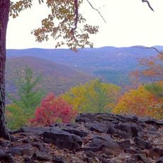
Above All State Park, State park in Warren, Connecticut

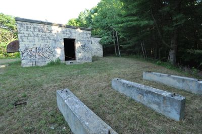
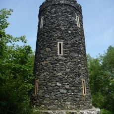
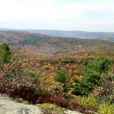
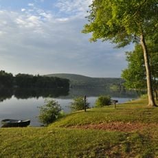
Above All State Park is an undeveloped natural area spanning about 31 acres at an elevation of about 1,473 feet with remnants of military structures scattered across the landscape. The park contains various building foundations and structural supports from its former use as a Cold War installation.

The site began in 1927 when heirs of Seymour Strong donated land, followed by an additional purchase from the Stanley estate that same year. Over the decades it shifted from private ownership to public park status, reflecting the region's evolving relationship with the land.

From 1957 to 1968, the site operated as an unmanned radar station within the continental air defense network during the Cold War. Visitors walking through the park today can sense how this remote location once served as a technological outpost during tense geopolitical times.

Access is through a barred gate off Connecticut Route 341, and it is advisable to check ahead for current entry conditions. There are no maintained trails or facilities, so visitors should be prepared for natural terrain and minimal infrastructure.

The park preserves visible relics of the radar installation, including an equipment building, tower footings, and steel supports for fuel tanks. These concrete remains offer a rare glimpse into the physical infrastructure of Cold War surveillance that survives at this remote location.

Location: Warren

Inception: 1927

Elevation above the sea: 448 m

Website: https://ctvisit.com/listings/above-all-state-park

GPS coordinates: 41.72667,-73.35278

Latest update: December 12, 2025 17:40

Photos
Around this place
Rye House
United States of America

Rye House

6.1 km
House VI
United States of America

House VI

12.1 km
Kent Falls State Park
United States of America

Kent Falls State Park

7.2 km
Mount Tom State Park
United States of America

Mount Tom State Park

7.2 km
Cathedral Pines
United States of America

Cathedral Pines

12.4 km
Macedonia Brook State Park
United States of America

Macedonia Brook State Park

12.1 km
Milton Center Historic District
United States of America

Milton Center Historic District

8.1 km
Cornwall Bridge
United States of America

Cornwall Bridge

10.5 km
White Memorial Foundation
United States of America

White Memorial Foundation

11.3 km
Housatonic Meadows State Park
United States of America

Housatonic Meadows State Park

13.3 km
Hunt Hill Farm
United States of America

Hunt Hill Farm

10.1 km
Flanders Historic District
United States of America

Flanders Historic District

8.8 km
Mount Bushnell State Park
United States of America

Mount Bushnell State Park

4.2 km
Trinity Church
United States of America

Trinity Church

8.6 km
New Preston Hill Historic District
United States of America

New Preston Hill Historic District

6 km
Merryall Union Evangelical Society Chapel
United States of America

Merryall Union Evangelical Society Chapel

10.4 km
Connecticut Antique Machinery Association
United States of America

Connecticut Antique Machinery Association

9.8 km
Capt. Philo Beardsley House
United States of America

Capt. Philo Beardsley House

4.3 km
Henry B. Bissell House
United States of America

Henry B. Bissell House

9.8 km
St. Andrew's Episcopal Church
United States of America

St. Andrew's Episcopal Church

7.2 km
Washington Green Historic District
United States of America

Washington Green Historic District

11.7 km
Rumsey Hall
United States of America

Rumsey Hall

13.2 km
Calhoun-Ives Historic District
United States of America

Calhoun-Ives Historic District

7.7 km
David Welch House
United States of America

David Welch House

8.7 km
Town Hall and District School No. 6
United States of America

Town Hall and District School No. 6

13.6 km
Lake Waramaug State Park
United States of America

Lake Waramaug State Park

3.3 km
Kent Falls
United States of America

Kent Falls

7.2 km
Mount Tom Tower
United States of America

Mount Tom Tower

7.6 km
Show the full map
Reviews

Visited this place? Tap the stars to rate it and share your experience / photos with the community! Try now! You can cancel it anytime.

« Above All State Park - State park in Warren, Connecticut » is provided by Around Us (aroundus.com). Images and texts are derived from Wikimedia project under a Creative Commons license. You are allowed to copy, distribute, and modify copies of this page, under the conditions set by the license, as long as this note is clearly visible.

Discover hidden gems everywhere you go!

From secret cafés to breathtaking viewpoints, skip the crowded tourist spots and find places that match your style. Our app makes it easy with voice search, smart filtering, route optimization, and insider tips from travelers worldwide. Download now for the complete mobile experience.

Around Us App Screenshot

A unique approach to discovering new places

Le Figaro

All the places worth exploring

France Info

A tailor-made excursion in just a few clicks

20 Minutes