Harmony Historic District

Log in to your account

AroundUs is a community-driven map of interesting places, built by curious explorers like you. It grows with every review, story, and photo you share.
Connect to save your favorite spots, contribute locations, and create personalized routes.
Continue with Google
Continue with Apple
Continue with X
Continue with Facebook
Continue with email
By continuing, you accept our Terms and Conditions and our Privacy Policy
Create an account
Add to collection
Map
Suggest a change
Share

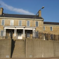
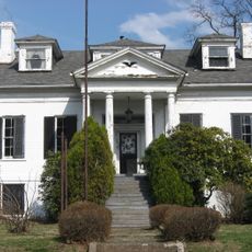
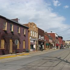
Harmony Historic District, National Historic Landmark in Harmony, Pennsylvania, United States

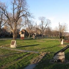
Harmony Historic District is a National Historic Landmark in Harmony, Pennsylvania, containing numerous Federal and Greek Revival structures from the 1800s spread across several blocks of residential and commercial properties. The district preserves the original street layout and building arrangement that defined the early settlement.

The Harmony Society, led by George Rapp, founded this settlement in 1804 as a religious commune dedicated to farming and manufacturing. The community operated on shared religious ideals and worked toward economic independence through collective enterprise.

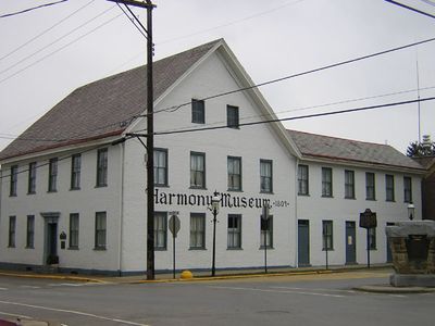
The museum displays German immigrant roots through artifacts, furniture, and traditional crafts from the original residents. Walking through the district, you can see how the community shaped daily life around shared work and worship.

Walking tours depart from the museum and guide visitors through the streets, explaining architectural details and historical aspects of the preserved buildings. The entire district is easy to explore on foot, and most structures are visible from the public pathways.

The district represents one of the earliest examples of German religious communal settlement in North America, still retaining its original spatial design today. The street layout and building arrangement reflect the direct vision of its founders from over 200 years ago.

Location: Harmony

GPS coordinates: 40.80306,-80.12833

Latest update: December 13, 2025 17:04

Photos
Around this place
Moraine State Park
United States of America

Moraine State Park

16.8 km
McConnells Mill State Park
United States of America

McConnells Mill State Park

14.7 km
Elm Court
United States of America

Elm Court

21.2 km
Fort McIntosh
United States of America

Fort McIntosh

19.2 km
Butler County Courthouse
United States of America

Butler County Courthouse

20.5 km
Beaver Bridge
United States of America

Beaver Bridge

18.4 km
Strand Theater
United States of America

Strand Theater

1.1 km
Matthew S. Quay House
United States of America

Matthew S. Quay House

19.2 km
Carnegie Free Library of Beaver Falls
United States of America

Carnegie Free Library of Beaver Falls

17.1 km
Merrick Art Gallery
United States of America

Merrick Art Gallery

17.2 km
Monaca – East Rochester Bridge
United States of America

Monaca – East Rochester Bridge

17 km
McConnell's Mill Covered Bridge
United States of America

McConnell's Mill Covered Bridge

17 km
Captain William Vicary House
United States of America

Captain William Vicary House

16.9 km
Rochester-Monaca Bridge
United States of America

Rochester-Monaca Bridge

17.6 km
William B. Dunlap Mansion
United States of America

William B. Dunlap Mansion

17.8 km
Eastvale Bridge
United States of America

Eastvale Bridge

16.4 km
Bridgewater Historic District
United States of America

Bridgewater Historic District

17.7 km
Fallston Bridge
United States of America

Fallston Bridge

17.5 km
Old Main
United States of America

Old Main

16.7 km
Sen. Walter Lowrie House
United States of America

Sen. Walter Lowrie House

20.5 km
Passavant House
United States of America

Passavant House

1.3 km
Rochester-Beaver Railroad Bridge
United States of America

Rochester-Beaver Railroad Bridge

17.9 km
Butler Historic District
United States of America

Butler Historic District

20.7 km
Butler County National Bank
United States of America

Butler County National Bank

20.6 km
Beaver River Railroad Bridge
United States of America

Beaver River Railroad Bridge

17.6 km
United States of America

Lake Arthur

17.1 km
Beaver Historic District
United States of America

Beaver Historic District

19.3 km
James Beach Clow House
United States of America

James Beach Clow House

11.3 km
Show the full map
Reviews

Visited this place? Tap the stars to rate it and share your experience / photos with the community! Try now! You can cancel it anytime.

« Harmony Historic District - National Historic Landmark in Harmony, Pennsylvania, United States » is provided by Around Us (aroundus.com). Images and texts are derived from Wikimedia project under a Creative Commons license. You are allowed to copy, distribute, and modify copies of this page, under the conditions set by the license, as long as this note is clearly visible.

Discover hidden gems everywhere you go!

From secret cafés to breathtaking viewpoints, skip the crowded tourist spots and find places that match your style. Our app makes it easy with voice search, smart filtering, route optimization, and insider tips from travelers worldwide. Download now for the complete mobile experience.

Around Us App Screenshot

A unique approach to discovering new places

Le Figaro

All the places worth exploring

France Info

A tailor-made excursion in just a few clicks

20 Minutes