Enable Location

We need your location to show you interesting places around you

Discover nearby places

Find interesting locations and hidden gems around you

Precise directions

Get accurate directions and distances to places

Your location is never shared with other users. It's only used when you tap the location button.

John Burroughs Homestead

Log in to your account

Start exploring — it's free

Trusted by 62,344 travelers worldwide

Continue with Google
Continue with Apple
or

We will send you a code to connect

By continuing, you accept our Terms and Conditions and our Privacy Policy

Check your inbox

We've sent a pincode in your inbox. Please enter the code below.

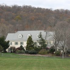
John Burroughs Homestead, building in Pennsylvania, United States

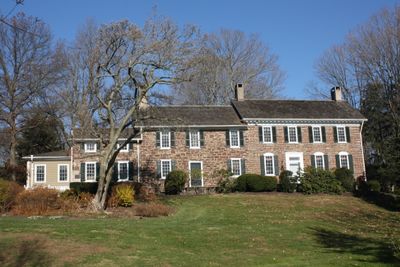
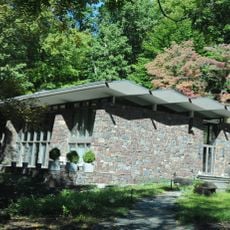
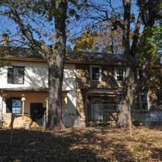
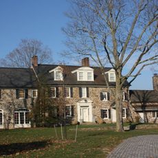
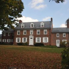
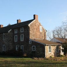
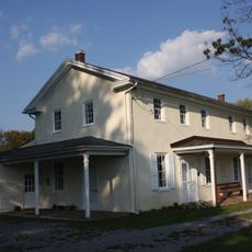
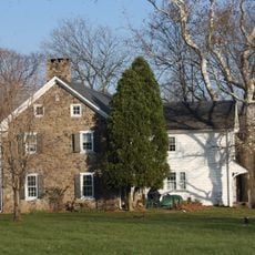
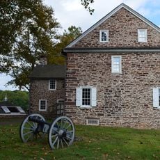
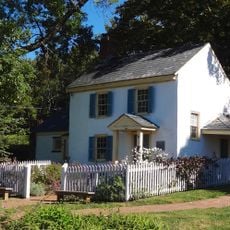
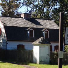
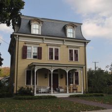
John Burroughs Homestead is a historic house in Bucks County, Pennsylvania, composed of several stone sections built during different periods. The property includes a main house with four distinct sections along with outbuildings such as a carriage house, tool shed, and caretaker's cottage, all constructed from stone and wood.

The original house was built in the 1700s and later served as the headquarters of Lieutenant Colonel James Hendricks. The property was added to the National Register of Historic Places in 1984, securing its recognition as an important landmark in American history.

The house is also known as Shady Hill and holds strong connections to John Burroughs, a celebrated naturalist and writer of the 1800s. The property reflects his love of nature and draws visitors interested in learning about his life and work.

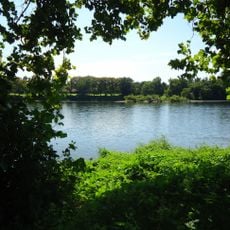
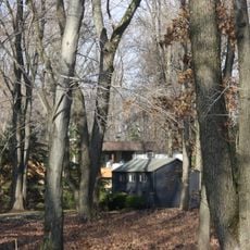
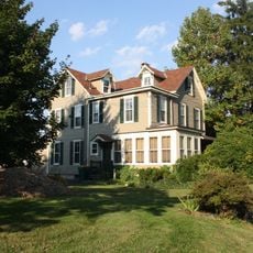
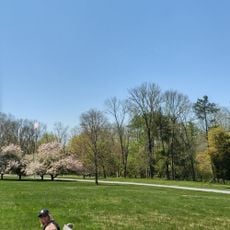
The property sits on a quiet lot with trees and open grounds that can be explored on foot. Visitors should expect seasonal hours and guided tours that provide information about the house and its historical context.

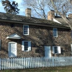
The property served not only as a residence but also as a gathering place for important discussions about conservation and nature protection. This dual purpose transforms it into more than just a building, making it a symbol of both regional and natural history significance.

The community of curious travelers

AroundUs brings together thousands of curated places, local tips, and hidden gems, enriched daily by 60,000 contributors worldwide.

Start exploring
Location
GPS coordinates
40.28440,-74.90060
Latest update
February 9, 2026 07:42
Around this place
Washington's Crossing
United States of America

Washington's Crossing

3 km
Washington Crossing Historic Park
United States of America

Washington Crossing Historic Park

2.5 km
Scudder Falls Bridge
United States of America

Scudder Falls Bridge

5.4 km
Washington Crossing State Park
United States of America

Washington Crossing State Park

4.3 km
Bowman's Hill Tower
United States of America

Bowman's Hill Tower

5.6 km
Washington Crossing Bridge
United States of America

Washington Crossing Bridge

3 km
Keith House
United States of America

Keith House

4.1 km
United States of America

Washington Crossing National Cemetery

2.3 km
Bowman's Hill Wildflower Preserve
United States of America

Bowman's Hill Wildflower Preserve

6.1 km
Scudders Falls
United States of America

Scudders Falls

4.5 km
John and Alice Fullam House
United States of America

John and Alice Fullam House

6.1 km
Howell Living History Farm
United States of America

Howell Living History Farm

6.3 km
London Purchase Farm
United States of America

London Purchase Farm

5.2 km
Waldenmark
United States of America

Waldenmark

5.9 km
Thompson-Neely House
United States of America

Thompson-Neely House

6.1 km
Hayhurst Farm
United States of America

Hayhurst Farm

3.8 km
Bear Tavern Road--Jacob's Creek Crossing Rural Historic District
United States of America

Bear Tavern Road--Jacob's Creek Crossing Rural Historic District

4.8 km
Dolington Village Historic District
United States of America

Dolington Village Historic District

2.1 km
Brownsburg Village Historic District
United States of America

Brownsburg Village Historic District

4.2 km
Benjamin Taylor Homestead
United States of America

Benjamin Taylor Homestead

3.2 km
Washington Crossing State Park
United States of America

Washington Crossing State Park

4.2 km
Peter Taylor Farmstead
United States of America

Peter Taylor Farmstead

4.5 km
Makefield Meeting
United States of America

Makefield Meeting

2.4 km
Smith Family Farmstead
United States of America

Smith Family Farmstead

4.4 km
McConkey's Ferry Inn
United States of America

McConkey's Ferry Inn

2.8 km
Nelson House
United States of America

Nelson House

3.1 km
Johnson Ferry House
United States of America

Johnson Ferry House

3.2 km
Titusville Historic District
United States of America

Titusville Historic District

3 km
Show the full map
« John Burroughs Homestead - building in Pennsylvania, United States » is provided by Around Us (aroundus.com). Images and texts are derived from Wikimedia project under a Creative Commons license. You are allowed to copy, distribute, and modify copies of this page, under the conditions set by the license, as long as this note is clearly visible.

Discover hidden gems everywhere you go!

From secret cafés to breathtaking viewpoints, skip the crowded tourist spots and find places that match your style. Our app makes it easy with voice search, smart filtering, route optimization, and insider tips from travelers worldwide. Download now for the complete mobile experience.

Around Us App Screenshot

A unique approach to discovering new places

Le Figaro

All the places worth exploring

France Info

A tailor-made excursion in just a few clicks

20 Minutes

Around Us
Travel Guide & Maps
Download

Send to your phone

QR Code
1

Open the camera app on your mobile.

2

Point at the QR code with your camera. A notification will appear.

3

Tap the notification to open the link.