Enable Location

We need your location to show you interesting places around you

Discover nearby places

Find interesting locations and hidden gems around you

Precise directions

Get accurate directions and distances to places

Your location is never shared with other users. It's only used when you tap the location button.

Hayhurst Farm

Log in to your account

Start exploring — it's free

Trusted by 63,104 travelers worldwide

Continue with Google
Continue with Apple
or

We will send you a code to connect

By continuing, you accept our Terms and Conditions and our Privacy Policy

Check your inbox

We've sent a pincode in your inbox. Please enter the code below.

Discussion Reviews 1 Photos
1.2k Popularity

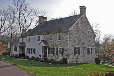
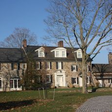
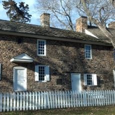
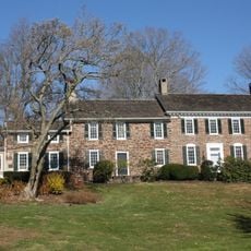
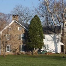
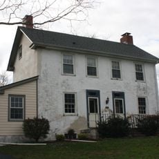
Hayhurst Farm, Colonial farmhouse in Bucks County, United States.

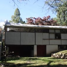
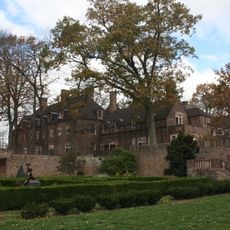
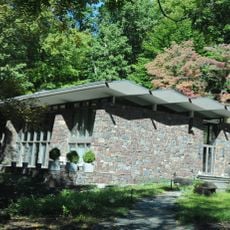
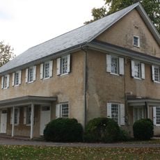
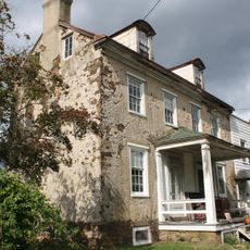
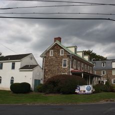
Hayhurst Farm is a colonial-era farmhouse located on an approximately 85-acre property in Bucks County, Pennsylvania. The structure displays traditional 1700s construction techniques typical of rural Pennsylvania farms of that period.

The farmhouse was built in 1742 by John Hayhurst, a Quaker minister connected to Wrightstown Friends Meeting. In December 1776, General John Sullivan used the property as a location of strategic importance during military operations leading to the Delaware crossing.

The name derives from the Hayhurst family who settled here. The building reflects how colonial farmers in Pennsylvania constructed their homes with local materials and practical design suited to rural life.

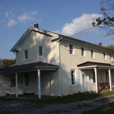
The property is privately owned and accessible by arrangement with the owners. The location is rural, so having transportation is necessary to visit the site.

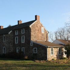
The farmhouse retains several original architectural elements from its original construction and represents a rare surviving example of colonial building techniques still visible today. Many visitors overlook the subtle details of the stone walls and window construction that reveal how builders worked in this period.

The community of curious travelers

AroundUs brings together thousands of curated places, local tips, and hidden gems, enriched daily by 60,000 contributors worldwide.

Start exploring
Location
GPS coordinates
40.29000,-74.94528
Latest update
December 14, 2025 18:00
Around this place
Washington Crossing Historic Park
United States of America

Washington Crossing Historic Park

5.9 km
Bowman's Hill Tower
United States of America

Bowman's Hill Tower

4.1 km
Keith House
United States of America

Keith House

634 m
United States of America

Washington Crossing National Cemetery

4.5 km
George Nakashima House, Studio and Workshop
United States of America

George Nakashima House, Studio and Workshop

5.7 km
Bowman's Hill Wildflower Preserve
United States of America

Bowman's Hill Wildflower Preserve

4.5 km
George F. Tyler Mansion
United States of America

George F. Tyler Mansion

5.9 km
John and Alice Fullam House
United States of America

John and Alice Fullam House

2.4 km
London Purchase Farm
United States of America

London Purchase Farm

2.6 km
Van Sant Covered Bridge
United States of America

Van Sant Covered Bridge

4.3 km
Waldenmark
United States of America

Waldenmark

2.7 km
Thompson-Neely House
United States of America

Thompson-Neely House

4.7 km
William Smith House
United States of America

William Smith House

4.9 km
John Burroughs Homestead
United States of America

John Burroughs Homestead

3.8 km
Dolington Village Historic District
United States of America

Dolington Village Historic District

5 km
Brownsburg Village Historic District
United States of America

Brownsburg Village Historic District

3.9 km
Wrightstown Friends Meeting Complex
United States of America

Wrightstown Friends Meeting Complex

4.2 km
Wycombe Village Historic District
United States of America

Wycombe Village Historic District

6.3 km
Benjamin Taylor Homestead
United States of America

Benjamin Taylor Homestead

4.6 km
Penns Park Historic District
United States of America

Penns Park Historic District

5.1 km
Penn's Park General Store Complex
United States of America

Penn's Park General Store Complex

5.3 km
Atkinson Road Bridge
United States of America

Atkinson Road Bridge

5 km
Peter Taylor Farmstead
United States of America

Peter Taylor Farmstead

4.1 km
Makefield Meeting
United States of America

Makefield Meeting

5.6 km
Smith Family Farmstead
United States of America

Smith Family Farmstead

3.5 km
Buckmanville Historic District
United States of America

Buckmanville Historic District

3.7 km
Schofield Ford Covered Bridge
United States of America

Schofield Ford Covered Bridge

5.9 km
Titusville Historic District
United States of America

Titusville Historic District

5.9 km
Show the full map
Reviews
Share your experience

No review yet

Discussions
Start a discussion...

No discussion yet

« Hayhurst Farm - Colonial farmhouse in Bucks County, United States » is provided by Around Us (aroundus.com). Images and texts are derived from Wikimedia project under a Creative Commons license. You are allowed to copy, distribute, and modify copies of this page, under the conditions set by the license, as long as this note is clearly visible.

Discover hidden gems everywhere you go!

From secret cafés to breathtaking viewpoints, skip the crowded tourist spots and find places that match your style. Our app makes it easy with voice search, smart filtering, route optimization, and insider tips from travelers worldwide. Download now for the complete mobile experience.

Around Us App Screenshot

A unique approach to discovering new places

Le Figaro

All the places worth exploring

France Info

A tailor-made excursion in just a few clicks

20 Minutes

Around Us
Travel Guide & Maps
Download

Send to your phone

QR Code
1

Open the camera app on your mobile.

2

Point at the QR code with your camera. A notification will appear.

3

Tap the notification to open the link.