Lambs Knoll

Log in to your account

AroundUs is a community-driven map of interesting places, built by curious explorers like you. It grows with every review, story, and photo you share.
Connect to save your favorite spots, contribute locations, and create personalized routes.
Continue with Google
Continue with Apple
Continue with X
Continue with Facebook
Continue with email
By continuing, you accept our Terms and Conditions and our Privacy Policy
Create an account
Add to collection
Map
Suggest a change
Share

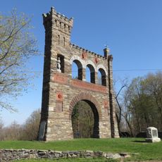
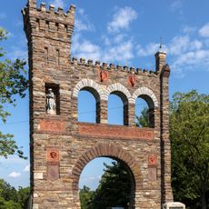
Lambs Knoll, Mountain summit in Frederick County, Maryland, US

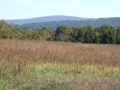
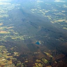
Lambs Knoll is a mountain summit in Frederick County that rises to 1,758 feet (536 meters) on South Mountain. The peak marks where a narrow ridge transitions into a broad highland plateau, creating a distinctive landscape feature along the hiking route.

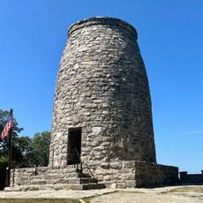
The Civilian Conservation Corps built an 80-foot fire tower on the summit in 1934, incorporating a 60-foot structure from Thayersville. These towers were part of a wider effort to protect forests across the Appalachian region during that era.

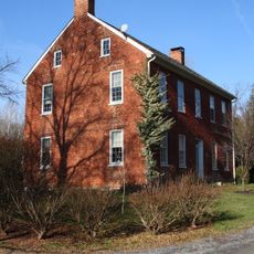
The summit bears the name of Milton and Mary Lamb, farmers who worked the land during the 1830s before the area gained recognition.

The summit is reachable via the Appalachian Trail with parking available at Reno Monument Road near Fox's Gap. Visitors should prepare for uneven terrain and changing weather conditions when planning their hike to this location.

The location once served as a Federal military microwave communications facility, indicating its strategic importance beyond a simple hiking destination. The original fire tower now stands behind protective fencing, marking this lesser-known chapter of its past.

Location: Maryland

GPS coordinates: 39.44833,-77.62687

Latest update: December 13, 2025 11:45

Photos
Around this place
Burnside's Bridge
United States of America

Burnside's Bridge

9 km
South Mountain
United States of America

South Mountain

5.8 km
Washington Monument State Park
United States of America

Washington Monument State Park

5.8 km
Gathland State Park
United States of America

Gathland State Park

5.1 km
Crystal Grottoes
United States of America

Crystal Grottoes

7 km
National War Correspondents Memorial
United States of America

National War Correspondents Memorial

4.9 km
Dahlgren Chapel
United States of America

Dahlgren Chapel

4.1 km
Bowman House
United States of America

Bowman House

7.5 km
Turner's and Fox's Gaps Historic District
United States of America

Turner's and Fox's Gaps Historic District

4.1 km
Bennies Hill Road Bridge
United States of America

Bennies Hill Road Bridge

6.5 km
Middletown Historic District
United States of America

Middletown Historic District

7.1 km
Airview Historic District
United States of America

Airview Historic District

8.4 km
Poffenberger Road Bridge
United States of America

Poffenberger Road Bridge

8.8 km
Henry Shoemaker Farmhouse
United States of America

Henry Shoemaker Farmhouse

3.5 km
Crampton's Gap Historic District
United States of America

Crampton's Gap Historic District

4.9 km
Bowlus Mill House
United States of America

Bowlus Mill House

5.8 km
Washington Monument
United States of America

Washington Monument

5.8 km
Burkittsville Historic District
United States of America

Burkittsville Historic District

6.3 km
Boonsboro Historic District
United States of America

Boonsboro Historic District

6.8 km
Geeting Farm
United States of America

Geeting Farm

7 km
Shafer's Mill
United States of America

Shafer's Mill

6.7 km
Routzahn-Miller Farmstead
United States of America

Routzahn-Miller Farmstead

5.2 km
Hills, Dales and The Vinyard
United States of America

Hills, Dales and The Vinyard

7.9 km
Hitt's Mill and Houses
United States of America

Hitt's Mill and Houses

8.4 km
Keedysville Historic District
United States of America

Keedysville Historic District

7.5 km
Stonebraker and Harbaugh–Shafer Building
United States of America

Stonebraker and Harbaugh–Shafer Building

6.9 km
Reno Monument
United States of America

Reno Monument

2.6 km
The Hitt Bridge
United States of America

The Hitt Bridge

8.7 km
Show the full map
Reviews

Visited this place? Tap the stars to rate it and share your experience / photos with the community! Try now! You can cancel it anytime.

« Lambs Knoll - Mountain summit in Frederick County, Maryland, US » is provided by Around Us (aroundus.com). Images and texts are derived from Wikimedia project under a Creative Commons license. You are allowed to copy, distribute, and modify copies of this page, under the conditions set by the license, as long as this note is clearly visible.

Discover hidden gems everywhere you go!

From secret cafés to breathtaking viewpoints, skip the crowded tourist spots and find places that match your style. Our app makes it easy with voice search, smart filtering, route optimization, and insider tips from travelers worldwide. Download now for the complete mobile experience.

Around Us App Screenshot

A unique approach to discovering new places

Le Figaro

All the places worth exploring

France Info

A tailor-made excursion in just a few clicks

20 Minutes