Enable Location

We need your location to show you interesting places around you

Discover nearby places

Find interesting locations and hidden gems around you

Precise directions

Get accurate directions and distances to places

Your location is never shared with other users. It's only used when you tap the location button.

Turner's and Fox's Gaps Historic District

Log in to your account

Start exploring — it's free

Trusted by 61,534 travelers worldwide

Continue with Google
Continue with Apple
or

We will send you a code to connect

By continuing, you accept our Terms and Conditions and our Privacy Policy

Check your inbox

We've sent a pincode in your inbox. Please enter the code below.

Turner's and Fox's Gaps Historic District

Turner's and Fox's Gaps Historic District, Civil War battlefield district in Frederick and Washington Counties, Maryland

Description

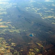
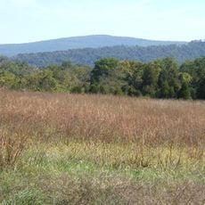
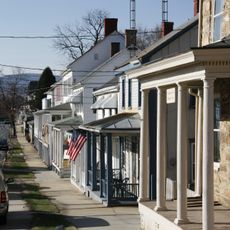
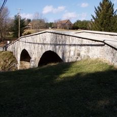
Turner's and Fox's Gaps Historic District sits on South Mountain with two main passes: Turner's Gap to the north and Fox's Gap to the south. The land is quite hilly with rolling terrain alternating between steep slopes and open fields.

History

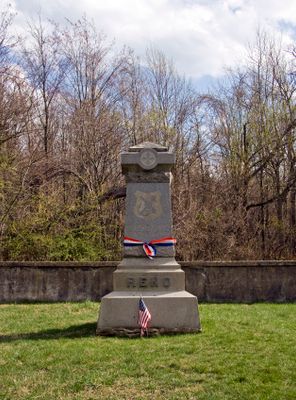
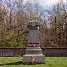
A major Civil War battle took place here on September 14, 1862, when armies fought for control of the two mountain passes. This event made the area a key location in the region's military history.

Culture

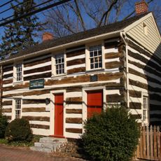
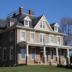
The place takes its name from the two mountain passes that shape the landscape here. Visitors can still see today how buildings and paths follow these geographical features.

Practical

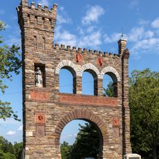
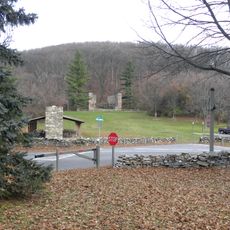
U.S. Route 40 Alternate, formerly known as the Old National Pike, runs through Turner's Gap and connects the two valleys. Hikers can also use the Appalachian Trail, which passes through the area.

Did you know?

The well-known Appalachian Trail runs through the area on a historic woodland path that connects the two mountain passes. This route gives hikers direct access to the battlefield landscapes.

Location
GPS coordinates
39.48467,-77.62021
Latest update
December 14, 2025 15:02

AroundUs brings together thousands of curated places, local tips, and hidden gems, enriched daily by 60,000 contributors worldwide. Discover all places nearby (Frederick County).

Around this place
South Mountain
United States of America

South Mountain

1.8 km
South Mountain State Park
United States of America

South Mountain State Park

7.9 km
Washington Monument State Park
United States of America

Washington Monument State Park

1.8 km
Greenbrier State Park
United States of America

Greenbrier State Park

5.7 km
Gathland State Park
United States of America

Gathland State Park

9.2 km
Crystal Grottoes
United States of America

Crystal Grottoes

5.1 km
National War Correspondents Memorial
United States of America

National War Correspondents Memorial

8.9 km
Lambs Knoll
United States of America

Lambs Knoll

4.1 km
Dahlgren Chapel
United States of America

Dahlgren Chapel

111 m
Bowman House
United States of America

Bowman House

4.2 km
Baltimore & Ohio Railroad Bridge, Antietam Creek
United States of America

Baltimore & Ohio Railroad Bridge, Antietam Creek

8.3 km
Middletown Historic District
United States of America

Middletown Historic District

7.9 km
Airview Historic District
United States of America

Airview Historic District

9.2 km
Hoffman Farm
United States of America

Hoffman Farm

8.9 km
Henry Shoemaker Farmhouse
United States of America

Henry Shoemaker Farmhouse

2.9 km
Crampton's Gap Historic District
United States of America

Crampton's Gap Historic District

9 km
Bowlus Mill House
United States of America

Bowlus Mill House

6.1 km
Washington Monument
United States of America

Washington Monument

1.8 km
Boonsboro Historic District
United States of America

Boonsboro Historic District

3.7 km
Geeting Farm
United States of America

Geeting Farm

6.8 km
Routzahn-Miller Farmstead
United States of America

Routzahn-Miller Farmstead

2.5 km
Hills, Dales and The Vinyard
United States of America

Hills, Dales and The Vinyard

7.5 km
Hitt's Mill and Houses
United States of America

Hitt's Mill and Houses

7.9 km
Keedysville Historic District
United States of America

Keedysville Historic District

6.8 km
Stonebraker and Harbaugh–Shafer Building
United States of America

Stonebraker and Harbaugh–Shafer Building

7.8 km
Reno Monument
United States of America

Reno Monument

1.6 km
Keedy House
United States of America

Keedy House

9.1 km
The Hitt Bridge
United States of America

The Hitt Bridge

8.1 km
Show the full map
« Turner's and Fox's Gaps Historic District - Civil War battlefield district in Frederick and Washington Counties, Maryland » is provided by Around Us (aroundus.com). Images and texts are derived from Wikimedia project under a Creative Commons license. You are allowed to copy, distribute, and modify copies of this page, under the conditions set by the license, as long as this note is clearly visible.

Discover hidden gems everywhere you go!

From secret cafés to breathtaking viewpoints, skip the crowded tourist spots and find places that match your style. Our app makes it easy with voice search, smart filtering, route optimization, and insider tips from travelers worldwide. Download now for the complete mobile experience.

Around Us App Screenshot

A unique approach to discovering new places

Le Figaro

All the places worth exploring

France Info

A tailor-made excursion in just a few clicks

20 Minutes

Around Us
Travel Guide & Maps
Download

Send to your phone

QR Code
1

Open the camera app on your mobile.

2

Point at the QR code with your camera. A notification will appear.

3

Tap the notification to open the link.