Mount Bigelow, Mountain summit in Franklin County and Somerset County, Maine.
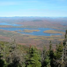
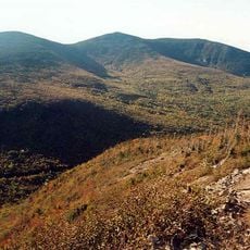
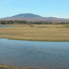
Mount Bigelow is a mountain ridge in Maine with several peaks, the highest being West Peak at approximately 4,145 feet (1,263 meters) and Avery Peak at approximately 4,088 feet (1,245 meters). The massif spans two counties and features a mix of forested slopes and open areas at higher elevations.
Major Timothy Bigelow surveyed the region in 1775 for strategic purposes during a military campaign, and the mountain was named after this historical visit. The summit later became protected as a natural landmark to prevent industrial development.
The Appalachian Trail crosses Mount Bigelow, with the Maine Appalachian Trail Club maintaining trails and operating seasonal backcountry campsites.
Hiking trails crisscross the Bigelow Preserve and provide access to different sections of the mountain with varying difficulty levels. The best time to visit is during warmer months when trails are dry and easy to navigate.
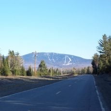
The area received National Natural Landmark protection in 1975, which blocked construction of a major ski resort on its slopes. This designation preserved the mountain's undeveloped character that visitors encounter today.
The community of curious travelers
AroundUs brings together thousands of curated places, local tips, and hidden gems, enriched daily by 60,000 contributors worldwide.