Enable Location

We need your location to show you interesting places around you

Discover nearby places

Find interesting locations and hidden gems around you

Precise directions

Get accurate directions and distances to places

Your location is never shared with other users. It's only used when you tap the location button.

Crocker Mountain

Log in to your account

Start exploring — it's free

Trusted by 62,828 travelers worldwide

Continue with Google
Continue with Apple
or

We will send you a code to connect

By continuing, you accept our Terms and Conditions and our Privacy Policy

Check your inbox

We've sent a pincode in your inbox. Please enter the code below.

Crocker Mountain

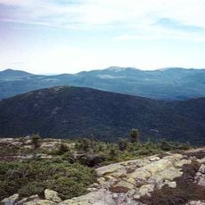
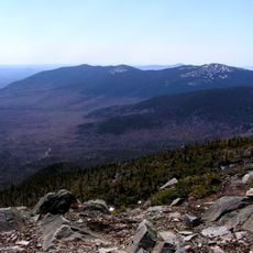
Crocker Mountain, Mountain summit in Carrabassett Valley, Maine, United States.

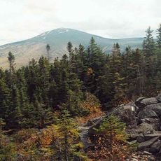
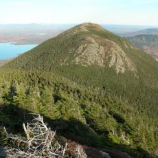
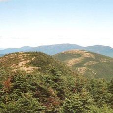
Crocker Mountain is a summit in the Appalachian range reaching about 4,228 feet in elevation. The peak features a distinctive glacial cirque formation between its main summit and South Crocker Mountain, creating a notable geographic feature in the landscape.

The mountain was named in the early 1900s during a period when Maine's mountain nomenclature was being systematized. The name honors William Crocker, a Massachusetts politician involved in the exploration and mapping of the region.

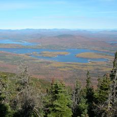
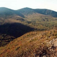
The Appalachian Trail traverses Crocker Mountain as part of its 2,170-mile route, connecting hiking communities from Georgia through Maine.

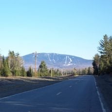
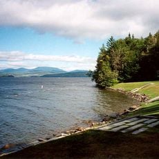
The mountain is best reached via Route 27 northwest of Sugarloaf ski area, with parking areas near Caribou Valley Road. Multiple trails connect in this zone, and visitors should prepare for variable weather and varying terrain steepness.

A section of the famous Appalachian Trail passes over Crocker Mountain, forming part of a multi-thousand kilometer hiking route. Visitors can experience a segment of this legendary long-distance trail here.

The community of curious travelers

AroundUs brings together thousands of curated places, local tips, and hidden gems, enriched daily by 60,000 contributors worldwide.

Start exploring
Location
GPS coordinates
45.04715,-70.38281
Latest update
December 12, 2025 12:07
Around this place
Show the full map
« Crocker Mountain - Mountain summit in Carrabassett Valley, Maine, United States » is provided by Around Us (aroundus.com). Images and texts are derived from Wikimedia project under a Creative Commons license. You are allowed to copy, distribute, and modify copies of this page, under the conditions set by the license, as long as this note is clearly visible.

Discover hidden gems everywhere you go!

From secret cafés to breathtaking viewpoints, skip the crowded tourist spots and find places that match your style. Our app makes it easy with voice search, smart filtering, route optimization, and insider tips from travelers worldwide. Download now for the complete mobile experience.

Around Us App Screenshot

A unique approach to discovering new places

Le Figaro

All the places worth exploring

France Info

A tailor-made excursion in just a few clicks

20 Minutes

Around Us
Travel Guide & Maps
Download

Send to your phone

QR Code
1

Open the camera app on your mobile.

2

Point at the QR code with your camera. A notification will appear.

3

Tap the notification to open the link.