Enable Location

We need your location to show you interesting places around you

Discover nearby places

Find interesting locations and hidden gems around you

Precise directions

Get accurate directions and distances to places

Your location is never shared with other users. It's only used when you tap the location button.

Rich Mountain

Log in to your account

Start exploring — it's free

Trusted by travelers worldwide

Continue with Google
Continue with Apple
or

We will send you a code to connect

By continuing, you accept our Terms and Conditions and our Privacy Policy

Check your inbox

We've sent a pincode in your inbox. Please enter the code below.

Rich Mountain

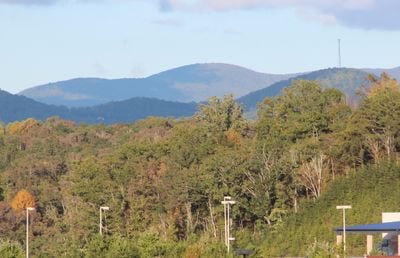
Rich Mountain, Mountain summit in Gilmer County, Georgia, United States.

Description

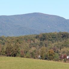
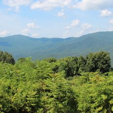
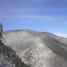
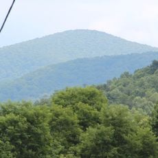
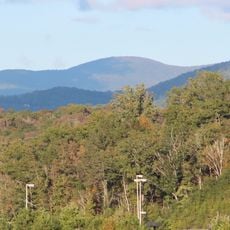
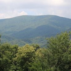
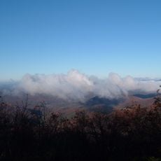
Rich Mountain is a summit reaching 1,231 m (4,040 feet) in northeastern Gilmer County, Georgia, forming the central peak of a circular mountain range. The slopes support dense hardwood forests that have grown back over time.

History

The summit was developed during the Great Depression when the Civilian Conservation Corps built a fire tower on its peak as part of a national work program. Only stone remnants of this structure remain visible today.

Culture

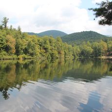
The mountain lies within the Rich Mountain Wilderness of Chattahoochee National Forest, preserving natural landscapes for future generations.

Practical

Reaching the summit requires off-trail hiking from Rich Mountain Road, a former logging path that winds through the mountain range. Visitors should come prepared for challenging terrain without marked trails.

Did you know?

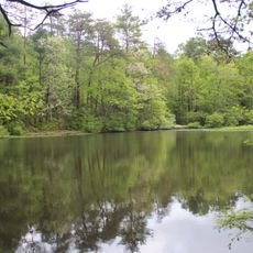
The mountain's soil contains deep black porter's loam, supporting extensive second-growth hardwood forests across its slopes and surrounding areas.

Location
GPS coordinates
34.74370,-84.34298
Latest update
December 13, 2025 11:46

AroundUs brings together thousands of curated places, local tips, and hidden gems, enriched daily by 60,000 contributors worldwide. Discover all places nearby (Georgia).

Around this place
Amicalola Falls State Park
United States of America

Amicalola Falls State Park

21.9 km
Springer Mountain
United States of America

Springer Mountain

18.9 km
Fort Mountain State Park
United States of America

Fort Mountain State Park

33 km
Carters Lake
United States of America

Carters Lake

30.6 km
Amicalola Falls
United States of America

Amicalola Falls

21.6 km
United States of America

Copper Basin

30.8 km
Lake Blue Ridge
United States of America

Lake Blue Ridge

12.4 km
Blue Ridge Scenic Railway
United States of America

Blue Ridge Scenic Railway

13.7 km
Mount Oglethorpe
United States of America

Mount Oglethorpe

28.7 km
Cohutta Wilderness
United States of America

Cohutta Wilderness

29.7 km
Big Frog Mountain
United States of America

Big Frog Mountain

33.3 km
Lake Winfield Scott
United States of America

Lake Winfield Scott

33.6 km
Big Frog Wilderness
United States of America

Big Frog Wilderness

33.2 km
Black Mountain
United States of America

Black Mountain

19.3 km
Rich Mountain Wilderness
United States of America

Rich Mountain Wilderness

1.5 km
Big Bald Mountain
United States of America

Big Bald Mountain

2.2 km
Ed Jenkins National Recreation Area
United States of America

Ed Jenkins National Recreation Area

18 km
Puckett Observatory
United States of America

Puckett Observatory

17.6 km
United States of America

Shallowford Bridge

8.9 km
Dockery Lake Recreation Area
United States of America

Dockery Lake Recreation Area

34.5 km
Gilmer County Courthouse
United States of America

Gilmer County Courthouse

13.9 km
Griffeth-Pendley House
United States of America

Griffeth-Pendley House

31.6 km
James W. Baugh Homeplace
United States of America

James W. Baugh Homeplace

13.9 km
Red Apple Barn
United States of America

Red Apple Barn

18.2 km
Fannin County Courthouse
United States of America

Fannin County Courthouse

13.4 km
Pickens County Courthouse
United States of America

Pickens County Courthouse

31.4 km
Blue Ridge Welcome Center
United States of America

Blue Ridge Welcome Center

15.2 km
Lake Nottely
United States of America

Lake Nottely

31.9 km
Show the full map
« Rich Mountain - Mountain summit in Gilmer County, Georgia, United States » is provided by Around Us (aroundus.com). Images and texts are derived from Wikimedia project under a Creative Commons license. You are allowed to copy, distribute, and modify copies of this page, under the conditions set by the license, as long as this note is clearly visible.

Discover hidden gems everywhere you go!

From secret cafés to breathtaking viewpoints, skip the crowded tourist spots and find places that match your style. Our app makes it easy with voice search, smart filtering, route optimization, and insider tips from travelers worldwide. Download now for the complete mobile experience.

Around Us App Screenshot

A unique approach to discovering new places

Le Figaro

All the places worth exploring

France Info

A tailor-made excursion in just a few clicks

20 Minutes

Around Us
Travel Guide & Maps
Download

Send to your phone

QR Code
1

Open the camera app on your mobile.

2

Point at the QR code with your camera. A notification will appear.

3

Tap the notification to open the link.