Enable Location

We need your location to show you interesting places around you

Discover nearby places

Find interesting locations and hidden gems around you

Precise directions

Get accurate directions and distances to places

Your location is never shared with other users. It's only used when you tap the location button.

Dockery Lake Recreation Area

Log in to your account

Start exploring — it's free

Trusted by 62,589 travelers worldwide

Continue with Google
Continue with Apple
or

We will send you a code to connect

By continuing, you accept our Terms and Conditions and our Privacy Policy

Check your inbox

We've sent a pincode in your inbox. Please enter the code below.

Dockery Lake Recreation Area

Dockery Lake Recreation Area, in Georgia

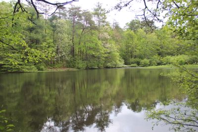
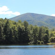
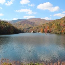
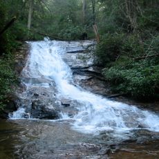
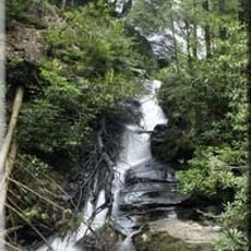
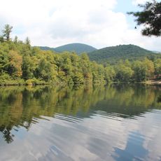
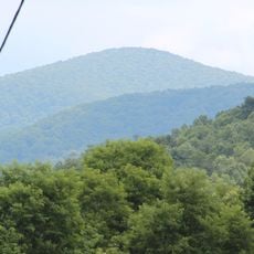
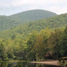
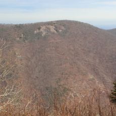
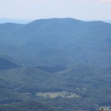
Dockery Lake Recreation Area is a reservoir in the Georgia mountains surrounded by tall trees within the Chattahoochee National Forest. The lake itself covers about six acres and is stocked with trout, while eleven campsites sit directly along the shore with basic amenities including picnic tables and drinking water.

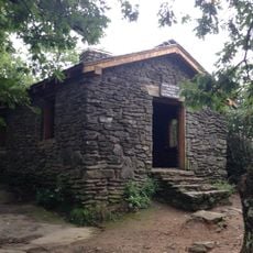
The area was developed as a recreation space to protect natural resources and encourage outdoor activities. This transformation made it an accessible retreat for locals and visitors.

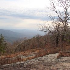
The name Dockery Lake reflects the local heritage of the region and its connection to forest use by area residents. Today, the site draws people seeking a quiet retreat and a chance to reconnect with the natural surroundings of the northern Georgia mountains.

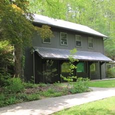
Reservations are required and can be booked up to six months in advance online or by phone, as walk-in visits are not possible. Water and toilet facilities are available from April through November, and visitors should arrive fully equipped since there are no electrical or water hookups at the campsites.

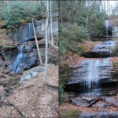
The lake is stocked with trout that are most active in early morning and late afternoon, making it popular with anglers seeking good catches. A nearby trail connects the camping area directly to the famous Appalachian Trail, allowing hikers to explore this legendary route without traveling far from their camp.

The community of curious travelers

AroundUs brings together thousands of curated places, local tips, and hidden gems, enriched daily by 60,000 contributors worldwide.

Start exploring
Location
GPS coordinates
34.67503,-83.97549
Latest update
February 9, 2026 07:46
Around this place
Blood Mountain
United States of America

Blood Mountain

8 km
Springer Mountain
United States of America

Springer Mountain

20.7 km
Vogel State Park
United States of America

Vogel State Park

11.1 km
DeSoto Falls
United States of America

DeSoto Falls

6.9 km
Helton Creek Falls
United States of America

Helton Creek Falls

11.3 km
Dukes Creek
United States of America

Dukes Creek

17.1 km
Consolidated Gold Mine
United States of America

Consolidated Gold Mine

15.2 km
Lake Winfield Scott
United States of America

Lake Winfield Scott

7.3 km
Blood Mountain Wilderness
United States of America

Blood Mountain Wilderness

8.4 km
Dahlonega Gold Museum Historic Site
United States of America

Dahlonega Gold Museum Historic Site

15.9 km
Black Mountain
United States of America

Black Mountain

22.1 km
Slaughter Mountain
United States of America

Slaughter Mountain

8.4 km
Smithgall Woods Conservation Area
United States of America

Smithgall Woods Conservation Area

19.2 km
Raven Cliffs Wilderness
United States of America

Raven Cliffs Wilderness

13.5 km
United States of America

Mark Trail Wilderness

19.7 km
Ed Jenkins National Recreation Area
United States of America

Ed Jenkins National Recreation Area

21.1 km
Three Sisters
United States of America

Three Sisters

9.3 km
Horsetrough Falls
United States of America

Horsetrough Falls

21.6 km
Price Memorial Hall
United States of America

Price Memorial Hall

16.2 km
Holly Theatre
United States of America

Holly Theatre

16 km
Wildcat Mountain
United States of America

Wildcat Mountain

13.4 km
Lake Trahlyta Spillway
United States of America

Lake Trahlyta Spillway

11.8 km
United States of America

Horsetrough Mountain

20.6 km
Levelland Mountain
United States of America

Levelland Mountain

9.4 km
Old White County Courthouse
United States of America

Old White County Courthouse

19.7 km
Fields Place-Vickery House
United States of America

Fields Place-Vickery House

16.1 km
Old Union County Jail
United States of America

Old Union County Jail

22.4 km
Chestatee River Diving Bell
United States of America

Chestatee River Diving Bell

15.7 km
Show the full map
« Dockery Lake Recreation Area - in Georgia » is provided by Around Us (aroundus.com). Images and texts are derived from Wikimedia project under a Creative Commons license. You are allowed to copy, distribute, and modify copies of this page, under the conditions set by the license, as long as this note is clearly visible.

Discover hidden gems everywhere you go!

From secret cafés to breathtaking viewpoints, skip the crowded tourist spots and find places that match your style. Our app makes it easy with voice search, smart filtering, route optimization, and insider tips from travelers worldwide. Download now for the complete mobile experience.

Around Us App Screenshot

A unique approach to discovering new places

Le Figaro

All the places worth exploring

France Info

A tailor-made excursion in just a few clicks

20 Minutes

Around Us
Travel Guide & Maps
Download

Send to your phone

QR Code
1

Open the camera app on your mobile.

2

Point at the QR code with your camera. A notification will appear.

3

Tap the notification to open the link.