Sourland Mountain, Mountain summit in central New Jersey, US.
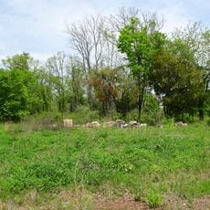
Sourland Mountain is a ridge in central New Jersey that stretches from the Delaware River near Lambertville to Hillsborough Township, with its highest point at 568 feet. Five main trails thread through the preserve, offering about 8 miles of walking paths across the landscape.
The Musconetcong branch of the Lenape people lived here before European settlement, using the mountain's resources for food and shelter. The arrival of Dutch settlers changed how the land was used, as they attempted to farm the rocky terrain.
The name likely comes from Dutch settlers who called the area 'sauer landt' because the rocky ground made farming difficult. This name reflects how early Europeans perceived the challenges of the terrain.
The mountain can be explored on five different trails, each offering varying difficulty levels and different landscape experiences. Visitors should wear proper footwear and watch their footing because the paths cross uneven rocky ground.
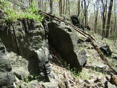
The mountain is made of dark diabase rock that pushed up from deep inside the earth about 200 million years ago as part of the same geological event that created the Palisades Sill. This unusual stone gives the ridge its distinctive dark color and makes it geologically remarkable.
The community of curious travelers
AroundUs brings together thousands of curated places, local tips, and hidden gems, enriched daily by 60,000 contributors worldwide.